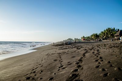
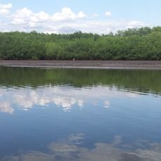
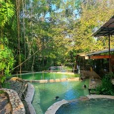
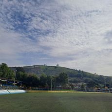
Monterrico Beach, Pacific coast beach in Monterrico, Guatemala.
Monterrico Beach is a Pacific coastal strand with black sand and powerful waves, shaped by volcanic activity across the landscape over time. The shoreline extends along a natural bay with distinctive coastal features that define the area.
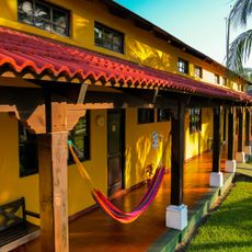
The coastal settlement evolved from a small fishing village into a recognized beach destination following road improvements constructed during the 1980s. This infrastructure development transformed the local economy and how people experienced the location.
The local fishing community continues using traditional methods passed down through generations, visible in their daily work along the shore. This coexistence between time-honored practices and modern tourism gives the beach its particular character.
The beach is accessible by regular bus services from Guatemala City and Antigua, with travel taking roughly two and a half hours. The best visiting conditions occur during the drier months when the weather stays more stable and pleasant.
The shore serves as a natural nesting ground for sea turtles from June through December and supports local conservation initiatives for marine wildlife. Visitors sometimes witness the nocturnal arrivals during these months when the creatures come ashore to lay eggs.
Location: Monterrico
GPS coordinates: 13.88880,-90.48119
Latest update: December 6, 2025 19:08
Guatemala offers photographers a mix of pre-Columbian sites, volcanic landscapes, and colonial buildings. The geography ranges from highland towns to rainforests and coastal areas along the Pacific and Caribbean. Ancient Maya temples stand alongside Spanish-era churches, while indigenous markets and traditional villages show cultural life. The landscape is marked by active and dormant volcanoes, often surrounded by coffee plantations. Places like Antigua Guatemala display colonial architecture with cobblestone streets and courtyards. Lake Atitlán sits between mountains and smaller communities. Tikal and other archaeological sites in the north preserve Maya structures within jungle settings. Chichicastenango Market is known for woven textiles and incense. Pacaya and Acatenango are accessible volcanoes, while Semuc Champey offers natural pools in a limestone forest. The variety of regions makes Guatemala a country with different perspectives in short distances.
Volcán de Agua
70.2 km
IRTRA Mundo Petapa
76.7 km
Casa de Dios
69.3 km
El Imposible National Park
56.8 km
Barra de Santiago
56 km
Tecuamburro
30.9 km
Castillo de Dorión
67 km
Cotzumalhuapa
76.4 km
Santa Teresa Hot Springs.
71.6 km
Iglesia del Calvario
74.8 km
Estadio Municipal de San Miguel Petapa
68.8 km
Zona Pradera
77.2 km
Salto Malacatiupán
74.6 km
Torres ECHO
76.8 km
Santa Isabel
64.7 km
Arena y Sol
76.3 km
Estadio Municipal de Bárcena
74.3 km
Utz Tzaba
3.4 km
Intecap Escuintla 1
58.1 km
Finca el barretal
60.5 km
Phare d'Acajutla (National Pier)
77.4 km
El Tular Santuario Natural
69.8 km
Parque Central Moyuta
46.2 km
Centro para la Cultura y las Artes "Dr. Alfredo Espino"
68.5 km
Torre Real
76.1 km
Lantana Tower
76.4 km
Tigo Tower
76.1 km
Ecovilla la Armonía
75.7 kmVisited this place? Tap the stars to rate it and share your experience / photos with the community! Try now! You can cancel it anytime.
Discover hidden gems everywhere you go!
From secret cafés to breathtaking viewpoints, skip the crowded tourist spots and find places that match your style. Our app makes it easy with voice search, smart filtering, route optimization, and insider tips from travelers worldwide. Download now for the complete mobile experience.
A unique approach to discovering new places❞
— Le Figaro
All the places worth exploring❞
— France Info
A tailor-made excursion in just a few clicks❞
— 20 Minutes