Enable Location

We need your location to show you interesting places around you

Discover nearby places

Find interesting locations and hidden gems around you

Precise directions

Get accurate directions and distances to places

Your location is never shared with other users. It's only used when you tap the location button.

Geography of Honduras

Log in to your account

Start exploring — it's free

Trusted by 69,083 travelers worldwide

Continue with Google
Continue with Apple
or

We will send you a code to connect

By continuing, you accept our Terms and Conditions and our Privacy Policy

Check your inbox

We've sent a pincode in your inbox. Please enter the code below.

Geography of Honduras
Discussion Reviews 1 Photos
134k Popularity

Geography of Honduras, Physical terrain in Central America.

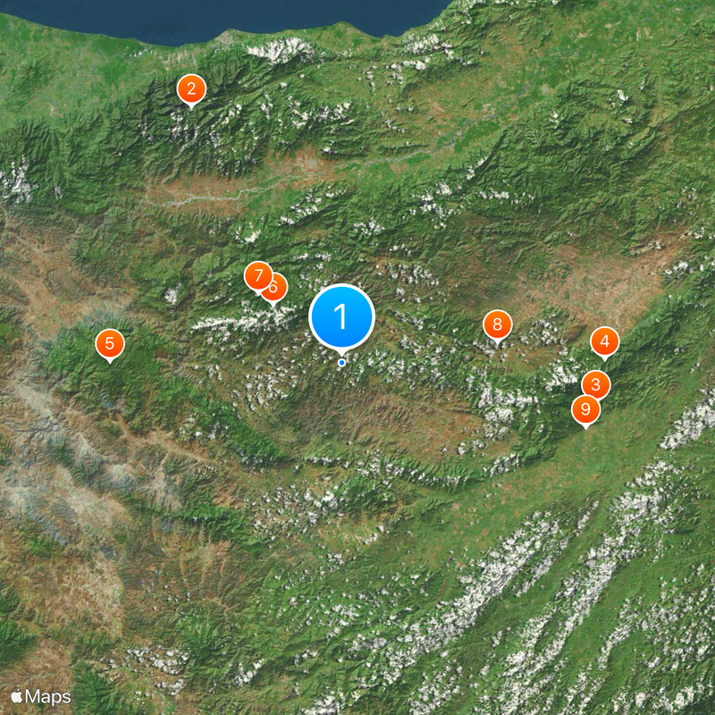
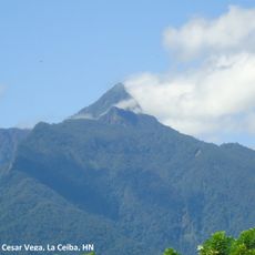
The geography of Honduras comprises rugged terrain in Central America with mountains covering most of the country and two coastlines on the Caribbean Sea and the Pacific Ocean. The relief rises from lowlands at both seas to peaks above 2800 meters inland.

After independence from Spain in 1821, the current borders with Guatemala, El Salvador and Nicaragua took shape. The natural division into coasts and highlands influenced settlement patterns before that and later shaped trade routes and transport links.

People live mainly in the central highlands, where towns sit in valleys between forested slopes and farmers work fields on terraced plots. Coastal villages and port towns follow different rhythms shaped by fishing and trade.

The country divides into three main zones: a mountainous interior with narrow valleys and steep slopes, a broad coastal lowland in the north along the Caribbean, and a shorter Pacific coast in the south. Travelers should expect different climate zones, as elevation changes greatly affect temperature and rainfall.

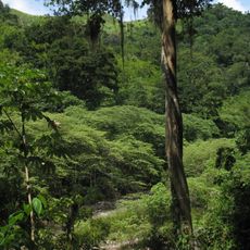
In the northeast, the Rio Platano Biosphere Reserve protects one of the largest remaining rainforests in Central America with lagoons, rivers and mountains over an area exceeding 5000 square kilometers. Archaeological sites within the forest recall earlier settlement in this remote region.

The community of curious travelers

AroundUs brings together thousands of curated places, local tips, and hidden gems, enriched daily by 60,000 contributors worldwide.

Start exploring
GPS coordinates
15.00000,-86.50000
Latest update
December 12, 2025 21:50
Reviews
Share your experience

No review yet

Discussions
Start a discussion...

No discussion yet

« Geography of Honduras - Physical terrain in Central America » is provided by Around Us (aroundus.com). Images and texts are derived from Wikimedia project under a Creative Commons license. You are allowed to copy, distribute, and modify copies of this page, under the conditions set by the license, as long as this note is clearly visible.

Discover hidden gems everywhere you go!

From secret cafés to breathtaking viewpoints, skip the crowded tourist spots and find places that match your style. Our app makes it easy with voice search, smart filtering, route optimization, and insider tips from travelers worldwide. Download now for the complete mobile experience.

Around Us App Screenshot

A unique approach to discovering new places

Le Figaro

All the places worth exploring

France Info

A tailor-made excursion in just a few clicks

20 Minutes

Around Us
Travel Guide & Maps
Download

Send to your phone

QR Code
1

Open the camera app on your mobile.

2

Point at the QR code with your camera. A notification will appear.

3

Tap the notification to open the link.