Imbabura Province, Province in northern Andes, Ecuador
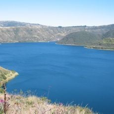
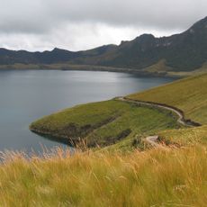
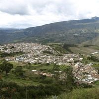
Imbabura is a province in the northern highlands of Ecuador that covers six cantons and stretches between mountains, valleys, and lakes. The relief alternates between steep slopes and open plains, crossed by small rivers and paths.
The province was created in 1824, after the area had been under Spanish administration during colonial times. Boundaries changed several times until the current territory was defined during the second half of the 19th century.
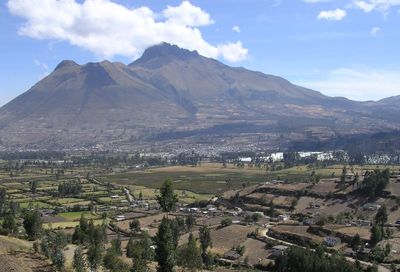
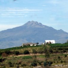
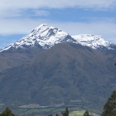
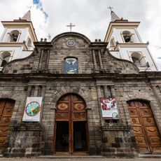
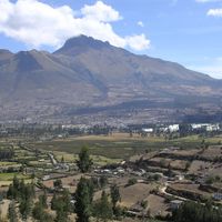
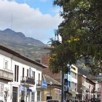
The name comes from the Imbabura Volcano, which locals also call the Mountain of Hope and which rises above the flat lands. On market days, vendors and visitors from surrounding communities gather to trade or buy textiles, ceramics, and food.
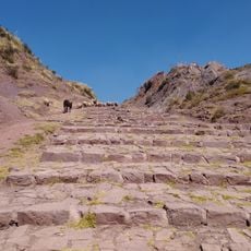
Buses run regularly between Ibarra and the other cantons, making travel within the province easier. Roads in the higher areas can be steep and sometimes poorly paved, so careful driving is advisable.
Some villages sit directly at the foot of the volcanoes, so on clear days the houses have the snow-capped peaks as a backdrop. On certain days, mist rises from the craters and slowly drifts down into the valley.
Location: Ecuador
Inception: June 25, 1824
Capital city: Ibarra
Elevation above the sea: 2,500 m
Shares border with: Carchi Province, Esmeraldas Province, Pichincha Province, Sucumbíos Province
Website: http://imbabura.gob.ec
GPS coordinates: 0.46667,-78.38333
Latest update: December 13, 2025 15:58
El Ángel Ecological Reserve
62.2 km
Cuicocha
18.6 km
Chiles volcano
63.1 km
Imbabura Volcano
32.7 km
Cotacachi Cayapas Ecological Reserve
35.4 km
Cotacachi Volcano
12.4 km
Cultural Complex Fabrica Imbabura
24.8 km
Torre Urban Plaza
31.3 km
Imbabura UNESCO Global Geopark
26.8 km
Lagunas de mojanda
38.8 km
Cerro Negro de Mayasquer
61.1 km
Inca-Caranqui
33.3 km
Chiles-Cerro Negro
63.1 km
Reserva Biologica Los Cedros
48.7 km
Fuya Fuya
38.3 km
Qhapaq Ñan, Andean Road System
33.9 km
Cathedral of Ibarra
32.3 km
Imbabura
32.8 km
Lagunas de Azufral
63.3 km
Páramo de Frailejones
64.4 km
Cuicocha Crater Lake
19.2 km
Aguas Hediondas
68.4 km
Tahuantinsuyo weaving workshop Miguel Andrango
30.2 km
Churay REC
29.2 km
Posada del Arte
27.8 kmVisited this place? Tap the stars to rate it and share your experience / photos with the community! Try now! You can cancel it anytime.
Discover hidden gems everywhere you go!
From secret cafés to breathtaking viewpoints, skip the crowded tourist spots and find places that match your style. Our app makes it easy with voice search, smart filtering, route optimization, and insider tips from travelers worldwide. Download now for the complete mobile experience.
A unique approach to discovering new places❞
— Le Figaro
All the places worth exploring❞
— France Info
A tailor-made excursion in just a few clicks❞
— 20 Minutes