Enable Location

We need your location to show you interesting places around you

Discover nearby places

Find interesting locations and hidden gems around you

Precise directions

Get accurate directions and distances to places

Your location is never shared with other users. It's only used when you tap the location button.

Mora Canton

Log in to your account

Start exploring — it's free

Trusted by 62,091 travelers worldwide

Continue with Google
Continue with Apple
or

We will send you a code to connect

By continuing, you accept our Terms and Conditions and our Privacy Policy

Check your inbox

We've sent a pincode in your inbox. Please enter the code below.

Mora Canton, Administrative canton in San José Province, Costa Rica

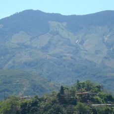
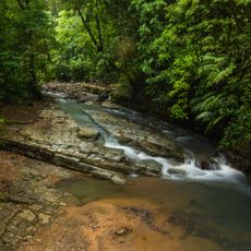
Mora Canton is an administrative district in San José Province spanning seven separate districts across varied terrain. The region sits at roughly 840 meters elevation and covers an area of 163 square kilometers.

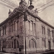
The region was established on May 25, 1883 and renamed in honor of Juan Rafael Mora Porras, Costa Rica's second president. This naming recognized his importance in the nation's political development.

Indigenous heritage remains visible through archaeological sites scattered across Tabarcia, Guayabo, and Quitirrisí, where ceramic artifacts reflect the area's pre-Columbian past. These locations show how early inhabitants lived and worked in this land.

National Routes 22 and 121 cross through the area, connecting to Colón, the administrative center, and surrounding districts. These highways are the main ways to move around the region.

The University for Peace, established by the United Nations General Assembly in 1980, has its main campus within this canton's boundaries. This international institution brings global significance to the region.

The community of curious travelers

AroundUs brings together thousands of curated places, local tips, and hidden gems, enriched daily by 60,000 contributors worldwide.

Start exploring
Capital city
Colón
Elevation above the sea
840 m
Shares border with
Turrubares Canton, Puriscal Canton, Acosta Canton, Santa Ana Canton, Escazú Canton
GPS coordinates
9.87417,-84.28222
Latest update
December 8, 2025 13:43
« Mora Canton - Administrative canton in San José Province, Costa Rica » is provided by Around Us (aroundus.com). Images and texts are derived from Wikimedia project under a Creative Commons license. You are allowed to copy, distribute, and modify copies of this page, under the conditions set by the license, as long as this note is clearly visible.

Discover hidden gems everywhere you go!

From secret cafés to breathtaking viewpoints, skip the crowded tourist spots and find places that match your style. Our app makes it easy with voice search, smart filtering, route optimization, and insider tips from travelers worldwide. Download now for the complete mobile experience.

Around Us App Screenshot

A unique approach to discovering new places

Le Figaro

All the places worth exploring

France Info

A tailor-made excursion in just a few clicks

20 Minutes

Around Us
Travel Guide & Maps
Download

Send to your phone

QR Code
1

Open the camera app on your mobile.

2

Point at the QR code with your camera. A notification will appear.

3

Tap the notification to open the link.