Chest opened
+${chestReward.xp} XP
Explorer
NOUVEAU ×${chestReward.collectible.quantity}
tapez pour fermer
Chest locked

Open chests in the app

Around Us is built for your phone — chests unlock when you walk, explore and capture nearby places.

Enable Location

We need your location to show you interesting places around you

Discover nearby places

Find interesting locations and hidden gems around you

Precise directions

Get accurate directions and distances to places

Your location is never shared with other users. It's only used when you tap the location button.

San Fernando

Log in to your account

Start exploring — it's free

Trusted by 72,887 travelers worldwide

Continue with Google
Continue with Apple
or

We will send you a code to connect

By continuing, you accept our Terms and Conditions and our Privacy Policy

Check your inbox

We've sent a pincode in your inbox. Please enter the code below.

San Fernando
Discussion Reviews 1 Photos
13.5k Popularity

San Fernando, Municipal center in San Fernando Municipality, Mexico

San Fernando is a municipal center in northern Tamaulipas that spans a large area serving as the administrative hub for the surrounding region. The locality connects numerous smaller communities through a network of regional roads.

The settlement was founded in 1749 when colonists from Cadereyta established themselves in the area to build a new community. Over time, the locality grew to serve as an important administrative center for the agricultural lands around it.

The town celebrates its patron saint each May 30th with traditional regional dishes like barbacoa, bringing the community together for this annual observance. Local traditions reflect the importance of agriculture and ranching in daily life.

The town is accessible by regional roads connecting it to numerous surrounding villages and communities. Visitors should plan for longer travel times, as the area remains primarily rural in character.

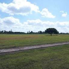
A river flows through the municipality creating fertile soils that have historically supported extensive farming and ranching. This water system remains central to how the area sustains its population and activities.

The community of curious travelers

AroundUs brings together thousands of curated places, local tips, and hidden gems, enriched daily by 60,000 contributors worldwide.

Start exploring
Elevation above the sea
42 m
GPS coordinates
24.84750,-98.15833
Latest update
December 7, 2025 20:26
Around this place
Basilica of the National Shrine of Our Lady of San Juan del Valle
United States of America

Basilica of the National Shrine of Our Lady of San Juan del Valle

150.4 km
Fort Brown
United States of America

Fort Brown

133.5 km
Gladys Porter Zoo
United States of America

Gladys Porter Zoo

136 km
Brownsville & Matamoros International Bridge
Mexico

Brownsville & Matamoros International Bridge

133.6 km
Palo Alto Battlefield National Historical Park
United States of America

Palo Alto Battlefield National Historical Park

149.2 km
Mexico

Laguna Madre

70.1 km
Santa Ana National Wildlife Refuge
United States of America

Santa Ana National Wildlife Refuge

137.6 km
Gateway International Bridge
Mexico

Gateway International Bridge

134.6 km
National Butterfly Center
United States of America

National Butterfly Center

149.8 km
Estadio El Hogar
Mexico

Estadio El Hogar

127.3 km
La Lomita Chapel
United States of America

La Lomita Chapel

146.9 km
Bentsen-Rio Grande Valley State Park
United States of America

Bentsen-Rio Grande Valley State Park

149.3 km
McAllen–Hidalgo–Reynosa International Bridge
Mexico

McAllen–Hidalgo–Reynosa International Bridge

139.3 km
Sabal Palm Sanctuary
United States of America

Sabal Palm Sanctuary

134.5 km
Parque Olímpico
Mexico

Parque Olímpico

133.1 km
Our Lady of Refuge Cathedral, Matamoros
Mexico

Our Lady of Refuge Cathedral, Matamoros

132.5 km
Fuerte Castamata
Mexico

Fuerte Castamata

132.6 km
Immaculate Conception Cathedral
United States of America

Immaculate Conception Cathedral

135 km
Resaca de la Palma Battlefield
United States of America

Resaca de la Palma Battlefield

138.9 km
Estero Llano Grande State Park
United States of America

Estero Llano Grande State Park

143.7 km
Old Brulay Plantation
United States of America

Old Brulay Plantation

135.6 km
Topgolf
United States of America

Topgolf

150.2 km
Cameron County Courthouse
United States of America

Cameron County Courthouse

135.2 km
United States Court House, Custom House, and Post Office
United States of America

United States Court House, Custom House, and Post Office

134.9 km
Pharr Aquatic Center
United States of America

Pharr Aquatic Center

148.8 km
Museo del Ferrocarril de Matamoros
Mexico

Museo del Ferrocarril de Matamoros

132.8 km
Reynosakatedralen
Mexico

Reynosakatedralen

139.1 km
Brownsville Heritage Museum
United States of America

Brownsville Heritage Museum

134.9 km
Show the full map
Reviews
Share your experience

No review yet

Discussions
Start a discussion...

No discussion yet

« San Fernando - Municipal center in San Fernando Municipality, Mexico » is provided by Around Us (aroundus.com). Images and texts are derived from Wikimedia project under a Creative Commons license. You are allowed to copy, distribute, and modify copies of this page, under the conditions set by the license, as long as this note is clearly visible.

Discover hidden gems everywhere you go!

From secret cafés to breathtaking viewpoints, skip the crowded tourist spots and find places that match your style. Our app makes it easy with voice search, smart filtering, route optimization, and insider tips from travelers worldwide. Download now for the complete mobile experience.

Around Us App Screenshot

A unique approach to discovering new places

Le Figaro

All the places worth exploring

France Info

A tailor-made excursion in just a few clicks

20 Minutes

Around Us
Travel Guide & Maps
Download

Send to your phone

QR Code
1

Open the camera app on your mobile.

2

Point at the QR code with your camera. A notification will appear.

3

Tap the notification to open the link.