Chest opened
+${chestReward.xp} XP
Explorer
NOUVEAU ×${chestReward.collectible.quantity}
tapez pour fermer
Chest locked

Open chests in the app

Around Us is built for your phone — chests unlock when you walk, explore and capture nearby places.

Enable Location

We need your location to show you interesting places around you

Discover nearby places

Find interesting locations and hidden gems around you

Precise directions

Get accurate directions and distances to places

Your location is never shared with other users. It's only used when you tap the location button.

San Marcos River

Log in to your account

Start exploring — it's free

Trusted by 72,880 travelers worldwide

Continue with Google
Continue with Apple
or

We will send you a code to connect

By continuing, you accept our Terms and Conditions and our Privacy Policy

Check your inbox

We've sent a pincode in your inbox. Please enter the code below.

San Marcos River
Discussion Reviews 1 Photos
19.2k Popularity

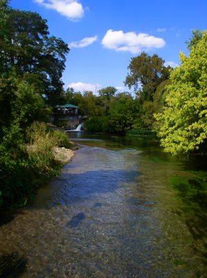
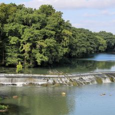
San Marcos River, Spring-fed river in central Texas, United States.

The San Marcos River is a spring-fed waterway in central Texas that originates from underground aquifer sources and flows southeastward through the region. The river moves slowly and steadily, cutting through green banks and pastoral landscapes before joining another major river downstream.

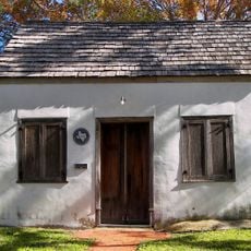
People have lived near this river for over 12,000 years, relying on its dependable water supply from deep underground sources. The steady flow from these ancient aquifers made permanent settlement possible in this part of Texas.

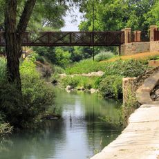
The river serves as a gathering place where locals and visitors spend weekends tubing and paddling through cool waters. People have built their social traditions around these activities for generations.

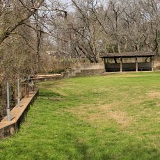
Several public access points line the river with free parking available at parks throughout the area. Early mornings or weekdays offer less crowded conditions if you prefer a quieter experience.

The water stays at the same cool temperature year-round, making it refreshing even during hot summer months. This constant temperature comes from the deep underground source that feeds the entire system.

The community of curious travelers

AroundUs brings together thousands of curated places, local tips, and hidden gems, enriched daily by 60,000 contributors worldwide.

Start exploring
Location
GPS coordinates
29.49095,-97.47107
Latest update
December 7, 2025 10:07
Around this place
Magnolia Hotel
United States of America

Magnolia Hotel

48.4 km
Palmetto State Park
United States of America

Palmetto State Park

15.2 km
Lockhart State Park
United States of America

Lockhart State Park

46.1 km
Caldwell County Courthouse
United States of America

Caldwell County Courthouse

47.9 km
Los Nogales
United States of America

Los Nogales

48.4 km
St. Mary's Church of the Assumption
United States of America

St. Mary's Church of the Assumption

43.9 km
Saffold Dam
United States of America

Saffold Dam

48.8 km
Seguin Walnut Springs Park
United States of America

Seguin Walnut Springs Park

48.9 km
Ascension of Our Lord Catholic Church
United States of America

Ascension of Our Lord Catholic Church

48.2 km
Gonzales County Courthouse
United States of America

Gonzales County Courthouse

2.1 km
Church of the Blessed Virgin Mary, the Queen of Peace
United States of America

Church of the Blessed Virgin Mary, the Queen of Peace

42.4 km
First Methodist Church
United States of America

First Methodist Church

48 km
Robert Hall House
United States of America

Robert Hall House

48.7 km
Church of the Immaculate Conception of Blessed Virgin Mary
United States of America

Church of the Immaculate Conception of Blessed Virgin Mary

46.2 km
Macedonia Baptist Church
United States of America

Macedonia Baptist Church

48 km
Grace Episcopal Church
United States of America

Grace Episcopal Church

47.7 km
Caldwell County Courthouse Historic District
United States of America

Caldwell County Courthouse Historic District

47.8 km
Breeden-Runge Wholesale Grocery Company Building
United States of America

Breeden-Runge Wholesale Grocery Company Building

47.6 km
Cuero Commercial Historic District
United States of America

Cuero Commercial Historic District

47.8 km
Terrell-Reuss Streets Historic District
United States of America

Terrell-Reuss Streets Historic District

47.5 km
DeWitt County Courthouse
United States of America

DeWitt County Courthouse

47.8 km
Stanley Theatre
United States of America

Stanley Theatre

27.2 km
Texas Theatre
United States of America

Texas Theatre

48.6 km
Palace Theatre
United States of America

Palace Theatre

48.5 km
Lynn Theatre
United States of America

Lynn Theatre

2.3 km
Lyric Theater
United States of America

Lyric Theater

41.4 km
Oak Forest Bridge
United States of America

Oak Forest Bridge

4.5 km
Cardwell Home
United States of America

Cardwell Home

47.6 km
Show the full map
Reviews
Share your experience

No review yet

Discussions
Start a discussion...

No discussion yet

« San Marcos River - Spring-fed river in central Texas, United States » is provided by Around Us (aroundus.com). Images and texts are derived from Wikimedia project under a Creative Commons license. You are allowed to copy, distribute, and modify copies of this page, under the conditions set by the license, as long as this note is clearly visible.

Discover hidden gems everywhere you go!

From secret cafés to breathtaking viewpoints, skip the crowded tourist spots and find places that match your style. Our app makes it easy with voice search, smart filtering, route optimization, and insider tips from travelers worldwide. Download now for the complete mobile experience.

Around Us App Screenshot

A unique approach to discovering new places

Le Figaro

All the places worth exploring

France Info

A tailor-made excursion in just a few clicks

20 Minutes

Around Us
Travel Guide & Maps
Download

Send to your phone

QR Code
1

Open the camera app on your mobile.

2

Point at the QR code with your camera. A notification will appear.

3

Tap the notification to open the link.