Enable Location

We need your location to show you interesting places around you

Discover nearby places

Find interesting locations and hidden gems around you

Precise directions

Get accurate directions and distances to places

Your location is never shared with other users. It's only used when you tap the location button.

Fayette County

Log in to your account

Start exploring — it's free

Trusted by 62,491 travelers worldwide

Continue with Google
Continue with Apple
or

We will send you a code to connect

By continuing, you accept our Terms and Conditions and our Privacy Policy

Check your inbox

We've sent a pincode in your inbox. Please enter the code below.

Fayette County, County administrative division in Texas, United States.

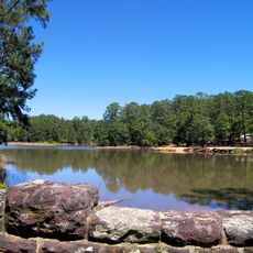
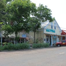
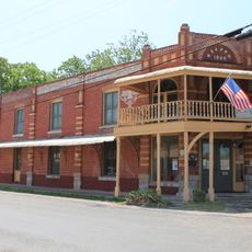
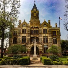
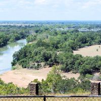
Fayette County is an administrative area in southeastern Texas that covers rolling hills and farmland between Austin and Houston. The region is shaped by agricultural areas, rural settlements, and small towns.

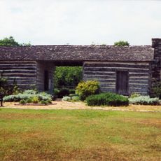
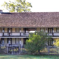
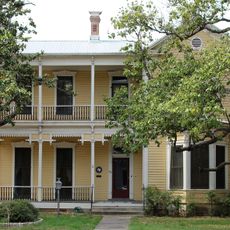
The county was named in 1837 during the Texas Republic period to honor French general Marquis de Lafayette. Early settlement was shaped by German and Bohemian immigrants who brought their way of living and building styles.

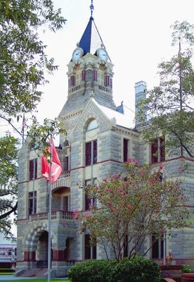
German and Czech heritage shows in the buildings that shape the landscape today, as well as in local festivals and crafts passed down through generations. These influences are visible in how people build their homes and gather together.

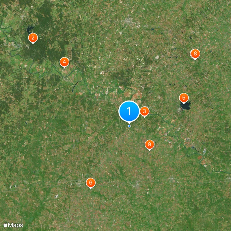
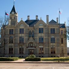
County offices in town handle official matters like permits and documents during regular business hours. Most locations are easily reached by car since the area consists of scattered settlements.

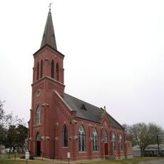
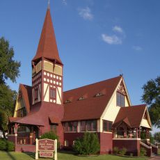
The area contains several painted churches from the 1800s with elaborately decorated interiors featuring religious art and patterns. These churches display European artistic influences that German and Bohemian settlers brought with them.

The community of curious travelers

AroundUs brings together thousands of curated places, local tips, and hidden gems, enriched daily by 60,000 contributors worldwide.

Start exploring
Location
Inception
1837
Capital city
La Grange
Shares border with
Austin County, Bastrop County, Gonzales County, Lee County, Lavaca County, Colorado County, Washington County, Caldwell County
GPS coordinates
29.86000,-96.93000
Latest update
December 20, 2025 14:55
Around this place
Bastrop State Park
United States of America

Bastrop State Park

43.1 km
Monument Hill and Kreische Brewery State Historic Sites
United States of America

Monument Hill and Kreische Brewery State Historic Sites

6 km
Buescher State Park
United States of America

Buescher State Park

29.7 km
United States of America

Fayette County Reservoir

20.1 km
St. Mary's Church of the Assumption
United States of America

St. Mary's Church of the Assumption

25 km
Bethlehem Lutheran Church
United States of America

Bethlehem Lutheran Church

31.7 km
Moore's Fort
United States of America

Moore's Fort

31.9 km
St. John the Baptist Catholic Church
United States of America

St. John the Baptist Catholic Church

10.7 km
Nativity of Mary, Blessed Virgin Catholic Church
United States of America

Nativity of Mary, Blessed Virgin Catholic Church

15.9 km
T. A. Hasler House
United States of America

T. A. Hasler House

46.7 km
Texas Wendish Heritage Museum
United States of America

Texas Wendish Heritage Museum

29 km
St. James Episcopal Church
United States of America

St. James Episcopal Church

7.6 km
Fayette County Courthouse and Jail
United States of America

Fayette County Courthouse and Jail

7 km
Fayetteville Historic District
United States of America

Fayetteville Historic District

25.3 km
United States of America

Fayette County Precinct No. 2 Courthouse

25.3 km
United States of America

Fayette County Courthouse Square Historic District

7.1 km
Zapp Building
United States of America

Zapp Building

24.9 km
Cummins Creek Bridge
United States of America

Cummins Creek Bridge

30.9 km
East Navidad River Bridge
United States of America

East Navidad River Bridge

21.3 km
United States of America

Simon Pytlovany House

18.6 km
Winedale Historical Center
United States of America

Winedale Historical Center

37.7 km
Bastain-Haralson, Ed, House
United States of America

Bastain-Haralson, Ed, House

46.5 km
Bedstead Truss Bridge
United States of America

Bedstead Truss Bridge

20.8 km
Fayette County Courthouse
United States of America

Fayette County Courthouse

7.1 km
United States of America

Soil Conservation Service Site 11 Reservoir

28.2 km
United States of America

Fowler-Jenkins House

46.9 km
United States of America

Schaeffer, W. F., House

46.3 km
United States of America

Old Bastrop County Pavilion

47.1 km
Show the full map
Administrative divisions
« Fayette County - County administrative division in Texas, United States » is provided by Around Us (aroundus.com). Images and texts are derived from Wikimedia project under a Creative Commons license. You are allowed to copy, distribute, and modify copies of this page, under the conditions set by the license, as long as this note is clearly visible.

Discover hidden gems everywhere you go!

From secret cafés to breathtaking viewpoints, skip the crowded tourist spots and find places that match your style. Our app makes it easy with voice search, smart filtering, route optimization, and insider tips from travelers worldwide. Download now for the complete mobile experience.

Around Us App Screenshot

A unique approach to discovering new places

Le Figaro

All the places worth exploring

France Info

A tailor-made excursion in just a few clicks

20 Minutes

Around Us
Travel Guide & Maps
Download

Send to your phone

QR Code
1

Open the camera app on your mobile.

2

Point at the QR code with your camera. A notification will appear.

3

Tap the notification to open the link.