Enable Location

We need your location to show you interesting places around you

Discover nearby places

Find interesting locations and hidden gems around you

Precise directions

Get accurate directions and distances to places

Your location is never shared with other users. It's only used when you tap the location button.

Log in to your account

Start exploring — it's free

Trusted by 62,500 travelers worldwide

Continue with Google
Continue with Apple
or

We will send you a code to connect

By continuing, you accept our Terms and Conditions and our Privacy Policy

Check your inbox

We've sent a pincode in your inbox. Please enter the code below.

South Llano River State Park

South Llano River State Park, State park and Dark Sky sanctuary in Texas, United States.

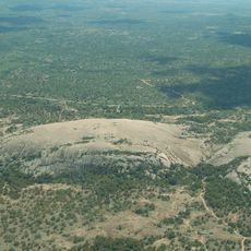
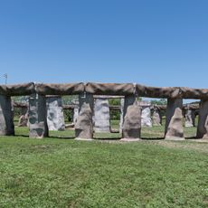
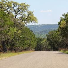
South Llano River State Park is a Texas state park with pecan groves, rocky uplands, and over 14 miles of trails across varied landscapes. The property is crossed by the continuously flowing river and offers different terrains to explore throughout the property.

The river draws from underground springs and has flowed continuously for thousands of years, which allowed early settlement in this region. Its constant water supply made it an important anchor point for regional development.

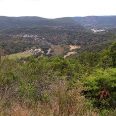
The park serves as a sanctuary where visitors come to escape artificial light and observe the night sky with their own eyes. Many people visit specifically during darker nights to watch the stars above the trees and river valleys.

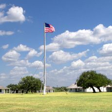
The park offers campsites with electrical hookups and water access for trailers, plus primitive sites that require a longer walk to reach. The infrastructure is concentrated in the lower areas, while the higher elevations are more sparse for hikers.

During winter months, thousands of Rio Grande turkeys gather in the trees to roost at night, a phenomenon observed here for over a century. This gathering is among the largest in Central Texas and regularly draws birdwatchers to the area.

The community of curious travelers

AroundUs brings together thousands of curated places, local tips, and hidden gems, enriched daily by 60,000 contributors worldwide.

Start exploring
Location
GPS coordinates
30.44680,-99.80530
Latest update
December 9, 2025 18:49
Around this place
Enchanted Rock
United States of America

Enchanted Rock

94.9 km
National Museum of the Pacific War
United States of America

National Museum of the Pacific War

92.4 km
Lost Maples State Natural Area
United States of America

Lost Maples State Natural Area

73 km
HA. 19
United States of America

HA. 19

92.1 km
Stonehenge II
United States of America

Stonehenge II

67.9 km
Fort McKavett
United States of America

Fort McKavett

51.5 km
Fort Mason
United States of America

Fort Mason

62.6 km
Fort Martin Scott
United States of America

Fort Martin Scott

94.7 km
Kerrville-Schreiner Park
United States of America

Kerrville-Schreiner Park

81.8 km
Capt. Charles Schreiner Mansion
United States of America

Capt. Charles Schreiner Mansion

78 km
Fredericksburg Historic District
United States of America

Fredericksburg Historic District

91.5 km
The Coming King Sculpture Prayer Gardens
United States of America

The Coming King Sculpture Prayer Gardens

78.3 km
Mason County Courthouse
United States of America

Mason County Courthouse

64.4 km
McCulloch County Courthouse
United States of America

McCulloch County Courthouse

90.5 km
State Highway 29 Bridge at the Colorado River
United States of America

State Highway 29 Bridge at the Colorado River

88.7 km
Fredericksburg Memorial Library
United States of America

Fredericksburg Memorial Library

91.5 km
Old McCulloch County Jail
United States of America

Old McCulloch County Jail

88.8 km
Mason Historic District
United States of America

Mason Historic District

65.1 km
Masonic Building
United States of America

Masonic Building

78 km
Edwards County Courthouse and Jail
United States of America

Edwards County Courthouse and Jail

61.7 km
Pacific Combat Zone
United States of America

Pacific Combat Zone

92.6 km
Sutton County Courthouse
United States of America

Sutton County Courthouse

81.6 km
Frank Van Der Stucken Birthplace
United States of America

Frank Van Der Stucken Birthplace

91.7 km
Hoerster Building
United States of America

Hoerster Building

91.9 km
Fort McKavett State Historic Site
United States of America

Fort McKavett State Historic Site

51.3 km
Menard County Courthouse
United States of America

Menard County Courthouse

52.2 km
Pampell's Opera House
United States of America

Pampell's Opera House

77.8 km
Kimble County Courthouse
United States of America

Kimble County Courthouse

6.1 km
Show the full map
« South Llano River State Park - State park and Dark Sky sanctuary in Texas, United States » is provided by Around Us (aroundus.com). Images and texts are derived from Wikimedia project under a Creative Commons license. You are allowed to copy, distribute, and modify copies of this page, under the conditions set by the license, as long as this note is clearly visible.

Discover hidden gems everywhere you go!

From secret cafés to breathtaking viewpoints, skip the crowded tourist spots and find places that match your style. Our app makes it easy with voice search, smart filtering, route optimization, and insider tips from travelers worldwide. Download now for the complete mobile experience.

Around Us App Screenshot

A unique approach to discovering new places

Le Figaro

All the places worth exploring

France Info

A tailor-made excursion in just a few clicks

20 Minutes

Around Us
Travel Guide & Maps
Download

Send to your phone

QR Code
1

Open the camera app on your mobile.

2

Point at the QR code with your camera. A notification will appear.

3

Tap the notification to open the link.