Menard County

Log in to your account

AroundUs is a community-driven map of interesting places, built by curious explorers like you. It grows with every review, story, and photo you share.
Connect to save your favorite spots, contribute locations, and create personalized routes.
Continue with Google
Continue with Apple
Continue with X
Continue with Facebook
Continue with email
By continuing, you accept our Terms and Conditions and our Privacy Policy
Create an account
Add to collection
Map
Suggest a change
Share

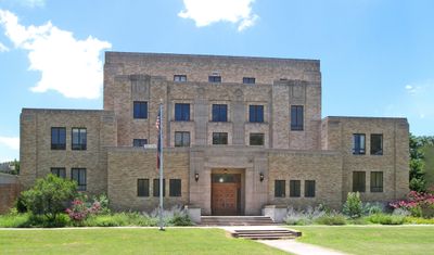
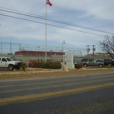
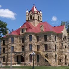
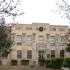
Menard County, Administrative division in Texas, US

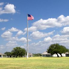
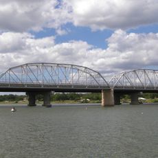
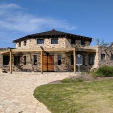
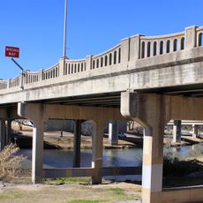
Menard County sits on the Edwards Plateau in Texas, spreading across rolling hills, valleys, and ranch lands. The landscape reaches elevations up to about 2,500 feet and is primarily used for livestock and farming.

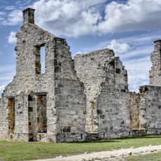
The county was established in 1858 and named after Michel Branamour Menard, who founded Galveston during early Texas settlement. The region became part of expanding Texas and developed as a ranching area over time.

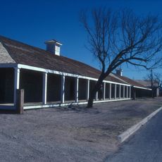
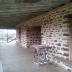
The area keeps alive memories of indigenous peoples and Spanish colonial times through local celebrations and community events. Ranching remains central to how people live and work here today.

The best time to visit is during mild seasons when weather is pleasant for exploring. Keep in mind that the area is sparsely populated, so access to services can be limited.

The area is closely tied to the legend of the Lost Bowie Mine, which James and Rezin Bowie pursued in the 1830s. This tale of treasure and adventure continues to captivate those who search for traces of this chapter in the region's past.

GPS coordinates: 30.85736,-99.83206

Latest update: December 8, 2025 13:41

Photos
Around this place
Fort Concho
United States of America

Fort Concho

87.5 km
Fort McKavett
United States of America

Fort McKavett

26.9 km
Fort Mason
United States of America

Fort Mason

57.4 km
Eden Detention Center
United States of America

Eden Detention Center

40 km
San Angelo Stadium
United States of America

San Angelo Stadium

87.5 km
Foster Field
United States of America

Foster Field

87.5 km
San Angelo Museum of Fine Arts
United States of America

San Angelo Museum of Fine Arts

87.9 km
Junell Center
United States of America

Junell Center

87.9 km
Mason County Courthouse
United States of America

Mason County Courthouse

58.7 km
McCulloch County Courthouse
United States of America

McCulloch County Courthouse

57.7 km
Houston Harte University Center
United States of America

Houston Harte University Center

88.7 km
Tom Green County Courthouse
United States of America

Tom Green County Courthouse

88.8 km
State Highway 29 Bridge at the Colorado River
United States of America

State Highway 29 Bridge at the Colorado River

85.4 km
J. B. Blakeney House
United States of America

J. B. Blakeney House

88.8 km
Old McCulloch County Jail
United States of America

Old McCulloch County Jail

56.5 km
Masonic Lodge 570
United States of America

Masonic Lodge 570

88.4 km
Mason Historic District
United States of America

Mason Historic District

59.4 km
Montgomery Ward Building
United States of America

Montgomery Ward Building

88.7 km
Sutton County Courthouse
United States of America

Sutton County Courthouse

83.9 km
Concho County Courthouse
United States of America

Concho County Courthouse

72.9 km
Freeze Building
United States of America

Freeze Building

88.4 km
Municipal Swimming Pool
United States of America

Municipal Swimming Pool

87.9 km
Fort McKavett State Historic Site
United States of America

Fort McKavett State Historic Site

26.7 km
San Angelo City Hall
United States of America

San Angelo City Hall

89 km
Menard County Courthouse
United States of America

Menard County Courthouse

7.9 km
Kimble County Courthouse
United States of America

Kimble County Courthouse

41.5 km
Texas Theatre
United States of America

Texas Theatre

88.5 km
Sixth Street Bridge
United States of America

Sixth Street Bridge

89.6 km
Show the full map
Reviews

Visited this place? Tap the stars to rate it and share your experience / photos with the community! Try now! You can cancel it anytime.

« Menard County - Administrative division in Texas, US » is provided by Around Us (aroundus.com). Images and texts are derived from Wikimedia project under a Creative Commons license. You are allowed to copy, distribute, and modify copies of this page, under the conditions set by the license, as long as this note is clearly visible.

Discover hidden gems everywhere you go!

From secret cafés to breathtaking viewpoints, skip the crowded tourist spots and find places that match your style. Our app makes it easy with voice search, smart filtering, route optimization, and insider tips from travelers worldwide. Download now for the complete mobile experience.

Around Us App Screenshot

A unique approach to discovering new places

Le Figaro

All the places worth exploring

France Info

A tailor-made excursion in just a few clicks

20 Minutes