Enable Location

We need your location to show you interesting places around you

Discover nearby places

Find interesting locations and hidden gems around you

Precise directions

Get accurate directions and distances to places

Your location is never shared with other users. It's only used when you tap the location button.

Log in to your account

Start exploring — it's free

Trusted by 67,498 travelers worldwide

Continue with Google
Continue with Apple
or

We will send you a code to connect

By continuing, you accept our Terms and Conditions and our Privacy Policy

Check your inbox

We've sent a pincode in your inbox. Please enter the code below.

McCurtain County Wilderness Area
Discussion Reviews Photo
1.1k Popularity

McCurtain County Wilderness Area, wilderness nature preserve in Oklahoma

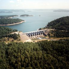
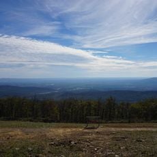
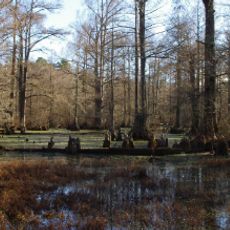
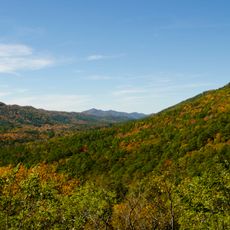
The McCurtain County Wilderness Area is a protected natural space and National Natural Landmark in Oklahoma covering around 14,000 acres. The terrain consists mainly of shortleaf pine and hardwood forests, crossed by rivers and a reservoir with forested shores and rolling hills throughout.

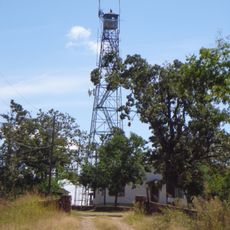
The area was purchased by Oklahoma in 1918 to establish a game preserve protecting the declining deer population at the time. In the 1930s, workers improved infrastructure through conservation programs, and it was officially named a wildlife area in 1953, then recognized as a National Natural Landmark in 1975.

The name reflects the county in which this natural area sits. Visitors experience today how over a century of protection has kept this forest relatively unchanged from human activity. The way locals and visitors use the space for hunting, bird-watching, and quiet forest walks shows how minimal human presence remains at the heart of the landscape.

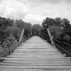
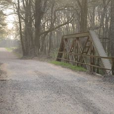
Access is about 21 miles north of Broken Bow via US Highway 259, followed by gravel roads to trailheads and boat ramp. A self-guided one-mile trail is open to the public, but exploring beyond main paths or overnight camping requires permits arranged at least two weeks in advance.

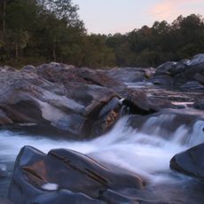
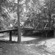
The Glover River is the only river in Oklahoma flowing completely untamed and undammed, home to the rare leopard darter fish first documented in 1955. This unbroken waterway makes the place extraordinary for fish species and ecosystems not found elsewhere in the state.

The community of curious travelers

AroundUs brings together thousands of curated places, local tips, and hidden gems, enriched daily by 60,000 contributors worldwide.

Start exploring
Location
GPS coordinates
34.29580,-94.64080
Latest update
February 9, 2026 07:44
Around this place
Broken Bow Lake
United States of America

Broken Bow Lake

13.6 km
Beavers Bend Resort Park
United States of America

Beavers Bend Resort Park

18.9 km
Queen Wilhelmina State Park
United States of America

Queen Wilhelmina State Park

49.9 km
Cossatot River State Park-Natural Area
United States of America

Cossatot River State Park-Natural Area

43.5 km
Little River National Wildlife Refuge
United States of America

Little River National Wildlife Refuge

40.7 km
Mountain Fork Bridge
United States of America

Mountain Fork Bridge

34 km
C.E. Foster House
United States of America

C.E. Foster House

49.9 km
Ebenezer Monument
United States of America

Ebenezer Monument

48.7 km
Mena City Hall
United States of America

Mena City Hall

49 km
Janssen Park
United States of America

Janssen Park

48.8 km
Little Cossatot River Bridge
United States of America

Little Cossatot River Bridge

53.8 km
Hale Creek Bridge
United States of America

Hale Creek Bridge

48.3 km
Polk County Courthouse
United States of America

Polk County Courthouse

49.1 km
Idabel Armory
United States of America

Idabel Armory

47.6 km
Judge Benjamin Shaver House
United States of America

Judge Benjamin Shaver House

48.4 km
DeQueen Commercial Historic District
United States of America

DeQueen Commercial Historic District

39.9 km
Hayes Hardware Store
United States of America

Hayes Hardware Store

39.9 km
First Presbyterian Church
United States of America

First Presbyterian Church

39.6 km
Elks Lodge
United States of America

Elks Lodge

49.1 km
Bishop Brookes House
United States of America

Bishop Brookes House

39.5 km
Mena Commercial Historic District
United States of America

Mena Commercial Historic District

49.1 km
Otis Theodore and Effiegene Locke Wingo House
United States of America

Otis Theodore and Effiegene Locke Wingo House

39.5 km
Sugar Creek Vista Overlook
United States of America

Sugar Creek Vista Overlook

55.8 km
Gillham City Jail
United States of America

Gillham City Jail

33.2 km
King Schoolhouse
United States of America

King Schoolhouse

35.5 km
Beaver's Bend Mining Company
United States of America

Beaver's Bend Mining Company

19 km
State Theater
United States of America

State Theater

47.8 km
Carter Mountain Lookout
United States of America

Carter Mountain Lookout

13.5 km
Show the full map
Reviews
Share your experience

No review yet

Discussions
Start a discussion...

No discussion yet

« McCurtain County Wilderness Area - wilderness nature preserve in Oklahoma » is provided by Around Us (aroundus.com). Images and texts are derived from Wikimedia project under a Creative Commons license. You are allowed to copy, distribute, and modify copies of this page, under the conditions set by the license, as long as this note is clearly visible.

Discover hidden gems everywhere you go!

From secret cafés to breathtaking viewpoints, skip the crowded tourist spots and find places that match your style. Our app makes it easy with voice search, smart filtering, route optimization, and insider tips from travelers worldwide. Download now for the complete mobile experience.

Around Us App Screenshot

A unique approach to discovering new places

Le Figaro

All the places worth exploring

France Info

A tailor-made excursion in just a few clicks

20 Minutes

Around Us
Travel Guide & Maps
Download

Send to your phone

QR Code
1

Open the camera app on your mobile.

2

Point at the QR code with your camera. A notification will appear.

3

Tap the notification to open the link.