Coffre ${chestReward.rarityLabel}
+${chestReward.xp} XP
Explorer
NOUVEAU ×${chestReward.collectible.quantity}
tapez pour fermer
Coffre
Épique Rare Commun
XP
+${(chestInfoModal.chest && chestInfoModal.chest.xp) || 0}
Expire
expiré ${chestInfoExpiresMinutes()} min ${Math.floor(chestInfoExpiresMinutes() / 60)} h ${chestInfoExpiresMinutes() % 60} min

Tu es dans la zone de fouille. Une fois ouvert, le contenu n'est révélé qu'après le tirage.

🔑
Cet item nécessite une clé Illustrator Ambassador Guide . Tu n'en as pas pour l'instant. Tu en as ${chestInfoMatchingKeyCount()} — réessaie pour la consommer.

Tu peux mettre ce coffre en attente : il restera dans ta file (${(collectibles_meta.savedChests || []).length} / ${collectibles_meta.savedChestsMax || 10}) jusqu'à ce que tu décroches la clé manquante.

Coffre

Trouve la paire

Gratte 3 cases. Deux symboles identiques = coffre ouvert.

⚠ Pas de paire en 3 grattages → contenu perdu.

Grattages
${(chestScratchModal.max - chestScratchModal.used)} / ${chestScratchModal.max}

Glisse pour gratter — révèle ~ la moitié et la case s'ouvre.

Coffre ·

Enable Location

We need your location to show you interesting places around you

Discover nearby places

Find interesting locations and hidden gems around you

Precise directions

Get accurate directions and distances to places

Your location is never shared with other users. It's only used when you tap the location button.

Washita River

Log in to your account

Start exploring — it's free

Trusted by 71,835 travelers worldwide

Continue with Google
Continue with Apple
or

We will send you a code to connect

By continuing, you accept our Terms and Conditions and our Privacy Policy

Check your inbox

We've sent a pincode in your inbox. Please enter the code below.

Washita River
Discussion Reviews 1 Photos
11.2k Popularity

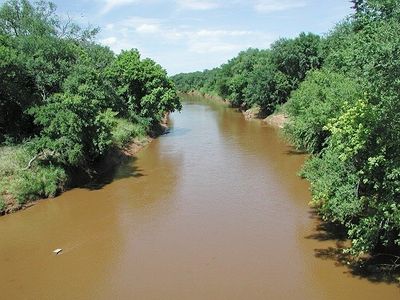
Washita River, River system in Texas Panhandle and Oklahoma, US

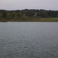
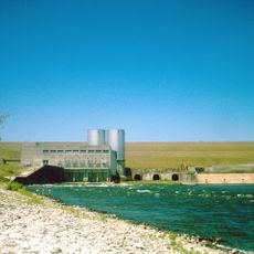
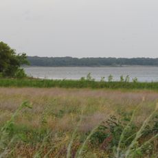
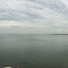
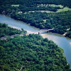
The Washita River is a river system flowing from the Texas Panhandle through Oklahoma, eventually joining the Red River. Along its course, several dams create reservoirs that serve water management and recreational purposes for the surrounding communities.

The river served as a vital area for the Cheyenne and other Indigenous peoples until military conflicts transformed the region. A major attack by the US military in 1868 marked a turning point in the area's history.

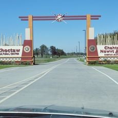
The river's name comes from a Choctaw word meaning "Big Hunt," reflecting the importance of hunting grounds along its course. Different Indigenous peoples who lived here gave it their own names, showing how central it was to their lives and travels.

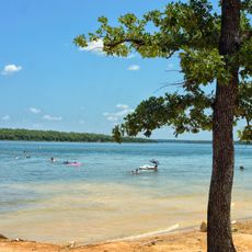
The river offers access to explore dams and reservoirs, particularly around Foss and Fort Cobb areas. Visit during milder months when water levels are stable for the most enjoyable experience.

Southeast of Davis, the river carved a deep gorge through the Arbuckle Mountains, creating a spectacular natural feature. This canyon demonstrates the river's power to shape the landscape over countless years.

The community of curious travelers

AroundUs brings together thousands of curated places, local tips, and hidden gems, enriched daily by 60,000 contributors worldwide.

Start exploring
Location
GPS coordinates
33.91530,-96.58250
Latest update
December 8, 2025 13:42
Around this place
Lake Texoma
United States of America

Lake Texoma

9.3 km
Choctaw Casino Resort
United States of America

Choctaw Casino Resort

16.1 km
Eisenhower Birthplace State Historic Site
United States of America

Eisenhower Birthplace State Historic Site

19.1 km
Denison Dam
United States of America

Denison Dam

10.9 km
Fort Washita
United States of America

Fort Washita

21.2 km
Hagerman National Wildlife Refuge
United States of America

Hagerman National Wildlife Refuge

29.4 km
Eisenhower State Park
United States of America

Eisenhower State Park

11 km
Sam Rayburn House Museum
United States of America

Sam Rayburn House Museum

51.8 km
Tishomingo National Wildlife Refuge
United States of America

Tishomingo National Wildlife Refuge

29.6 km
Fannin County Courthouse
United States of America

Fannin County Courthouse

53 km
Chickasaw Nation Capitols
United States of America

Chickasaw Nation Capitols

37 km
State Highway No. 78 Bridge at the Red River
United States of America

State Highway No. 78 Bridge at the Red River

40.1 km
Sam Rayburn Library and Museum
United States of America

Sam Rayburn Library and Museum

52.2 km
Oklahoma Presbyterian College
United States of America

Oklahoma Presbyterian College

19.9 km
Paul Brown Federal Building and United States Courthouse
United States of America

Paul Brown Federal Building and United States Courthouse

30.9 km
Three Valley Museum
United States of America

Three Valley Museum

20.5 km
Robert E. Lee School
United States of America

Robert E. Lee School

19.9 km
Bryan County Courthouse
United States of America

Bryan County Courthouse

20.5 km
Love County Courthouse
United States of America

Love County Courthouse

49.9 km
Marshall County Courthouse
United States of America

Marshall County Courthouse

26.1 km
Love County Jail and Sheriff's Residence
United States of America

Love County Jail and Sheriff's Residence

49.9 km
Marina Beach
United States of America

Marina Beach

49.1 km
Choctaw Cultural Center
United States of America

Choctaw Cultural Center

15.9 km
Harber Wildlife Museum
United States of America

Harber Wildlife Museum

25.7 km
Sam Rayburn House State Historic Site
United States of America

Sam Rayburn House State Historic Site

51.8 km
Eisenhower Veterans Monument
United States of America

Eisenhower Veterans Monument

20.7 km
Lake Murray State Park
United States of America

Lake Murray State Park

49.4 km
McClellan-Cunningham House
United States of America

McClellan-Cunningham House

52.6 km
Show the full map
Reviews
Share your experience

No review yet

Discussions
Start a discussion...

No discussion yet

« Washita River - River system in Texas Panhandle and Oklahoma, US » is provided by Around Us (aroundus.com). Images and texts are derived from Wikimedia project under a Creative Commons license. You are allowed to copy, distribute, and modify copies of this page, under the conditions set by the license, as long as this note is clearly visible.

Discover hidden gems everywhere you go!

From secret cafés to breathtaking viewpoints, skip the crowded tourist spots and find places that match your style. Our app makes it easy with voice search, smart filtering, route optimization, and insider tips from travelers worldwide. Download now for the complete mobile experience.

Around Us App Screenshot

A unique approach to discovering new places

Le Figaro

All the places worth exploring

France Info

A tailor-made excursion in just a few clicks

20 Minutes

Around Us
Travel Guide & Maps
Download

Send to your phone

QR Code
1

Open the camera app on your mobile.

2

Point at the QR code with your camera. A notification will appear.

3

Tap the notification to open the link.