Chest opened
+${chestReward.xp} XP
Explorer
NOUVEAU ×${chestReward.collectible.quantity}
tapez pour fermer
Chest locked

Open chests in the app

Around Us is built for your phone — chests unlock when you walk, explore and capture nearby places.

Enable Location

We need your location to show you interesting places around you

Discover nearby places

Find interesting locations and hidden gems around you

Precise directions

Get accurate directions and distances to places

Your location is never shared with other users. It's only used when you tap the location button.

Log in to your account

Start exploring — it's free

Trusted by 72,934 travelers worldwide

Continue with Google
Continue with Apple
or

We will send you a code to connect

By continuing, you accept our Terms and Conditions and our Privacy Policy

Check your inbox

We've sent a pincode in your inbox. Please enter the code below.

Discussion Reviews Photo
6.4k Popularity

Fort Towson, Historic district in Oklahoma, United States.

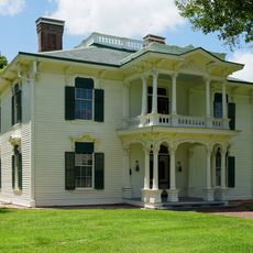
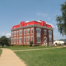
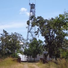
Fort Towson is a historic site in southeastern Oklahoma, near the confluence of the Red River and the Kiamichi River, featuring stone foundation ruins, partially restored structures, and walking paths across the grounds. The layout of the site still reflects the original arrangement of the military post, including the positions of barracks, storage buildings, and administrative structures.

The US Army established the post in 1824 near the border with Spanish territory, with the aim of monitoring the frontier and protecting relocated tribal nations in the region. The post was abandoned and reactivated several times over the following decades, and was eventually occupied by Confederate forces during the Civil War.

Fort Towson sat at a crossroads between military operations, trade networks, and the lands of the Choctaw Nation, and walking the grounds today gives a sense of how different communities moved through the same space. The stone and brick ruins that remain reflect how the site was shared and contested over decades.

The grounds are easy to walk and information boards along the paths help you place the different areas in context. A visitor center on the site displays objects from archaeological digs and military history, which helps make sense of what you see outside.

A Confederate general signed his surrender near this site in 1865, making it one of the last places where the Civil War formally ended. This event is less known than the surrender at Appomattox, yet it marked the close of organized Confederate resistance west of the Mississippi River.

The community of curious travelers

AroundUs brings together thousands of curated places, local tips, and hidden gems, enriched daily by 60,000 contributors worldwide.

Start exploring
Location
GPS coordinates
34.02778,-95.25639
Latest update
March 3, 2026 10:11
Around this place
Eiffel Tower
United States of America

Eiffel Tower

49.8 km
Broken Bow Lake
United States of America

Broken Bow Lake

55 km
Beavers Bend Resort Park
United States of America

Beavers Bend Resort Park

53.5 km
Hugo Lake
United States of America

Hugo Lake

15.4 km
Sam Bell Maxey House
United States of America

Sam Bell Maxey House

49.9 km
Choctaw Capitol Building
United States of America

Choctaw Capitol Building

68.4 km
AT6 Monument
United States of America

AT6 Monument

54.3 km
Little River National Wildlife Refuge
United States of America

Little River National Wildlife Refuge

45.6 km
Lamar County Historical Museum
United States of America

Lamar County Historical Museum

50 km
Delta County Courthouse
United States of America

Delta County Courthouse

83.1 km
First United Methodist Church
United States of America

First United Methodist Church

49.2 km
Cupco Church
United States of America

Cupco Church

74.5 km
First Church of Christ, Scientist
United States of America

First Church of Christ, Scientist

49.7 km
Snow School
United States of America

Snow School

43.5 km
Clayton High School Auditorium
United States of America

Clayton High School Auditorium

63.2 km
First Presbyterian Church
United States of America

First Presbyterian Church

49.7 km
Idabel Armory
United States of America

Idabel Armory

42.8 km
First Presbyterian Church
United States of America

First Presbyterian Church

84.3 km
Bishop Brookes House
United States of America

Bishop Brookes House

84.2 km
Otis Theodore and Effiegene Locke Wingo House
United States of America

Otis Theodore and Effiegene Locke Wingo House

84.2 km
Hugo Historic District
United States of America

Hugo Historic District

23.7 km
Beaver's Bend Mining Company
United States of America

Beaver's Bend Mining Company

48.5 km
Sam Bell Maxey House State Historic Site
United States of America

Sam Bell Maxey House State Historic Site

49.9 km
Erie Theatre
United States of America

Erie Theatre

23.7 km
Grand Theater
United States of America

Grand Theater

49.3 km
State Theater
United States of America

State Theater

42.2 km
Carter Mountain Lookout
United States of America

Carter Mountain Lookout

50.7 km
Paris Community Theatre
United States of America

Paris Community Theatre

49.4 km
Show the full map
Reviews
Share your experience

No review yet

Discussions
Start a discussion...

No discussion yet

« Fort Towson - Historic district in Oklahoma, United States » is provided by Around Us (aroundus.com). Images and texts are derived from Wikimedia project under a Creative Commons license. You are allowed to copy, distribute, and modify copies of this page, under the conditions set by the license, as long as this note is clearly visible.

Discover hidden gems everywhere you go!

From secret cafés to breathtaking viewpoints, skip the crowded tourist spots and find places that match your style. Our app makes it easy with voice search, smart filtering, route optimization, and insider tips from travelers worldwide. Download now for the complete mobile experience.

Around Us App Screenshot

A unique approach to discovering new places

Le Figaro

All the places worth exploring

France Info

A tailor-made excursion in just a few clicks

20 Minutes

Around Us
Travel Guide & Maps
Download

Send to your phone

QR Code
1

Open the camera app on your mobile.

2

Point at the QR code with your camera. A notification will appear.

3

Tap the notification to open the link.