Enable Location

We need your location to show you interesting places around you

Discover nearby places

Find interesting locations and hidden gems around you

Precise directions

Get accurate directions and distances to places

Your location is never shared with other users. It's only used when you tap the location button.

Toledo Bend Reservoir

Log in to your account

Start exploring — it's free

Trusted by 61,815 travelers worldwide

Continue with Google
Continue with Apple
or

We will send you a code to connect

By continuing, you accept our Terms and Conditions and our Privacy Policy

Check your inbox

We've sent a pincode in your inbox. Please enter the code below.

Toledo Bend Reservoir

Toledo Bend Reservoir, Water reservoir at Texas-Louisiana border, United States.

Description

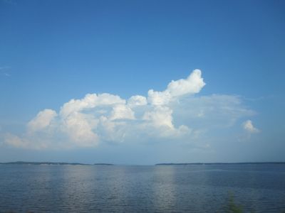
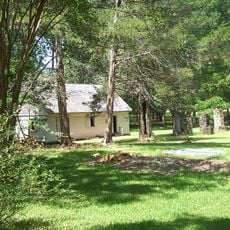
Toledo Bend Reservoir is a water reservoir at the Texas-Louisiana border, running through forests of pine and cypress. The shoreline stretches for several hundred miles with small coves, shallow inlets, and narrow channels cut by green water.

History

Authorities from both states started building the dam in 1966 and filled the basin over three years until it reached its final form in 1969. The project created jobs in rural areas and brought new settlements to the shores where only small villages stood before.

Culture

Anglers gather at small docks and public shoreline areas, exchanging tips about the best spots for bass. The tradition of fishing competitions brings new participants to different sections of the shore each month, where they refine their techniques over long weekends.

Practical

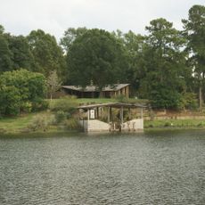
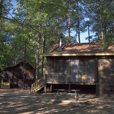
Boat ramps and campgrounds are scattered along both shores, with paved roads leading to the main access points. Buoys mark shallow areas and submerged obstacles, so carrying a navigation chart or following familiar routes is advisable.

Did you know?

A team of specialists spent several weeks in 2003 collecting debris from the shallow water and shoreline forests. The search focused on remote coves where currents swept objects to hidden spots reachable only by small boats.

Location
GPS coordinates
31.19650,-93.57210
Latest update
December 19, 2025 23:53

AroundUs brings together thousands of curated places, local tips, and hidden gems, enriched daily by 60,000 contributors worldwide. Discover all places nearby (Louisiana).

Around this place
Los Adaes
United States of America

Los Adaes

62.9 km
Hodges Gardens State Park
United States of America

Hodges Gardens State Park

23.8 km
Beauregard Parish Jail
United States of America

Beauregard Parish Jail

47.5 km
Fort Jesup
United States of America

Fort Jesup

49 km
South Toledo Bend State Park
United States of America

South Toledo Bend State Park

1.3 km
North Toledo Bend State Park
United States of America

North Toledo Bend State Park

42 km
Mission Dolores State Historic Site
United States of America

Mission Dolores State Historic Site

63 km
Burr's Ferry Bridge
United States of America

Burr's Ferry Bridge

15.4 km
Beauregard Parish Courthouse
United States of America

Beauregard Parish Courthouse

47.4 km
Beauregard Parish Training School
United States of America

Beauregard Parish Training School

48.7 km
William Garrett Plantation
United States of America

William Garrett Plantation

65.8 km
Church of St. Anne
United States of America

Church of St. Anne

71 km
First United Methodist Church
United States of America

First United Methodist Church

29.9 km
US 190 Bridge at the Neches River
United States of America

US 190 Bridge at the Neches River

70.9 km
DeRidder USO Building
United States of America

DeRidder USO Building

48 km
Robeline Methodist Church
United States of America

Robeline Methodist Church

60.6 km
DeRidder Commercial Historic District
United States of America

DeRidder Commercial Historic District

47.4 km
Vernon Parish Courthouse
United States of America

Vernon Parish Courthouse

30.3 km
Gaines–Oliphint House
United States of America

Gaines–Oliphint House

34.9 km
Burks House
United States of America

Burks House

49.3 km
Jasper County Courthouse
United States of America

Jasper County Courthouse

51 km
City Hotel
United States of America

City Hotel

62.7 km
Newton County Courthouse
United States of America

Newton County Courthouse

42.8 km
San Augustine County Courthouse and Jail
United States of America

San Augustine County Courthouse and Jail

63.3 km
Ezekiel W. Cullen House
United States of America

Ezekiel W. Cullen House

63 km
Edmond Ellison Smart House
United States of America

Edmond Ellison Smart House

30.4 km
Sabine Theatre
United States of America

Sabine Theatre

42.2 km
Belle-Jim Hotel
United States of America

Belle-Jim Hotel

51 km
Show the full map
« Toledo Bend Reservoir - Water reservoir at Texas-Louisiana border, United States » is provided by Around Us (aroundus.com). Images and texts are derived from Wikimedia project under a Creative Commons license. You are allowed to copy, distribute, and modify copies of this page, under the conditions set by the license, as long as this note is clearly visible.

Discover hidden gems everywhere you go!

From secret cafés to breathtaking viewpoints, skip the crowded tourist spots and find places that match your style. Our app makes it easy with voice search, smart filtering, route optimization, and insider tips from travelers worldwide. Download now for the complete mobile experience.

Around Us App Screenshot

A unique approach to discovering new places

Le Figaro

All the places worth exploring

France Info

A tailor-made excursion in just a few clicks

20 Minutes

Around Us
Travel Guide & Maps
Download

Send to your phone

QR Code
1

Open the camera app on your mobile.

2

Point at the QR code with your camera. A notification will appear.

3

Tap the notification to open the link.