Fort Jesup

Log in to your account

AroundUs is a community-driven map of interesting places, built by curious explorers like you. It grows with every review, story, and photo you share.
Connect to save your favorite spots, contribute locations, and create personalized routes.
Continue with Google
Continue with Apple
Continue with X
Continue with Facebook
Continue with email
By continuing, you accept our Terms and Conditions and our Privacy Policy
Create an account
Add to collection
Map
Suggest a change
Share

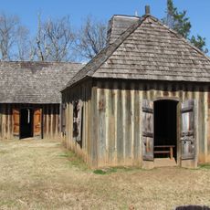
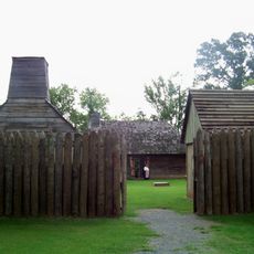
Fort Jesup, Military fort in Sabine Parish, Louisiana, United States.

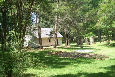
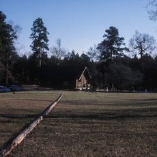
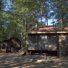
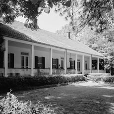
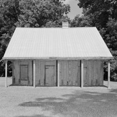
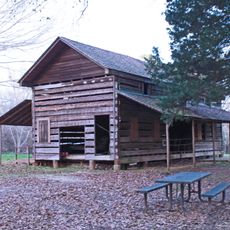
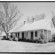
Fort Jesup was a military post at the western boundary of Louisiana with various buildings supporting garrison operations. The site includes restored and reconstructed structures showing early 1800s camp life.

The fort was established in 1822 to control the border region between US and Spanish territories. It played an important role during North American expansion in the following decades.

The location reflects the military's role in shaping the border region, particularly through management of relationships between different communities. Visitors can understand today how the garrison influenced daily life and development of surrounding areas.

The grounds are located roughly 6 miles northeast of Many and are publicly accessible. Visitors should wear comfortable shoes and allow time to explore the buildings and exhibits.

The garrison witnessed major territorial changes as Texas shifted from Spanish control to independence and then to statehood. This transformation played out literally at the borders the post monitored.

Location: Sabine Parish

Inception: 1822

Website: https://lastateparks.com/historic-sites/fort-jesup-state-historic-site

GPS coordinates: 31.61139,-93.40083

Latest update: December 10, 2025 16:26

Photos
Around this place
Melrose Plantation
United States of America

Melrose Plantation

41.2 km
Magnolia Plantation
United States of America

Magnolia Plantation

44.2 km
Los Adaes
United States of America

Los Adaes

14.9 km
Hodges Gardens State Park
United States of America

Hodges Gardens State Park

27.1 km
Cane River Creole National Historical Park
United States of America

Cane River Creole National Historical Park

38.2 km
Oaklawn Plantation
United States of America

Oaklawn Plantation

37.4 km
Oakland Plantation
United States of America

Oakland Plantation

38.1 km
Harry Turpin Stadium
United States of America

Harry Turpin Stadium

32.6 km
Fort St. Jean Baptiste State Historic Site
United States of America

Fort St. Jean Baptiste State Historic Site

33.5 km
North Toledo Bend State Park
United States of America

North Toledo Bend State Park

32.3 km
Kate Chopin House
United States of America

Kate Chopin House

46.5 km
Basilica of the Immaculate Conception
United States of America

Basilica of the Immaculate Conception

34 km
Rebel State Historic Site
United States of America

Rebel State Historic Site

33.5 km
Natchitoches Historic District
United States of America

Natchitoches Historic District

33.3 km
Narcisse Prudhomme Plantation
United States of America

Narcisse Prudhomme Plantation

37.6 km
Badin-Roque House
United States of America

Badin-Roque House

40.5 km
Church of St. Anne
United States of America

Church of St. Anne

22.2 km
Robeline Methodist Church
United States of America

Robeline Methodist Church

12.7 km
Gaines–Oliphint House
United States of America

Gaines–Oliphint House

37.3 km
Old Courthouse Museum
United States of America

Old Courthouse Museum

34 km
Jones House
United States of America

Jones House

41.8 km
Sabine Theatre
United States of America

Sabine Theatre

9.3 km
Fort St. Jean Baptiste
United States of America

Fort St. Jean Baptiste

33.6 km
Port of Natchitoches
United States of America

Port of Natchitoches

39.4 km
Natchitoches Parish Library
United States of America

Natchitoches Parish Library

41.5 km
Davis Springs Methodist Church
United States of America

Davis Springs Methodist Church

44.7 km
Bank of Montgomery Washington Street Branch
United States of America

Bank of Montgomery Washington Street Branch

34.3 km
Church Street Bridge
United States of America

Church Street Bridge

34.2 km
Show the full map
Reviews

Visited this place? Tap the stars to rate it and share your experience / photos with the community! Try now! You can cancel it anytime.

« Fort Jesup - Military fort in Sabine Parish, Louisiana, United States » is provided by Around Us (aroundus.com). Images and texts are derived from Wikimedia project under a Creative Commons license. You are allowed to copy, distribute, and modify copies of this page, under the conditions set by the license, as long as this note is clearly visible.

Discover hidden gems everywhere you go!

From secret cafés to breathtaking viewpoints, skip the crowded tourist spots and find places that match your style. Our app makes it easy with voice search, smart filtering, route optimization, and insider tips from travelers worldwide. Download now for the complete mobile experience.

Around Us App Screenshot

A unique approach to discovering new places

Le Figaro

All the places worth exploring

France Info

A tailor-made excursion in just a few clicks

20 Minutes