Enable Location

We need your location to show you interesting places around you

Discover nearby places

Find interesting locations and hidden gems around you

Precise directions

Get accurate directions and distances to places

Your location is never shared with other users. It's only used when you tap the location button.

Liberty

Log in to your account

Start exploring — it's free

Trusted by 63,938 travelers worldwide

Continue with Google
Continue with Apple
or

We will send you a code to connect

By continuing, you accept our Terms and Conditions and our Privacy Policy

Check your inbox

We've sent a pincode in your inbox. Please enter the code below.

Discussion Reviews 1 Photos
17.1k Popularity

Liberty, town in Mississippi, United States

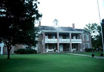
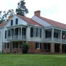
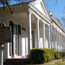
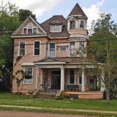
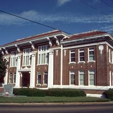
Liberty is a small town in Amite County in southeastern Mississippi and serves as the county seat. Its center is marked by a courthouse built in 1839 that has been updated over the years and holds the stories of many generations.

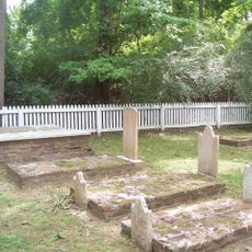
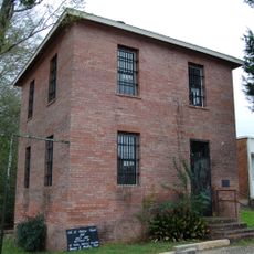
Liberty was officially established in 1809 and developed as the local government center of Amite County. The war monument erected in 1871 was the first of its kind in Mississippi, honoring soldiers who fought during the Civil War.

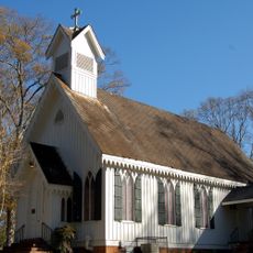
The name Liberty comes from English and means freedom. The town reflects Southern traditions where residents gather for church services, school events, and local festivals held throughout the year.

The town has limited tourist attractions but modest stores and restaurants offer an authentic experience of rural Mississippi. Streets are quiet and easy to walk through, and the surroundings feature farmland and open fields.

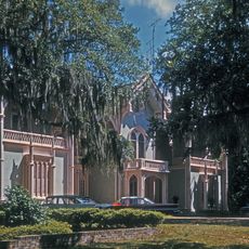
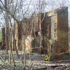
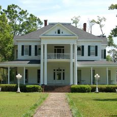
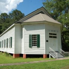
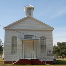
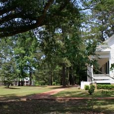
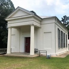
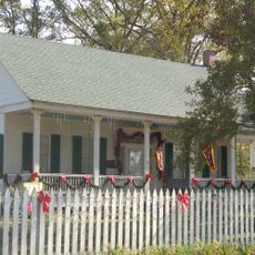
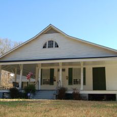
A small music building on the grounds of the Liberty Female Seminary from 1853 survived the Civil War undamaged while other structures were destroyed. This building now stands on the National Register and is a rare witness to that era.

The community of curious travelers

AroundUs brings together thousands of curated places, local tips, and hidden gems, enriched daily by 60,000 contributors worldwide.

Start exploring
Location
Elevation above the sea
103 m
GPS coordinates
31.16080,-90.80390
Latest update
February 17, 2026 01:20
Around this place
Percy Quin State Park
United States of America

Percy Quin State Park

27 km
Locust Grove State Historic Site
United States of America

Locust Grove State Historic Site

62 km
Afton Villa Gardens
United States of America

Afton Villa Gardens

65.5 km
Mazique Archeological Site
United States of America

Mazique Archeological Site

62.4 km
Cherry Grove Plantation
United States of America

Cherry Grove Plantation

62.3 km
Rosemont
United States of America

Rosemont

45.4 km
Elizabeth Female Academy
United States of America

Elizabeth Female Academy

65.5 km
Macedonia Baptist Church
United States of America

Macedonia Baptist Church

65 km
Liberty Presbyterian Church
United States of America

Liberty Presbyterian Church

561 m
Marston House
United States of America

Marston House

38.7 km
1938 Clinton High School
United States of America

1938 Clinton High School

38.8 km
Blythewood
United States of America

Blythewood

56 km
Union Church Presbyterian Church
United States of America

Union Church Presbyterian Church

58.1 km
Arcola Presbyterian Church
United States of America

Arcola Presbyterian Church

50.8 km
Jackson Historic District
United States of America

Jackson Historic District

52.6 km
St. Andrew's Episcopal Church
United States of America

St. Andrew's Episcopal Church

38.9 km
Inez Hotel
United States of America

Inez Hotel

57.9 km
Kingston Methodist Church
United States of America

Kingston Methodist Church

51.8 km
Courthouse and Lawyers' Row
United States of America

Courthouse and Lawyers' Row

41.4 km
William Frederick Holmes House
United States of America

William Frederick Holmes House

34.4 km
Old St. Helena Parish Jail
United States of America

Old St. Helena Parish Jail

39.2 km
Green Shutters
United States of America

Green Shutters

42.6 km
Greensburg Land Office
United States of America

Greensburg Land Office

39.2 km
Boatner House
United States of America

Boatner House

38.7 km
Bank of Slaughter
United States of America

Bank of Slaughter

59.1 km
Greenlawn
United States of America

Greenlawn

56.3 km
Kentwood Historical and Cultural Arts Museum
United States of America

Kentwood Historical and Cultural Arts Museum

37.5 km
Walthall County Courthouse and Jail
United States of America

Walthall County Courthouse and Jail

63.3 km
Show the full map
Reviews
Share your experience

No review yet

Discussions
Start a discussion...

No discussion yet

« Liberty - town in Mississippi, United States » is provided by Around Us (aroundus.com). Images and texts are derived from Wikimedia project under a Creative Commons license. You are allowed to copy, distribute, and modify copies of this page, under the conditions set by the license, as long as this note is clearly visible.

Discover hidden gems everywhere you go!

From secret cafés to breathtaking viewpoints, skip the crowded tourist spots and find places that match your style. Our app makes it easy with voice search, smart filtering, route optimization, and insider tips from travelers worldwide. Download now for the complete mobile experience.

Around Us App Screenshot

A unique approach to discovering new places

Le Figaro

All the places worth exploring

France Info

A tailor-made excursion in just a few clicks

20 Minutes

Around Us
Travel Guide & Maps
Download

Send to your phone

QR Code
1

Open the camera app on your mobile.

2

Point at the QR code with your camera. A notification will appear.

3

Tap the notification to open the link.