Chest opened
+${chestReward.xp} XP
Explorer
NOUVEAU ×${chestReward.collectible.quantity}
tapez pour fermer
Chest locked

Open chests in the app

Around Us is built for your phone — chests unlock when you walk, explore and capture nearby places.

Enable Location

We need your location to show you interesting places around you

Discover nearby places

Find interesting locations and hidden gems around you

Precise directions

Get accurate directions and distances to places

Your location is never shared with other users. It's only used when you tap the location button.

Log in to your account

Start exploring — it's free

Trusted by 73,074 travelers worldwide

Continue with Google
Continue with Apple
or

We will send you a code to connect

By continuing, you accept our Terms and Conditions and our Privacy Policy

Check your inbox

We've sent a pincode in your inbox. Please enter the code below.

Ka-Do-Ha Indian Village
Discussion Reviews Photo
2.6k Popularity

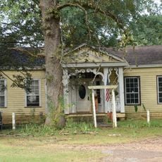
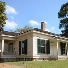
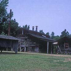
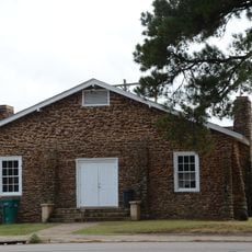
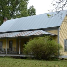
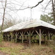
Ka-Do-Ha Indian Village, Native American archaeological site in Murfreesboro, Arkansas.

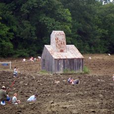
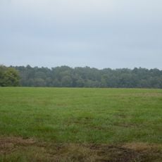
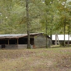
Ka-Do-Ha is an archaeological site in Arkansas featuring preserved earthen mounds and displays of ancient artifacts within a sprawling outdoor setting. The grounds include a designated area where visitors can participate in supervised excavation activities and handle remnants of the past.

The settlement originated around 1000 and belonged to the Kadohadacho civilization that inhabited this region for centuries. It was rediscovered in 1964 and has since become a place where this community's history is accessible to visitors.

The site displays pottery, arrowheads, and jewelry that reflect the daily skills and traditions of the Kadohadacho people. Visitors can examine these objects closely and gain a sense of how inhabitants crafted and used these tools.

The site is open year-round, and visiting on mild weather days makes the outdoor digging experience more enjoyable. Wear comfortable shoes and bring sun protection, as you will spend considerable time outside exploring the grounds.

Visitors can dig for artifacts like arrowheads using real tools in designated fields on the property. This hands-on experience lets you try archaeological work yourself and potentially uncover genuine objects from the past.

The community of curious travelers

AroundUs brings together thousands of curated places, local tips, and hidden gems, enriched daily by 60,000 contributors worldwide.

Start exploring
GPS coordinates
34.06450,-93.73210
Latest update
December 12, 2025 17:45
Around this place
Crater of Diamonds State Park
United States of America

Crater of Diamonds State Park

6.7 km
Historic Washington State Park
United States of America

Historic Washington State Park

32.7 km
Nashville High School
United States of America

Nashville High School

14.5 km
Confederate State Capitol building
United States of America

Confederate State Capitol building

32.2 km
Oak Grove Missionary Baptist Church
United States of America

Oak Grove Missionary Baptist Church

28.1 km
Prairie D'Ane Battlefield
United States of America

Prairie D'Ane Battlefield

38.3 km
Ebenezer Campground
United States of America

Ebenezer Campground

21.6 km
Elbert W. Holt House
United States of America

Elbert W. Holt House

16.1 km
Mineral Springs Waterworks
United States of America

Mineral Springs Waterworks

27.4 km
Rosenwald School
United States of America

Rosenwald School

25.8 km
Washington Confederate Monument
United States of America

Washington Confederate Monument

32.4 km
Elkin's Ferry Battlefield
United States of America

Elkin's Ferry Battlefield

37.7 km
Oak Grove Rosenwald School
United States of America

Oak Grove Rosenwald School

42 km
Old Bank of Amity
United States of America

Old Bank of Amity

33.5 km
Hale Creek Bridge
United States of America

Hale Creek Bridge

41.9 km
Howard County Courthouse
United States of America

Howard County Courthouse

16.8 km
Dr. Boaz House
United States of America

Dr. Boaz House

33.2 km
First United Methodist Church
United States of America

First United Methodist Church

41.4 km
Conway Hotel
United States of America

Conway Hotel

5.2 km
Self Creek Bridge
United States of America

Self Creek Bridge

19.3 km
Womack–Parker House
United States of America

Womack–Parker House

16.2 km
Flavius Holt House
United States of America

Flavius Holt House

16.3 km
Grandison D. Royston House
United States of America

Grandison D. Royston House

32.9 km
Goodlett Gin
United States of America

Goodlett Gin

32.3 km
Nashville American Legion Building
United States of America

Nashville American Legion Building

18.2 km
Pike County Courthouse
United States of America

Pike County Courthouse

3.9 km
Shelton-Lockeby House
United States of America

Shelton-Lockeby House

1.4 km
Clear Springs Tabernacle
United States of America

Clear Springs Tabernacle

31.4 km
Show the full map
Reviews
Share your experience

No review yet

Discussions
Start a discussion...

No discussion yet

« Ka-Do-Ha Indian Village - Native American archaeological site in Murfreesboro, Arkansas » is provided by Around Us (aroundus.com). Images and texts are derived from Wikimedia project under a Creative Commons license. You are allowed to copy, distribute, and modify copies of this page, under the conditions set by the license, as long as this note is clearly visible.

Discover hidden gems everywhere you go!

From secret cafés to breathtaking viewpoints, skip the crowded tourist spots and find places that match your style. Our app makes it easy with voice search, smart filtering, route optimization, and insider tips from travelers worldwide. Download now for the complete mobile experience.

Around Us App Screenshot

A unique approach to discovering new places

Le Figaro

All the places worth exploring

France Info

A tailor-made excursion in just a few clicks

20 Minutes

Around Us
Travel Guide & Maps
Download

Send to your phone

QR Code
1

Open the camera app on your mobile.

2

Point at the QR code with your camera. A notification will appear.

3

Tap the notification to open the link.