Enable Location

We need your location to show you interesting places around you

Discover nearby places

Find interesting locations and hidden gems around you

Precise directions

Get accurate directions and distances to places

Your location is never shared with other users. It's only used when you tap the location button.

Menard-Hodges Site

Log in to your account

Start exploring — it's free

Trusted by 62,454 travelers worldwide

Continue with Google
Continue with Apple
or

We will send you a code to connect

By continuing, you accept our Terms and Conditions and our Privacy Policy

Check your inbox

We've sent a pincode in your inbox. Please enter the code below.

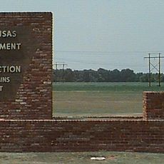
Menard-Hodges Site, Archaeological mound complex in Arkansas County, United States.

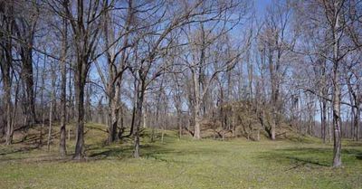
The Menard-Hodges Site contains two large earthen mounds that rise above the surrounding land, with a central plaza between them marking the heart of this ancient settlement. The higher structures served as platforms for buildings and ceremonies that once dominated the landscape.

People first settled this location around 600 BC and continued living here through different cultural periods until European explorers arrived in the 1700s. This long span of habitation reveals how significant and stable this place was as a human settlement.

The location served as an important Quapaw community center, where people gathered for ceremonies and daily life. Walking through the site today, you can sense how this place connected different groups across the region.

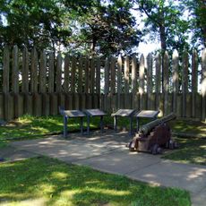
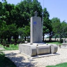
The site can be visited as part of a protected national memorial where you can walk among the mounds and view them from different angles. The open landscape makes it easy to understand the layout and how the ancient people organized this space.

Early fieldwork in the 1880s uncovered hundreds of pottery vessels that helped establish how many different Native American groups had used this place over centuries. These discoveries made the site one of the most important records of continuous cultural life in the region.

The community of curious travelers

AroundUs brings together thousands of curated places, local tips, and hidden gems, enriched daily by 60,000 contributors worldwide.

Start exploring
Location
GPS coordinates
34.00387,-91.25421
Latest update
December 12, 2025 14:23
Around this place
Cummins Unit
United States of America

Cummins Unit

30.9 km
Mississippi Alluvial Plain
United States of America

Mississippi Alluvial Plain

23.5 km
Arkansas Post
United States of America

Arkansas Post

8.5 km
Yancopin Bridge
United States of America

Yancopin Bridge

7 km
Great River Road State Park
United States of America

Great River Road State Park

26.8 km
St. Charles Battle Monument
United States of America

St. Charles Battle Monument

42.6 km
Arkansas County Courthouse-Southern District
United States of America

Arkansas County Courthouse-Southern District

33.3 km
Halliburton House
United States of America

Halliburton House

33.7 km
St. Charles Battle Site
United States of America

St. Charles Battle Site

43.3 km
A.M. Bohnert Rice Plantation Pump
United States of America

A.M. Bohnert Rice Plantation Pump

11.8 km
North Jackson Street Bridge
United States of America

North Jackson Street Bridge

33.9 km
Grace Episcopal Church
United States of America

Grace Episcopal Church

26.6 km
L.A. Black Rice Milling Association Inc. Office
United States of America

L.A. Black Rice Milling Association Inc. Office

32.9 km
Warrens Bridge
United States of America

Warrens Bridge

43.2 km
North Washington Street Bridge
United States of America

North Washington Street Bridge

33.8 km
First United Methodist Church
United States of America

First United Methodist Church

33.3 km
DeWitt Commercial Historic District
United States of America

DeWitt Commercial Historic District

33.2 km
Taylor Log House and Site
United States of America

Taylor Log House and Site

37.8 km
Maxwell Street Bridge
United States of America

Maxwell Street Bridge

33.6 km
Frank Tillar Memorial Methodist Episcopal Church, South
United States of America

Frank Tillar Memorial Methodist Episcopal Church, South

37.5 km
Dr. J.D. Watts House
United States of America

Dr. J.D. Watts House

25.6 km
Kemp Cotton Gin Historic District
United States of America

Kemp Cotton Gin Historic District

26.9 km
Parnell-Sharpe House
United States of America

Parnell-Sharpe House

43.6 km
Jay Lewis House
United States of America

Jay Lewis House

43.3 km
McKennon-Shea House
United States of America

McKennon-Shea House

25.7 km
Arkansas Post National Memorial Visitor Center and Museum
United States of America

Arkansas Post National Memorial Visitor Center and Museum

8.5 km
Rohwer Relocation Center Memorial Cemetery
United States of America

Rohwer Relocation Center Memorial Cemetery

26.5 km
Lock and Dam Number 3
United States of America

Lock and Dam Number 3

42.9 km
Show the full map
« Menard-Hodges Site - Archaeological mound complex in Arkansas County, United States » is provided by Around Us (aroundus.com). Images and texts are derived from Wikimedia project under a Creative Commons license. You are allowed to copy, distribute, and modify copies of this page, under the conditions set by the license, as long as this note is clearly visible.

Discover hidden gems everywhere you go!

From secret cafés to breathtaking viewpoints, skip the crowded tourist spots and find places that match your style. Our app makes it easy with voice search, smart filtering, route optimization, and insider tips from travelers worldwide. Download now for the complete mobile experience.

Around Us App Screenshot

A unique approach to discovering new places

Le Figaro

All the places worth exploring

France Info

A tailor-made excursion in just a few clicks

20 Minutes

Around Us
Travel Guide & Maps
Download

Send to your phone

QR Code
1

Open the camera app on your mobile.

2

Point at the QR code with your camera. A notification will appear.

3

Tap the notification to open the link.