George County

Log in to your account

AroundUs is a community-driven map of interesting places, built by curious explorers like you. It grows with every review, story, and photo you share.
Connect to save your favorite spots, contribute locations, and create personalized routes.
Continue with Google
Continue with Apple
Continue with X
Continue with Facebook
Continue with email
By continuing, you accept our Terms and Conditions and our Privacy Policy
Create an account
Add to collection
Map
Suggest a change
Share

George County, Administrative county in Mississippi, United States.

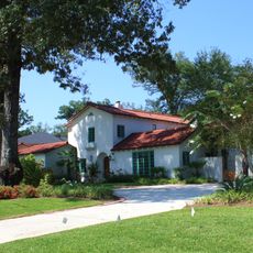
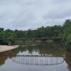
George County is an administrative area in eastern Mississippi with Lucedale as its county seat and main center. The landscape consists of forests and farmland crossed by federal and state highways that link it to neighboring counties.

The area was separated from Perry County in 1910, marking a period of administrative reorganization in early 20th century Mississippi. This division allowed for better local governance and development of the newly formed county.

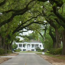
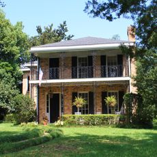
The community maintains strong ties to small-town life, with church gatherings and local events serving as central points where neighbors meet and share traditions together. These gatherings reflect the importance of family and social bonds that define daily life in rural Mississippi.

The infrastructure includes US Route 98 and several state highways that facilitate movement through the area and access to local services. Visitors should plan ahead when traveling and bring a map, as the county is largely rural with services concentrated in Lucedale.

The area is deeply rooted in forestry and agriculture, with timber production and farming serving as traditional economic pillars that shape the region's character. These economic activities remain visible in the landscape and contribute to local identity.

Location: Mississippi

Inception: 1910

Capital city: Lucedale

Shares border with: Greene County, Jackson County, Perry County, Stone County, Mobile County

Website: http://georgecountyms.com

GPS coordinates: 30.87000,-88.64000

Latest update: December 7, 2025 20:24

Photos
Around this place
United States of America

Hancock Whitney Stadium

47 km
Mobile Museum of Art
United States of America

Mobile Museum of Art

49.9 km
Black Creek Wilderness
United States of America

Black Creek Wilderness

39 km
Mobile Botanical Gardens
United States of America

Mobile Botanical Gardens

49.5 km
Splash Pad
United States of America

Splash Pad

49.6 km
Stewartfield
United States of America

Stewartfield

51.5 km
Magee Farm
United States of America

Magee Farm

45.8 km
James Arthur Morrison House
United States of America

James Arthur Morrison House

50.8 km
Carolina Hall
United States of America

Carolina Hall

51.5 km
19th Century Spring Hill Neighborhood TR
United States of America

19th Century Spring Hill Neighborhood TR

51.4 km
Roberts House
United States of America

Roberts House

51.1 km
Collins-Robinson House
United States of America

Collins-Robinson House

50.6 km
N.Q. and Virginia M. Thompson House
United States of America

N.Q. and Virginia M. Thompson House

46.6 km
Ross Knox House
United States of America

Ross Knox House

51.1 km
Red Creek Wildlife Management Area (Mississippi)
United States of America

Red Creek Wildlife Management Area (Mississippi)

31.2 km
Robert L. Spotswood House
United States of America

Robert L. Spotswood House

50.8 km
Citronelle Railroad Historic District
United States of America

Citronelle Railroad Historic District

46 km
Vernal Presbyterian Church
United States of America

Vernal Presbyterian Church

18.5 km
Leaf River Bridge
United States of America

Leaf River Bridge

33.3 km
Collins-Marston House
United States of America

Collins-Marston House

50.7 km
Tanner Farmhouse
United States of America

Tanner Farmhouse

26.7 km
George Austin McHenry House
United States of America

George Austin McHenry House

50.9 km
Willis G. Clark House
United States of America

Willis G. Clark House

43.7 km
Davis-Oak Grove District
United States of America

Davis-Oak Grove District

43.3 km
Griffin House
United States of America

Griffin House

50.5 km
Central Core Historic District
United States of America

Central Core Historic District

46.9 km
Barr's Subdivision Historic District
United States of America

Barr's Subdivision Historic District

45.5 km
Gulf Hills
United States of America

Gulf Hills

52.3 km
Show the full map
Reviews

Visited this place? Tap the stars to rate it and share your experience / photos with the community! Try now! You can cancel it anytime.

Administrative divisions
« George County - Administrative county in Mississippi, United States » is provided by Around Us (aroundus.com). Images and texts are derived from Wikimedia project under a Creative Commons license. You are allowed to copy, distribute, and modify copies of this page, under the conditions set by the license, as long as this note is clearly visible.

Discover hidden gems everywhere you go!

From secret cafés to breathtaking viewpoints, skip the crowded tourist spots and find places that match your style. Our app makes it easy with voice search, smart filtering, route optimization, and insider tips from travelers worldwide. Download now for the complete mobile experience.

Around Us App Screenshot

A unique approach to discovering new places

Le Figaro

All the places worth exploring

France Info

A tailor-made excursion in just a few clicks

20 Minutes