Chest opened
+${chestReward.xp} XP
Explorer
NOUVEAU ×${chestReward.collectible.quantity}
tapez pour fermer
Chest locked

Open chests in the app

Around Us is built for your phone — chests unlock when you walk, explore and capture nearby places.

Enable Location

We need your location to show you interesting places around you

Discover nearby places

Find interesting locations and hidden gems around you

Precise directions

Get accurate directions and distances to places

Your location is never shared with other users. It's only used when you tap the location button.

Thomasville

Log in to your account

Start exploring — it's free

Trusted by 72,881 travelers worldwide

Continue with Google
Continue with Apple
or

We will send you a code to connect

By continuing, you accept our Terms and Conditions and our Privacy Policy

Check your inbox

We've sent a pincode in your inbox. Please enter the code below.

Discussion Reviews 1 Photos
11.5k Popularity

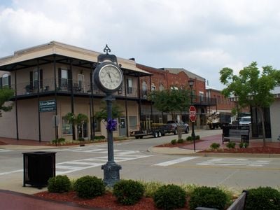
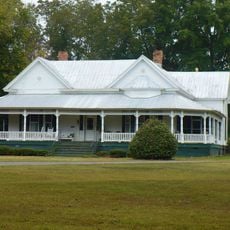
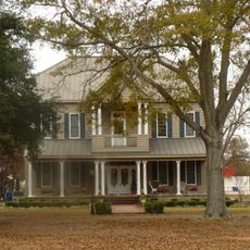
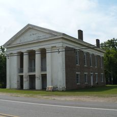
Thomasville, Historic commercial center in Clarke County, Alabama.

Thomasville is a commercial center in Clarke County, Alabama, sitting on elevated terrain between two rivers. The city features business parks and a commercial corridor that form the core of local trade and commerce.

The city began in 1888 when merchants relocated their operations closer to the railroad tracks. They named the settlement after a railroad financier who helped shape the region's development.

The Thomasville Civic Center hosts theatrical productions, concerts, and community gatherings in its gallery and theater spaces throughout the year.

The area is easily reached via US Route 43, which connects businesses and industry throughout the region. Visitors can navigate easily using this main corridor as a reference point.

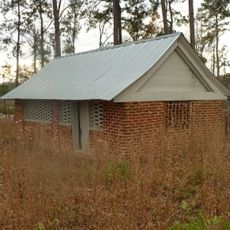
A former lumber facility now houses multiple services including a career center, public library, and local museum under one roof. This adaptive reuse shows how the city repurposes historic structures for modern needs.

The community of curious travelers

AroundUs brings together thousands of curated places, local tips, and hidden gems, enriched daily by 60,000 contributors worldwide.

Start exploring
GPS coordinates
31.91349,-87.73584
Latest update
December 8, 2025 13:40
Around this place
Fort Sinquefield
United States of America

Fort Sinquefield

28.2 km
Millers Ferry Lock and Dam
United States of America

Millers Ferry Lock and Dam

37.9 km
Dry Fork Plantation
United States of America

Dry Fork Plantation

35.5 km
Coffeeville Lock and Dam
United States of America

Coffeeville Lock and Dam

41.1 km
Half Chance Iron Bridge
United States of America

Half Chance Iron Bridge

44.7 km
William "Bill" Dannelly Reservoir
United States of America

William "Bill" Dannelly Reservoir

39.3 km
Mount Sterling Methodist Church
United States of America

Mount Sterling Methodist Church

45 km
William King Beck House
United States of America

William King Beck House

40.6 km
C. S. Golden House
United States of America

C. S. Golden House

41.4 km
J. P. McKee Lustron House
United States of America

J. P. McKee Lustron House

46.7 km
Bush House
United States of America

Bush House

22.3 km
Old Marengo County Courthouse
United States of America

Old Marengo County Courthouse

44.8 km
Airmount Grave Shelter
United States of America

Airmount Grave Shelter

8.8 km
Cobb House
United States of America

Cobb House

23.7 km
Alston-Cobb House
United States of America

Alston-Cobb House

23 km
Thomaston Colored Institute
United States of America

Thomaston Colored Institute

41.2 km
Wilcox Female Institute
United States of America

Wilcox Female Institute

42.5 km
Prairie Mission
United States of America

Prairie Mission

38.6 km
Wilcox County Courthouse Historic District
United States of America

Wilcox County Courthouse Historic District

43 km
Whatley Historic District
United States of America

Whatley Historic District

29.5 km
Stephen Beech Cleveland House
United States of America

Stephen Beech Cleveland House

34.1 km
Grove Hill Courthouse Square Historic District
United States of America

Grove Hill Courthouse Square Historic District

23.1 km
Thomasville Historic District
United States of America

Thomasville Historic District

95 m
Dickinson House
United States of America

Dickinson House

22.9 km
Doit W. McClellan Lustron House
United States of America

Doit W. McClellan Lustron House

46.7 km
Patrick Farrish House
United States of America

Patrick Farrish House

41.1 km
Jesse Pickens Pugh Farmstead
United States of America

Jesse Pickens Pugh Farmstead

25.3 km
John A. Coate House
United States of America

John A. Coate House

23.5 km
Show the full map
Reviews
Share your experience

No review yet

Discussions
Start a discussion...

No discussion yet

« Thomasville - Historic commercial center in Clarke County, Alabama » is provided by Around Us (aroundus.com). Images and texts are derived from Wikimedia project under a Creative Commons license. You are allowed to copy, distribute, and modify copies of this page, under the conditions set by the license, as long as this note is clearly visible.

Discover hidden gems everywhere you go!

From secret cafés to breathtaking viewpoints, skip the crowded tourist spots and find places that match your style. Our app makes it easy with voice search, smart filtering, route optimization, and insider tips from travelers worldwide. Download now for the complete mobile experience.

Around Us App Screenshot

A unique approach to discovering new places

Le Figaro

All the places worth exploring

France Info

A tailor-made excursion in just a few clicks

20 Minutes

Around Us
Travel Guide & Maps
Download

Send to your phone

QR Code
1

Open the camera app on your mobile.

2

Point at the QR code with your camera. A notification will appear.

3

Tap the notification to open the link.