Dry Fork Plantation, human settlement in Alabama, United States of America
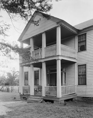
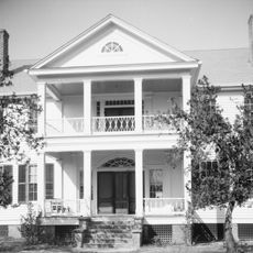
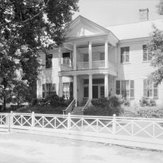
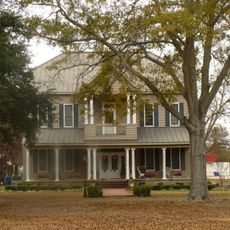
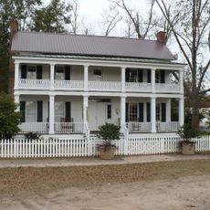
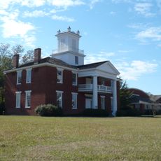
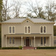
Dry Fork Plantation is a two-story farmhouse built in the mid-1830s with wooden siding and a gabled roof. The house has eight rooms, each roughly 18 feet across with tall ceilings, a central hall with rooms on both sides, and was constructed with over 25,000 pieces of timber and about 12,000 bricks made on the property.
The house was built between 1832 and 1834 for James Asbury Tait, a wealthy planter from Maryland who managed vast lands and hundreds of enslaved people. It was added to the National Register of Historic Places in 1999 and remains the oldest documented house in Wilcox County, Alabama.
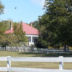
The name refers to a local creek that was important to early settlement in the area. The house reflects values of family stability and established wealth that defined rural society in the 1800s.
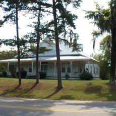
The house sits on quiet land about a quarter mile east of a main road near Sedan and is visible from the street, but it remains a private residence. Visitors should view it from the roadside and respect the privacy of current residents, as parking is not available and foot access is limited.
The house was built by enslaved artisans named Hezekiah and Elijah who hand-crafted the decorative woodwork inside, including carved mantels, doors, and cornices with patterns like fan shapes and chevrons. This craftsmanship is now recognized as a significant part of the house's architectural achievement.
The community of curious travelers
AroundUs brings together thousands of curated places, local tips, and hidden gems, enriched daily by 60,000 contributors worldwide.