Leake County

Log in to your account

AroundUs is a community-driven map of interesting places, built by curious explorers like you. It grows with every review, story, and photo you share.
Connect to save your favorite spots, contribute locations, and create personalized routes.
Continue with Google
Continue with Apple
Continue with X
Continue with Facebook
Continue with email
By continuing, you accept our Terms and Conditions and our Privacy Policy
Create an account
Add to collection
Map
Suggest a change
Share

Leake County, Administrative division in central Mississippi, United States.

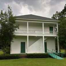
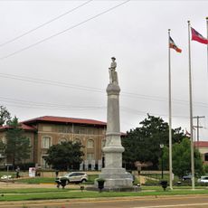
Leake County is an administrative division in central Mississippi covering roughly 585 square miles. It includes the city of Carthage along with several smaller towns such as Lena, Sebastopol, and Walnut Grove.

The county was established in 1833 and named after Walter Leake, who served as Mississippi's governor from 1822 to 1825. This naming honored an important figure in the state's early development.

Communities with different backgrounds live throughout the smaller towns and countryside, each bringing their own traditions to local celebrations and gathering places. This diversity shapes the character of neighborhoods and how people spend time together in their daily routines.

The county is crossed by several major roads including Highways 13, 16, 25, 35, and 43, along with portions of the Natchez Trace Parkway. These transportation routes connect the different towns and make exploring the area straightforward.

An interesting geographic fact is that the population center of the entire state of Mississippi is located near the town of Lena. This spot was calculated based on where people actually live across the state.

GPS coordinates: 32.74011,-89.52413

Latest update: December 7, 2025 20:43

Photos
Around this place
Tougaloo College
United States of America

Tougaloo College

70.5 km
Grierson's Raid
United States of America

Grierson's Raid

67.3 km
Ross Barnett Reservoir
United States of America

Ross Barnett Reservoir

55 km
United States of America

True South Classic

66 km
Bienville National Forest
United States of America

Bienville National Forest

46.4 km
Roosevelt State Park
United States of America

Roosevelt State Park

48.8 km
Tombigbee National Forest
United States of America

Tombigbee National Forest

76.2 km
Chapel of the Cross
United States of America

Chapel of the Cross

67 km
Boyd Mounds Site
United States of America

Boyd Mounds Site

60.1 km
Rankin County Confederate Monument
United States of America

Rankin County Confederate Monument

67.7 km
Holmes County State Park
United States of America

Holmes County State Park

48.7 km
Legion State Park
United States of America

Legion State Park

64 km
Rainwater Observatory and Planetarium
United States of America

Rainwater Observatory and Planetarium

62.3 km
Hebron Academy
United States of America

Hebron Academy

69.1 km
Old First Presbyterian Church
United States of America

Old First Presbyterian Church

35.9 km
Montgomery House
United States of America

Montgomery House

63.8 km
Acona Church, Cemetery, and School
United States of America

Acona Church, Cemetery, and School

74.7 km
Downtown Brandon Historic District
United States of America

Downtown Brandon Historic District

67.8 km
Foster-Fair House
United States of America

Foster-Fair House

60.9 km
Downtown Philadelphia Historic District
United States of America

Downtown Philadelphia Historic District

38.9 km
Benjamin Franklin Smyth House
United States of America

Benjamin Franklin Smyth House

58 km
Old United States Post Office
United States of America

Old United States Post Office

39 km
Cocke-Martin-Jackson House
United States of America

Cocke-Martin-Jackson House

67.5 km
Baptist Church of Christ at Sardis
United States of America

Baptist Church of Christ at Sardis

71.8 km
Stevens-Buchanan House
United States of America

Stevens-Buchanan House

68.3 km
Shiloh Splash Park
United States of America

Shiloh Splash Park

67.6 km
Strand Theatre
United States of America

Strand Theatre

61.1 km
Collinsville Beach
United States of America

Collinsville Beach

72.2 km
Show the full map
Reviews

Visited this place? Tap the stars to rate it and share your experience / photos with the community! Try now! You can cancel it anytime.

« Leake County - Administrative division in central Mississippi, United States » is provided by Around Us (aroundus.com). Images and texts are derived from Wikimedia project under a Creative Commons license. You are allowed to copy, distribute, and modify copies of this page, under the conditions set by the license, as long as this note is clearly visible.

Discover hidden gems everywhere you go!

From secret cafés to breathtaking viewpoints, skip the crowded tourist spots and find places that match your style. Our app makes it easy with voice search, smart filtering, route optimization, and insider tips from travelers worldwide. Download now for the complete mobile experience.

Around Us App Screenshot

A unique approach to discovering new places

Le Figaro

All the places worth exploring

France Info

A tailor-made excursion in just a few clicks

20 Minutes