Enable Location

We need your location to show you interesting places around you

Discover nearby places

Find interesting locations and hidden gems around you

Precise directions

Get accurate directions and distances to places

Your location is never shared with other users. It's only used when you tap the location button.

Bienville National Forest

Log in to your account

Start exploring — it's free

Trusted by 64,458 travelers worldwide

Continue with Google
Continue with Apple
or

We will send you a code to connect

By continuing, you accept our Terms and Conditions and our Privacy Policy

Check your inbox

We've sent a pincode in your inbox. Please enter the code below.

Bienville National Forest
Discussion Reviews 1 Photos
5.3k Popularity

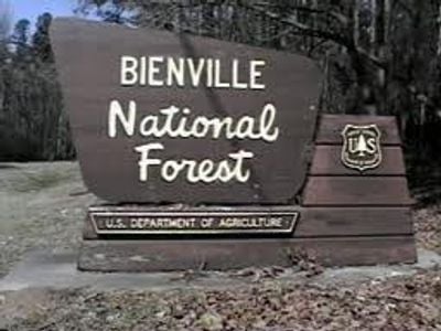
Bienville National Forest, National forest in Jasper County, Mississippi, United States.

Bienville National Forest is a federally managed woodland in central Mississippi, made up mostly of pine and oak trees. The Leaf River and Strong River run through it, and several lakes dot the area.

The forest was established in 1936 as part of a federal program that bought and protected land that had been heavily logged in the decades before. The pine stands replanted during that era now form the core of what visitors see today.

The forest takes its name from Jean-Baptiste Le Moyne de Bienville, a French colonial governor who shaped much of early Louisiana and Mississippi. Visitors walking the trails today can find interpretive signs that connect the landscape to that colonial past.

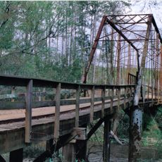
The forest has campgrounds, hiking trails, and picnic spots spread across the area, so it helps to check which zone you want to visit before arriving. Fishing is possible at several lakes, but seasonal rules apply and it is worth confirming them in advance.

Within the forest, three separate wildlife management zones are dedicated specifically to white-tailed deer and wild turkeys, which is unusual for a national forest of this size. These zones follow their own set of rules that differ from the rest of the forest, so hunters and wildlife watchers should look into them separately.

The community of curious travelers

AroundUs brings together thousands of curated places, local tips, and hidden gems, enriched daily by 60,000 contributors worldwide.

Start exploring
Location
Operator
United States Forest Service
GPS coordinates
32.33233,-89.42094
Latest update
March 3, 2026 10:08
Around this place
Tougaloo College
United States of America

Tougaloo College

70 km
Jackson Volcano
United States of America

Jackson Volcano

70.8 km
Ross Barnett Reservoir
United States of America

Ross Barnett Reservoir

56.7 km
United States of America

True South Classic

64.1 km
Stuckey's Bridge
United States of America

Stuckey's Bridge

53.9 km
Fountainhead
United States of America

Fountainhead

70.4 km
Eudora Welty House
United States of America

Eudora Welty House

70.5 km
LeFleur's Bluff State Park
United States of America

LeFleur's Bluff State Park

68.8 km
Roosevelt State Park
United States of America

Roosevelt State Park

23.7 km
Boyd Mounds Site
United States of America

Boyd Mounds Site

62.2 km
Rankin County Confederate Monument
United States of America

Rankin County Confederate Monument

53.6 km
Castle Crest
United States of America

Castle Crest

70.5 km
Montrose Presbyterian Church
United States of America

Montrose Presbyterian Church

29 km
Hebron Academy
United States of America

Hebron Academy

50.5 km
Montgomery House
United States of America

Montgomery House

67.1 km
Downtown Brandon Historic District
United States of America

Downtown Brandon Historic District

53.7 km
Downtown Philadelphia Historic District
United States of America

Downtown Philadelphia Historic District

56.9 km
Old United States Post Office
United States of America

Old United States Post Office

56.9 km
Cocke-Martin-Jackson House
United States of America

Cocke-Martin-Jackson House

53.1 km
Judge John L. Buckley House
United States of America

Judge John L. Buckley House

58.8 km
Stevens-Buchanan House
United States of America

Stevens-Buchanan House

53.9 km
Shiloh Splash Park
United States of America

Shiloh Splash Park

52.5 km
Mississippi Sports Hall of Fame & Museum
United States of America

Mississippi Sports Hall of Fame & Museum

69.1 km
Eudora Welty House
United States of America

Eudora Welty House

70.5 km
Dunn's Falls
United States of America

Dunn's Falls

57.6 km
Roosevelt State Park Historic District
United States of America

Roosevelt State Park Historic District

24.4 km
Booker T. Washington High School
United States of America

Booker T. Washington High School

57.3 km
Museum to Market Trail
United States of America

Museum to Market Trail

70.9 km
Show the full map
Reviews
Share your experience

No review yet

Discussions
Start a discussion...

No discussion yet

« Bienville National Forest - National forest in Jasper County, Mississippi, United States » is provided by Around Us (aroundus.com). Images and texts are derived from Wikimedia project under a Creative Commons license. You are allowed to copy, distribute, and modify copies of this page, under the conditions set by the license, as long as this note is clearly visible.

Discover hidden gems everywhere you go!

From secret cafés to breathtaking viewpoints, skip the crowded tourist spots and find places that match your style. Our app makes it easy with voice search, smart filtering, route optimization, and insider tips from travelers worldwide. Download now for the complete mobile experience.

Around Us App Screenshot

A unique approach to discovering new places

Le Figaro

All the places worth exploring

France Info

A tailor-made excursion in just a few clicks

20 Minutes

Around Us
Travel Guide & Maps
Download

Send to your phone

QR Code
1

Open the camera app on your mobile.

2

Point at the QR code with your camera. A notification will appear.

3

Tap the notification to open the link.