Enable Location

We need your location to show you interesting places around you

Discover nearby places

Find interesting locations and hidden gems around you

Precise directions

Get accurate directions and distances to places

Your location is never shared with other users. It's only used when you tap the location button.

Tallahatchie National Wildlife Refuge

Log in to your account

Start exploring — it's free

Trusted by 61,867 travelers worldwide

Continue with Google
Continue with Apple
or

We will send you a code to connect

By continuing, you accept our Terms and Conditions and our Privacy Policy

Check your inbox

We've sent a pincode in your inbox. Please enter the code below.

Tallahatchie National Wildlife Refuge

Tallahatchie National Wildlife Refuge, National Wildlife Refuge in Grenada County, Mississippi.

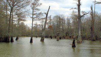
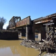
Tallahatchie National Wildlife Refuge is a protected area in Grenada County comprising flat land with cultivated fields, abandoned cropland, and hardwood bottomland forests intersected by Tippo Bayou. The terrain blends different landscape types that support varied wildlife habitats.

The refuge was established in 1990 after decades of clearing and drainage for cotton farming. Restoration of natural habitats followed this period of intensive agricultural use.

The refuge education programs teach visitors about local ecosystems through workshops and guided nature observations throughout the year.

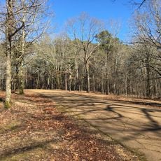
The access roads are open to the public from mid-September through May 1, allowing wildlife viewing under favorable conditions. Visitors should expect varying conditions depending on the season and plan accordingly.

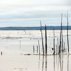
Seasonal floods in former oxbow bends and fields beside Tippo Bayou create temporary wetlands in the colder months. These transient water bodies attract substantial numbers of waterfowl seeking resting and feeding areas.

The community of curious travelers

AroundUs brings together thousands of curated places, local tips, and hidden gems, enriched daily by 60,000 contributors worldwide.

Start exploring
Location
Inception
1990
GPS coordinates
33.80220,-90.10490
Latest update
December 14, 2025 14:43
Around this place
Dockery Plantation
United States of America

Dockery Plantation

47.7 km
Grenada Lake
United States of America

Grenada Lake

30.7 km
Rice–Totten Field
United States of America

Rice–Totten Field

39.4 km
Grammy Museum Mississippi
United States of America

Grammy Museum Mississippi

58.3 km
George P. Cossar State Park
United States of America

George P. Cossar State Park

42 km
I. T. Montgomery House
United States of America

I. T. Montgomery House

58.3 km
Cotesworth
United States of America

Cotesworth

34.7 km
Tallahatchie County Second District Courthouse
United States of America

Tallahatchie County Second District Courthouse

30.8 km
Temple Adath Israel
United States of America

Temple Adath Israel

57.7 km
Acona Church, Cemetery, and School
United States of America

Acona Church, Cemetery, and School

60 km
Immanuel Episcopal Church
United States of America

Immanuel Episcopal Church

49.5 km
Odd Fellows and Confederate Cemetery
United States of America

Odd Fellows and Confederate Cemetery

27.4 km
First Methodist Church of Greenwood
United States of America

First Methodist Church of Greenwood

32.4 km
Charley's Trace
United States of America

Charley's Trace

21.4 km
Grenada Masonic Temple
United States of America

Grenada Masonic Temple

28.1 km
Southworth House
United States of America

Southworth House

33.5 km
Lee House
United States of America

Lee House

58.4 km
Wesley Memorial Methodist Episcopal
United States of America

Wesley Memorial Methodist Episcopal

32.9 km
Emmett Till Interpretive Center
United States of America

Emmett Till Interpretive Center

30.9 km
Emmett Till Historic Intrepid Center - ETHIC
United States of America

Emmett Till Historic Intrepid Center - ETHIC

17.5 km
Evergreen Plantation
United States of America

Evergreen Plantation

24.4 km
Cotton Warehouse Classic Cars
United States of America

Cotton Warehouse Classic Cars

57.7 km
Keesler Bridge
United States of America

Keesler Bridge

32.1 km
Batesville Historic District
United States of America

Batesville Historic District

58.8 km
Grenada Railway Yalobusha River Bridge
United States of America

Grenada Railway Yalobusha River Bridge

28.5 km
Downtown Grenada Historic District
United States of America

Downtown Grenada Historic District

28 km
Margin Street Historic District
United States of America

Margin Street Historic District

27.7 km
Wesley Methodist Church Historic District
United States of America

Wesley Methodist Church Historic District

33.1 km
Show the full map
« Tallahatchie National Wildlife Refuge - National Wildlife Refuge in Grenada County, Mississippi » is provided by Around Us (aroundus.com). Images and texts are derived from Wikimedia project under a Creative Commons license. You are allowed to copy, distribute, and modify copies of this page, under the conditions set by the license, as long as this note is clearly visible.

Discover hidden gems everywhere you go!

From secret cafés to breathtaking viewpoints, skip the crowded tourist spots and find places that match your style. Our app makes it easy with voice search, smart filtering, route optimization, and insider tips from travelers worldwide. Download now for the complete mobile experience.

Around Us App Screenshot

A unique approach to discovering new places

Le Figaro

All the places worth exploring

France Info

A tailor-made excursion in just a few clicks

20 Minutes

Around Us
Travel Guide & Maps
Download

Send to your phone

QR Code
1

Open the camera app on your mobile.

2

Point at the QR code with your camera. A notification will appear.

3

Tap the notification to open the link.