Chest opened
+${chestReward.xp} XP
Explorer
NOUVEAU ×${chestReward.collectible.quantity}
tapez pour fermer

See the monuments around you in AR Open chests in the app

Around Us is built for your phone — point your camera at the streets and discover the monuments and places around you in augmented reality. Around Us is built for your phone — chests unlock when you walk, explore and capture nearby places.

•

Enable Location

We need your location to show you interesting places around you

Discover nearby places

Find interesting locations and hidden gems around you

Precise directions

Get accurate directions and distances to places

Your location is never shared with other users. It's only used when you tap the location button.

Payne Field

Log in to your account

Start exploring — it's free

Trusted by 93,038 travelers worldwide

Continue with Google
Continue with Apple
or

We will send you a code to connect

By continuing, you accept our Terms and Conditions and our Privacy Policy

Check your inbox

We've sent a pincode in your inbox. Please enter the code below.

Payne Field, Military training airfield in West Point, United States

Payne Field was a 533-acre airfield 4.3 miles north-northeast of West Point, Mississippi, built in 1918 at a cost of $891,340. Dozens of wooden buildings served as headquarters, maintenance shops and officers' quarters, while enlisted men bivouacked in tents. It could accommodate up to 1,000 personnel.

The field was established in 1918 as one of thirty-two training camps created after the United States entered World War I. Operations ceased in 1920 when military aviation training in the country was reorganized.

The field honours Captain Dewitt Payne of South Bend, Indiana, who died on 1 February 1918 when his plane crashed as he flew to aid a pilot downed in a treetop at Taliaferro Field, Texas. Local officials expected the base to stay open after 1918 because of the combat record of Payne-trained pilots in Europe.

The site lies 4.3 miles north-northeast of West Point, Mississippi, on land leased to the Army in 1917. The Surgeon General called it one of the worst malaria belts in the United States, and physicians reported that 20 percent of their practice was malaria cases. No buildings or archaeological remains are documented as surviving; plan accordingly.

Macauley's westbound De Havilland DH-4 lost its propeller in a rainstorm and landed at Payne Field for repairs, but rain had left the runway too muddy to take off, delaying him over a week. The field's malaria belt also shaped daily life: physicians reported that 20 percent of their practice was malaria cases.

The community of curious travelers

AroundUs brings together thousands of curated places, local tips, and hidden gems, enriched daily by 93,038 contributors worldwide.

Start exploring
Location
Inception
1917
GPS coordinates
33.66560,-88.63250
Latest update
October 26, 2026 13:07
Around this place
Waverley
United States of America

Waverley

10 mi
Davis Wade Stadium
United States of America

Davis Wade Stadium

17.2 mi
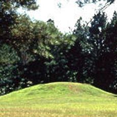
Bynum Mound and Village Site
United States of America

Bynum Mound and Village Site

24.2 mi
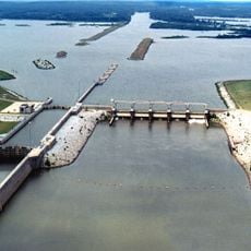
John C. Stennis Lock and Dam
United States of America

John C. Stennis Lock and Dam

13.1 mi
Sam D. Hamilton Noxubee National Wildlife Refuge
United States of America

Sam D. Hamilton Noxubee National Wildlife Refuge

27 mi
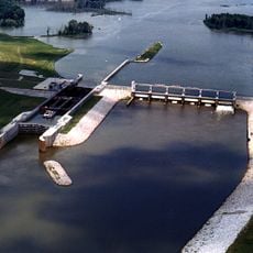
Aberdeen Lock and Dam
United States of America

Aberdeen Lock and Dam

13.1 mi
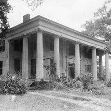
Reuben Davis House
United States of America

Reuben Davis House

11.9 mi
Old Fort House
United States of America

Old Fort House

16.5 mi
Charles McLaran House
United States of America

Charles McLaran House

16.8 mi
Stephen D. Lee House
United States of America

Stephen D. Lee House

16.6 mi
South Columbus Historic District
United States of America

South Columbus Historic District

18 mi
Brownrigg-Harris-Kennebrew House
United States of America

Brownrigg-Harris-Kennebrew House

16.5 mi
Judge Bates House
United States of America

Judge Bates House

26.3 mi
The Cedars
United States of America

The Cedars

16.3 mi
Houston Carnegie Library
United States of America

Houston Carnegie Library

26.5 mi
West Commerce Street Historic District
United States of America

West Commerce Street Historic District

11.9 mi
Aberdeen City Hall
United States of America

Aberdeen City Hall

12.1 mi
Cox-Uithoven House
United States of America

Cox-Uithoven House

11 mi
John Holliday House
United States of America

John Holliday House

11.7 mi
Waverly Bridge
United States of America

Waverly Bridge

10.5 mi
Amory's Tribute to the Heroes of 1861–1865
United States of America

Amory's Tribute to the Heroes of 1861–1865

23.6 mi
Weaver Place
United States of America

Weaver Place

16.7 mi
Old Homestead
United States of America

Old Homestead

12 mi
Harris-Banks House
United States of America

Harris-Banks House

16.9 mi
John M. Stone Cotton Mill
United States of America

John M. Stone Cotton Mill

17.4 mi
Aberdeen Downtown Historic District
United States of America

Aberdeen Downtown Historic District

12.2 mi
Amory Railway Bridge
United States of America

Amory Railway Bridge

24.2 mi
Houston Historic District
United States of America

Houston Historic District

26.5 mi
Show the full map
Reviews
Share your experience

No review yet

Discussions
Start a discussion...

No discussion yet

« Payne Field - Military training airfield in West Point, United States » is provided by Around Us (aroundus.com). Images and texts are derived from Wikimedia project under a Creative Commons license. You are allowed to copy, distribute, and modify copies of this page, under the conditions set by the license, as long as this note is clearly visible.

Discover hidden gems everywhere you go!

From secret cafés to breathtaking viewpoints, skip the crowded tourist spots and find places that match your style. Our app makes it easy with voice search, smart filtering, route optimization, and insider tips from travelers worldwide. Download now for the complete mobile experience.
Around Us App Screenshot
❝

A unique approach to discovering new places❞

— Le Figaro

❝

All the places worth exploring❞

— France Info

❝

A tailor-made excursion in just a few clicks❞

— 20 Minutes

Around Us
Travel Guide & Maps
Download

Send to your phone

QR Code
1

Open the camera app on your mobile.

2

Point at the QR code with your camera. A notification will appear.

3

Tap the notification to open the link.