Blount County

Log in to your account

AroundUs is a community-driven map of interesting places, built by curious explorers like you. It grows with every review, story, and photo you share.
Connect to save your favorite spots, contribute locations, and create personalized routes.
Continue with Google
Continue with Apple
Continue with X
Continue with Facebook
Continue with email
By continuing, you accept our Terms and Conditions and our Privacy Policy
Create an account
Add to collection
Map
Suggest a change
Share

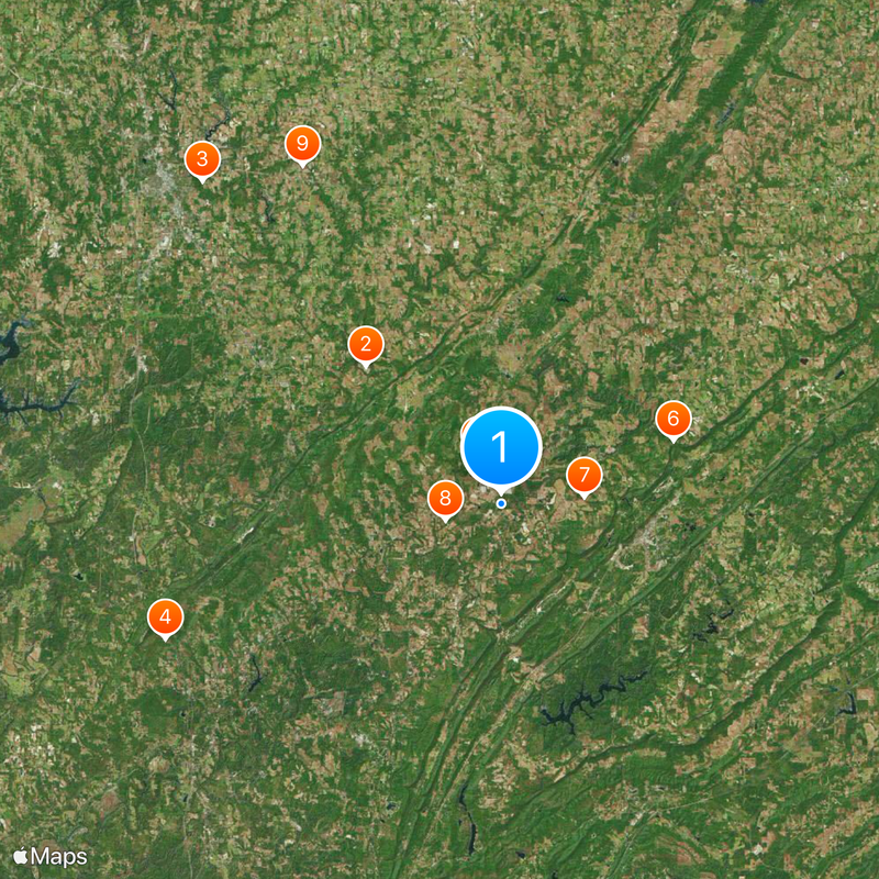
Blount County, Administrative division in Tennessee, United States.

Blount County is an administrative division in Alabama that covers a large area with diverse landscapes throughout the region. The land includes forests, farmland, and several waterways that shape the terrain and connect different communities together.

Blount County was established in 1819 and named after William Blount, an early governor who shaped Alabama's growth. The area was originally home to Cherokee nations before settlement transformed the region.

The county maintains several initiatives promoting local business support, including the Buy in Blount program that strengthens community economic development.

Key information and services for visitors are easy to find at community centers and public offices throughout the area. Roads connect the different towns well, and rest stops provide helpful landmarks when exploring.

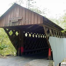
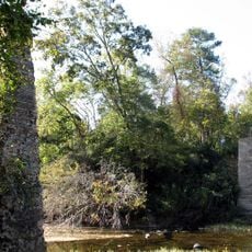
The Thunderhead Mountain marks the highest elevation point in the county, while Cades Cove provides natural areas for wildlife observation.

Location: Alabama

Inception: February 6, 1818

Capital city: Oneonta

Elevation above the sea: 189 m

Shares border with: Marshall County, Etowah County, St. Clair County, Walker County, Jefferson County, Cullman County

Website: https://blountcountyal.gov

GPS coordinates: 33.96667,-86.58333

Latest update: December 20, 2025 13:37

Photos
Around this place
Shrine of the Most Blessed Sacrament
United States of America

Shrine of the Most Blessed Sacrament

13.9 km
Ave Maria Grotto
United States of America

Ave Maria Grotto

31.6 km
Rickwood Caverns State Park
United States of America

Rickwood Caverns State Park

26 km
Swann Covered Bridge
United States of America

Swann Covered Bridge

3.8 km
Horton Mill Covered Bridge
United States of America

Horton Mill Covered Bridge

13.2 km
Easley Covered Bridge
United States of America

Easley Covered Bridge

6 km
Nectar Covered Bridge
United States of America

Nectar Covered Bridge

4.1 km
United States of America

Lidy Walker Covered Bridge

28.2 km
Cullman Historic District
United States of America

Cullman Historic District

32.6 km
Ernest Edward Greene House
United States of America

Ernest Edward Greene House

33.3 km
Stiefelmeyer's
United States of America

Stiefelmeyer's

33.4 km
Robert G. Griffith, Sr. House
United States of America

Robert G. Griffith, Sr. House

28.9 km
Cullman Downtown Commercial Historic District
United States of America

Cullman Downtown Commercial Historic District

33.2 km
United States of America

Cullman County Museum

33.7 km
Springville Historic District
United States of America

Springville Historic District

23.7 km
Presley Store
United States of America

Presley Store

23.7 km
United States of America

Abbaye Saint-Bernard

32.2 km
Baileyton Good Time DragStrip
United States of America

Baileyton Good Time DragStrip

31.3 km
United States of America

Lake Catoma

34 km
United States of America

Oneonta Recreation Park

8.9 km
United States of America

Scirum Bluff

3.7 km
Oneonta Aquatics Facility
United States of America

Oneonta Aquatics Facility

9.1 km
United States of America

Cedar Cliff

30.4 km
United States of America

Ingram Arkadelphia Lake

30.8 km
United States of America

Mountain Lake

21 km
United States of America

Camps Lake

10.8 km
United States of America

Ritz Theatre

33.3 km
United States of America

Fox Theatre

11.6 km
Show the full map
Reviews

Visited this place? Tap the stars to rate it and share your experience / photos with the community! Try now! You can cancel it anytime.

« Blount County - Administrative division in Tennessee, United States » is provided by Around Us (aroundus.com). Images and texts are derived from Wikimedia project under a Creative Commons license. You are allowed to copy, distribute, and modify copies of this page, under the conditions set by the license, as long as this note is clearly visible.

Discover hidden gems everywhere you go!

From secret cafés to breathtaking viewpoints, skip the crowded tourist spots and find places that match your style. Our app makes it easy with voice search, smart filtering, route optimization, and insider tips from travelers worldwide. Download now for the complete mobile experience.

Around Us App Screenshot

A unique approach to discovering new places

Le Figaro

All the places worth exploring

France Info

A tailor-made excursion in just a few clicks

20 Minutes