Santana do Livramento, Border municipality in Rio Grande do Sul, Brazil
Santana do Livramento is a municipality in Rio Grande do Sul that sits directly on Brazil's border with Uruguay. The urban area flows seamlessly into Rivera across the border, creating a shared space where both sides function as a single community.
The settlement was founded in 1823 when Portuguese colonists received land grants and established a community. A railway line opened in 1912 that connected this side to Uruguay, allowing train travel between Rio de Janeiro and Montevideo for many decades.
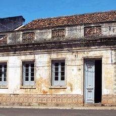
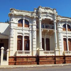
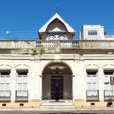
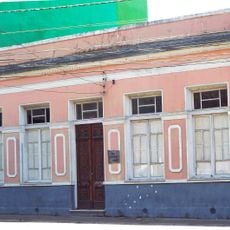
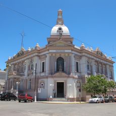
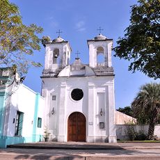
The town draws on both Brazilian and Uruguayan customs visible in everyday life, from street festivals to local architecture and how residents move freely between the two sides. This blending shapes the rhythm of daily activity throughout the year.
Good road connections link the town to major Brazilian cities, with an international airport just across the border in Rivera available since 2023. Visitors can move easily between both sides on foot or by car, as border crossing is straightforward for most travelers.
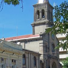
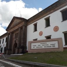
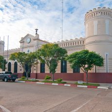
A railway station from 1912 still stands in town as a reminder of when trains regularly crossed between Brazil and Uruguay. Though international service ended long ago, the building marks an era when rail travel connected the two countries directly.
Location: Rio Grande do Sul
Inception: 1823
Elevation above the sea: 159 m
Shares border with: Rivera, Dom Pedrito, Quaraí, Rosário do Sul
Website: http://sdolivramento.com.br/prefeitura
GPS coordinates: -30.89083,-55.53278
Latest update: December 10, 2025 15:52
Natural Protected Area Valle del Lunarejo
47.7 km
Puente Internacional de la Concordia
104.4 km
Piedra Pintada
91.3 km
Laguna de las Lavanderas
102.2 km
Rincon de tres cerros
82.6 km
Ponte Marechal José de Abreu
93.3 km
Cathedral of Tacuarembó
100.7 km
Ibirapuitã Biological Reserve
110.2 km
Ibirapuitã Environmental Protection Area
60.8 km
Museo de Artes Visuales de Tacuarembó
100.7 km
Sports museum in Tacuarembó
101 km
Parque Natural Regional Valle del Lunarejo
49.4 km
Museo de Geociencias
100.8 km
Parque 25 de Agosto
102.2 km
Museo del Indio y del Gaucho Washington Escobar
100.9 km
Estadio Goyenola
101.3 km
Antiga Casa do Marechal Bento Manuel Ribeiro de Almeida
125.6 km
Antigas Residências Em Alegrete
125.6 km
Caixa d'Água
82.6 km
Maara - Museu de Arqueologia e Artes
125.6 km
Museu Oswaldo Aranha
125.8 km
Prefeitura Municipal
82.6 km
Jefatura de Policía, Artigas
104.6 km
Centro de detención del Regimiento de Caballería No. 3
2.6 km
Camping Don Ari
7.6 km
Centro de detención del Regimiento de Caballería No. 10
106.2 km
Museo Parroquial del Templo San Eugenio
104.7 km
Jefatura de policía de Artigas
104.6 kmVisited this place? Tap the stars to rate it and share your experience / photos with the community! Try now! You can cancel it anytime.
Discover hidden gems everywhere you go!
From secret cafés to breathtaking viewpoints, skip the crowded tourist spots and find places that match your style. Our app makes it easy with voice search, smart filtering, route optimization, and insider tips from travelers worldwide. Download now for the complete mobile experience.
A unique approach to discovering new places❞
— Le Figaro
All the places worth exploring❞
— France Info
A tailor-made excursion in just a few clicks❞
— 20 Minutes