Natural Protected Area Valle del Lunarejo, Protected natural area in Rivera Department, Uruguay
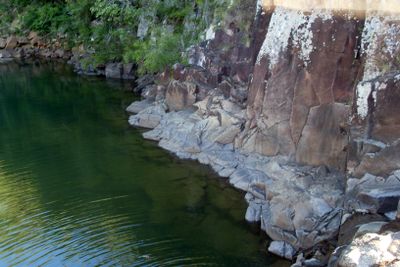
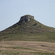
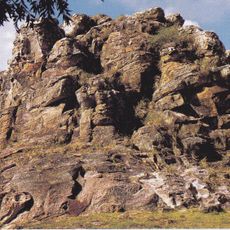
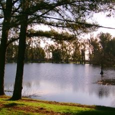
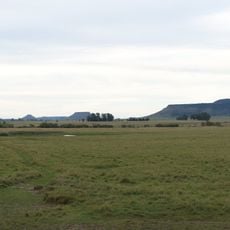
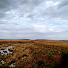
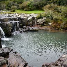
Natural Protected Area Valle del Lunarejo is a nature reserve covering roughly 29,000 hectares of valleys, streams, hills over 350 meters high, numerous waterfalls, forests, and grasslands. Deep basalt rock formations shape the entire landscape and create its distinctive terrain.
The area became significant during the Battle of Masoller in 1904, when General Aparicio Saravia received fatal wounds during Uruguayan civil conflicts. This event marked it as a crucial location in the nation's political history.
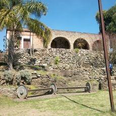
Stone buildings scattered throughout the area reflect its past role as a contested border zone between Uruguay and Rio Grande do Sul. They stand as reminders of how people once used this landscape for strategic defense.
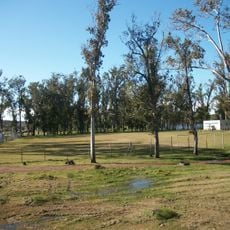
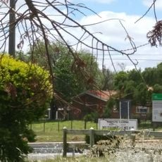
The protected area is accessible via Route 30 near Masoller, Boqueron, La Palma, and Lunarejo, with the Visitor Center located at kilometer 237. Trails are easier to navigate during drier months when water levels drop.
The region is home to over 150 bird species along with rare animals like margay cats, coatis, anteaters, and armadillos living among subtropical vegetation. This wildlife thrives within the protected basalt formations.
Location: Rivera Department
Elevation above the sea: 285 m
GPS coordinates: -31.18217,-55.90000
Latest update: December 9, 2025 18:40
Puente Internacional de la Concordia
102.7 km
Cerro Batoví
77.9 km
Piedra Pintada
87.6 km
Laguna de las Lavanderas
60.8 km
Rincon de tres cerros
56.6 km
Altos del Arapey
156.9 km
Pozo Hondo
79.5 km
Ponte Marechal José de Abreu
140.7 km
Cathedral of Tacuarembó
59.4 km
Museo Carlos Gardel
76.1 km
Ibirapuitã Biological Reserve
140.4 km
Ibirapuitã Environmental Protection Area
94.8 km
Museo de Artes Visuales de Tacuarembó
59.3 km
Sports museum in Tacuarembó
59.6 km
Parque Natural Regional Valle del Lunarejo
4.9 km
Museo de Geociencias
59.4 km
Parque 25 de Agosto
60.8 km
Museo del Indio y del Gaucho Washington Escobar
59.6 km
Estadio Goyenola
59.6 km
Antiga Casa do Marechal Bento Manuel Ribeiro de Almeida
155.9 km
Caixa d'Água
118.9 km
Antigas Residências Em Alegrete
155.9 km
Maara - Museu de Arqueologia e Artes
155.9 km
Prefeitura Municipal
119 km
Jefatura de Policía, Artigas
102.6 km
Centro de detención del Regimiento de Caballería No. 3
45.5 km
Museo Parroquial del Templo San Eugenio
102.6 km
Centro de detención del Regimiento de Caballería No. 10
102.7 kmVisited this place? Tap the stars to rate it and share your experience / photos with the community! Try now! You can cancel it anytime.
Discover hidden gems everywhere you go!
From secret cafés to breathtaking viewpoints, skip the crowded tourist spots and find places that match your style. Our app makes it easy with voice search, smart filtering, route optimization, and insider tips from travelers worldwide. Download now for the complete mobile experience.
A unique approach to discovering new places❞
— Le Figaro
All the places worth exploring❞
— France Info
A tailor-made excursion in just a few clicks❞
— 20 Minutes