·

Enable Location

We need your location to show you interesting places around you

Discover nearby places

Find interesting locations and hidden gems around you

Precise directions

Get accurate directions and distances to places

Your location is never shared with other users. It's only used when you tap the location button.

Log in to your account

Start exploring — it's free

Trusted by 62,735 travelers worldwide

Continue with Google
Continue with Apple
or

We will send you a code to connect

By continuing, you accept our Terms and Conditions and our Privacy Policy

Check your inbox

We've sent a pincode in your inbox. Please enter the code below.

East Luwu

East Luwu, Administrative district in South Sulawesi, Indonesia

East Luwu is an administrative district in South Sulawesi with mountainous terrain, lakes, and coastal areas. The region spans diverse landscapes and includes multiple villages spread across different administrative districts.

The area became an independent administrative district in 2003 after separating from neighboring territories. This administrative change enabled local governance and the development of its own administrative structures.

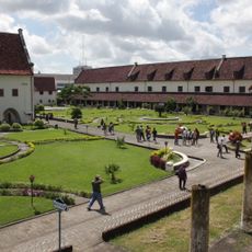
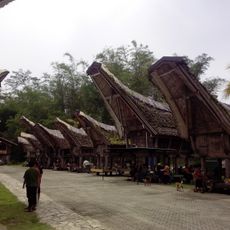
Communities here maintain traditional ceremonies and customs that shape everyday life. These local practices are visible to visitors and reflect how people express their connection to the land.

Malili serves as the main administrative center and best starting point for exploring the region. From here, visitors can easily access services and reach various parts of the district.

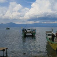
Two large lakes in this area form a unique freshwater system of considerable depth. The deeper lake reaches extreme depths that make it a notable feature of the local landscape.

The community of curious travelers

AroundUs brings together thousands of curated places, local tips, and hidden gems, enriched daily by 60,000 contributors worldwide.

Start exploring
Location
Capital city
Malili
Elevation above the sea
126 m
Shares border with
North Luwu, Poso, North Morowali, Morowali, Konawe, North Kolaka
GPS coordinates
-2.60000,121.13300
Latest update
December 7, 2025 10:04
« East Luwu - Administrative district in South Sulawesi, Indonesia » is provided by Around Us (aroundus.com). Images and texts are derived from Wikimedia project under a Creative Commons license. You are allowed to copy, distribute, and modify copies of this page, under the conditions set by the license, as long as this note is clearly visible.

Discover hidden gems everywhere you go!

From secret cafés to breathtaking viewpoints, skip the crowded tourist spots and find places that match your style. Our app makes it easy with voice search, smart filtering, route optimization, and insider tips from travelers worldwide. Download now for the complete mobile experience.

Around Us App Screenshot

A unique approach to discovering new places

Le Figaro

All the places worth exploring

France Info

A tailor-made excursion in just a few clicks

20 Minutes

Around Us
Travel Guide & Maps
Download

Send to your phone

QR Code
1

Open the camera app on your mobile.

2

Point at the QR code with your camera. A notification will appear.

3

Tap the notification to open the link.