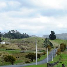
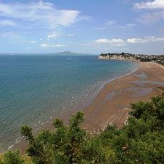
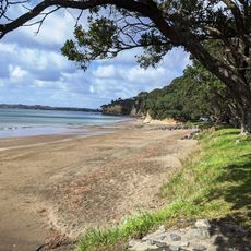
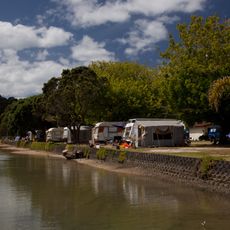
Ōrewa Beach, beach in New Zealand
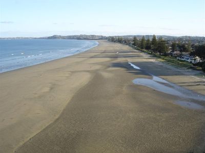
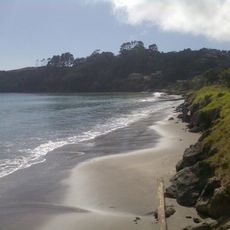
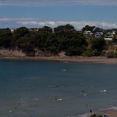
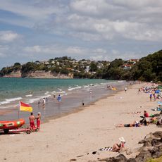
Ōrewa Beach is a beach in the Auckland Region featuring fine gray sand and shallow water that gradually deepens toward the sea. The shoreline stretches for several kilometers and is backed by green hillsides, with the northern end marked by rocky formations.
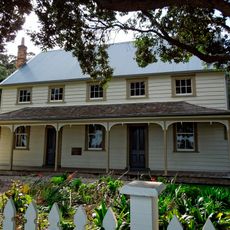
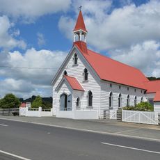
The area was a traditional settlement for the Maori people long before European arrival. The name comes from a Maori word referring to the curve or bend in the landscape where this beach is located.
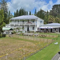
The beach is easily accessible and offers plenty of space for activities like swimming, surfing, and picnicking. Parking and facilities are available nearby, so visitors can spend the day comfortably.
Location: Auckland Region
GPS coordinates: -36.58350,174.69598
Latest update: December 6, 2025 19:07
Auckland sits between the Pacific Ocean and the Tasman Sea on a narrow isthmus marked by roughly 50 extinct volcanic cones. Mount Eden and One Tree Hill rise above the neighborhoods and offer views across the harbor, while Rangitoto stands as the largest volcanic island in the region and can be reached by ferry. The coastline shifts between the sheltered eastern beaches such as Mission Bay and Takapuna Beach and the black sand western shores at Piha and Bethells Beach, where the Pacific meets the Waitakere Ranges directly. The Auckland War Memorial Museum in Auckland Domain holds Polynesian collections and New Zealand military history, while Auckland Art Gallery displays European and indigenous art. Viaduct Harbour serves as a dining precinct and departure point for harbor cruises, and the New Zealand Maritime Museum documents the country's seafaring past. Karangahape Road gathers alternative shops and nightlife, Ponsonby draws an older crowd with cafés and boutiques. Britomart clusters restaurants and design stores in converted waterfront buildings. Waiheke Island hosts wineries such as Mudbrick Vineyard and Man O' War Vineyards scattered among vineyards and bays, while Tantalus Estate operates in West Auckland. Auckland Botanic Gardens present native plant species across 158 acres, and Auckland Zoo keeps over 1,400 animals. Queen Street runs through the center from the harbor to the University of Auckland, and Sky Tower stands 1,076 feet (328 meters) above the city. This selection covers the main sites for understanding Auckland's geography and range.
Shakespear Regional Park
12 km
Wenderholm Regional Park
5.3 km
Warkworth Radio Observatory
17 km
Scandrett Regional Park
17.1 km
Tiritiri Matangi Lighthouse
18.2 km
Couldrey House
5.7 km
Warkworth 12m Radio Telescope
17 km
Long Bay-Okura Marine Reserve
11.3 km
Warkworth 30m Radio Telescope
17 km
Mahurangi Regional Park
8.5 km
Okura Bush Scenic Reserve
9.5 km
Lucas Creek Waterfall
15.5 km
Pohuehue Falls
14.8 km
Waterfall Gully
11.1 km
Long Bay Regional Park
11.3 km
Casnell Island Scenic Reserve
8.9 km
Tindalls Beach
7.7 km
Scott Homestead
11.4 km
Church of St Peter and St Paul
8.3 km
Ōtānerua / Hatfields Beach
1.9 km
Henley House
17.9 km
Puhoi Hotel and Stables
8.5 km
Big Manly Beach
7.6 km
Red Beach
2.6 km
Waiake Beach
14.2 km
Duck Creek
4.7 km
Vaughan Homestead
11.8 km
Tiritiri Matangi Island Scientific Reserve
17.3 kmReviews
Visited this place? Tap the stars to rate it and share your experience / photos with the community! Try now! You can cancel it anytime.
Discover hidden gems everywhere you go!
From secret cafés to breathtaking viewpoints, skip the crowded tourist spots and find places that match your style. Our app makes it easy with voice search, smart filtering, route optimization, and insider tips from travelers worldwide. Download now for the complete mobile experience.
A unique approach to discovering new places❞
— Le Figaro
All the places worth exploring❞
— France Info
A tailor-made excursion in just a few clicks❞
— 20 Minutes