Chest opened
+${chestReward.xp} XP
Explorer
NOUVEAU ×${chestReward.collectible.quantity}
tapez pour fermer
Chest locked

Open chests in the app

Around Us is built for your phone — chests unlock when you walk, explore and capture nearby places.

Enable Location

We need your location to show you interesting places around you

Discover nearby places

Find interesting locations and hidden gems around you

Precise directions

Get accurate directions and distances to places

Your location is never shared with other users. It's only used when you tap the location button.

Log in to your account

Start exploring — it's free

Trusted by 72,887 travelers worldwide

Continue with Google
Continue with Apple
or

We will send you a code to connect

By continuing, you accept our Terms and Conditions and our Privacy Policy

Check your inbox

We've sent a pincode in your inbox. Please enter the code below.

Discussion Reviews Photo
10.5k Popularity

Port Mansfield, Census-designated place in Willacy County, Texas, United States

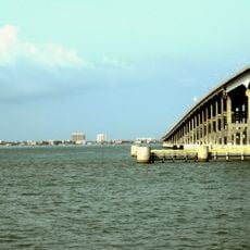
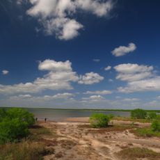
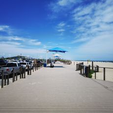
Port Mansfield is a small coastal settlement in Willacy County, Texas, situated on both land and water. The community includes a navigational channel that provides access to the Intracoastal Waterway and the Gulf of Mexico.

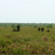
The settlement was established when access to the Gulf of Mexico was becoming important for coastal Texas development. The community has experienced different population phases that reflect its changing economic role over the decades.

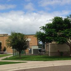
The San Perlita Independent School District provides education services to Port Mansfield students, alongside specialized programs from South Texas Independent School District.

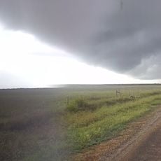
The community operates in the Central Time Zone and can be reached through local services using the area code 956. Visitors should note that accessibility can vary depending on weather and water conditions, especially near the channel.

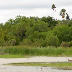
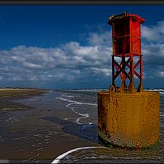
The Port Mansfield Channel was specially constructed to cut through Padre Island and provide direct access to the Gulf of Mexico. This man-made waterway requires regular maintenance by the U.S. Army Corps of Engineers to keep it navigable.

The community of curious travelers

AroundUs brings together thousands of curated places, local tips, and hidden gems, enriched daily by 60,000 contributors worldwide.

Start exploring
Location
Elevation above the sea
1 m
GPS coordinates
26.55528,-97.43083
Latest update
December 10, 2025 15:54
Around this place
Queen Isabella Causeway
United States of America

Queen Isabella Causeway

57.5 km
Fort Brown
United States of America

Fort Brown

74.7 km
Gladys Porter Zoo
United States of America

Gladys Porter Zoo

71.9 km
Brownsville & Matamoros International Bridge
Mexico

Brownsville & Matamoros International Bridge

74.2 km
Palo Alto Battlefield National Historical Park
United States of America

Palo Alto Battlefield National Historical Park

58.4 km
Gateway International Bridge
Mexico

Gateway International Bridge

73.4 km
Laguna Atascosa National Wildlife Refuge
United States of America

Laguna Atascosa National Wildlife Refuge

30.6 km
Lower Rio Grande Valley National Wildlife Refuge
United States of America

Lower Rio Grande Valley National Wildlife Refuge

58.7 km
STARGATE
United States of America

STARGATE

67.9 km
Pier 19
United States of America

Pier 19

59.2 km
Isla Blanca Park
United States of America

Isla Blanca Park

60.2 km
Point Isabel Lighthouse
United States of America

Point Isabel Lighthouse

57.6 km
Palmito Ranch Battlefield
United States of America

Palmito Ranch Battlefield

69.3 km
Parque Olímpico
Mexico

Parque Olímpico

74.9 km
Immaculate Conception Cathedral
United States of America

Immaculate Conception Cathedral

73 km
Resaca de la Palma Battlefield
United States of America

Resaca de la Palma Battlefield

69 km
Estero Llano Grande State Park
United States of America

Estero Llano Grande State Park

71.1 km
Gravity Park
United States of America

Gravity Park

56.9 km
Cameron County Courthouse
United States of America

Cameron County Courthouse

72.8 km
Bobz World
United States of America

Bobz World

54 km
United States Court House, Custom House, and Post Office
United States of America

United States Court House, Custom House, and Post Office

73 km
Old Lyford High School
United States of America

Old Lyford High School

39.9 km
Isla Blanca Beach
United States of America

Isla Blanca Beach

60.6 km
Iwo Jima Museum Gift Shop
United States of America

Iwo Jima Museum Gift Shop

43.8 km
South Padre Island Nude Beach
United States of America

South Padre Island Nude Beach

46.5 km
Brownsville Heritage Museum
United States of America

Brownsville Heritage Museum

73.1 km
Beach Park At Isla Blanca
United States of America

Beach Park At Isla Blanca

59.5 km
Boca Chica State Park
United States of America

Boca Chica State Park

68.1 km
Show the full map
Reviews
Share your experience

No review yet

Discussions
Start a discussion...

No discussion yet

« Port Mansfield - Census-designated place in Willacy County, Texas, United States » is provided by Around Us (aroundus.com). Images and texts are derived from Wikimedia project under a Creative Commons license. You are allowed to copy, distribute, and modify copies of this page, under the conditions set by the license, as long as this note is clearly visible.

Discover hidden gems everywhere you go!

From secret cafés to breathtaking viewpoints, skip the crowded tourist spots and find places that match your style. Our app makes it easy with voice search, smart filtering, route optimization, and insider tips from travelers worldwide. Download now for the complete mobile experience.

Around Us App Screenshot

A unique approach to discovering new places

Le Figaro

All the places worth exploring

France Info

A tailor-made excursion in just a few clicks

20 Minutes

Around Us
Travel Guide & Maps
Download

Send to your phone

QR Code
1

Open the camera app on your mobile.

2

Point at the QR code with your camera. A notification will appear.

3

Tap the notification to open the link.