Enable Location

We need your location to show you interesting places around you

Discover nearby places

Find interesting locations and hidden gems around you

Precise directions

Get accurate directions and distances to places

Your location is never shared with other users. It's only used when you tap the location button.

Log in to your account

Start exploring — it's free

Trusted by 62,492 travelers worldwide

Continue with Google
Continue with Apple
or

We will send you a code to connect

By continuing, you accept our Terms and Conditions and our Privacy Policy

Check your inbox

We've sent a pincode in your inbox. Please enter the code below.

Sam Rayburn Reservoir

Sam Rayburn Reservoir, Water reservoir in Deep East Texas, United States.

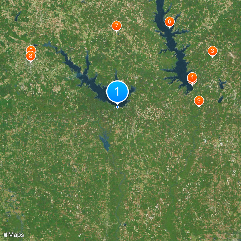
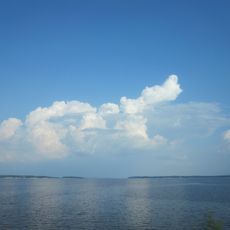
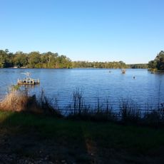
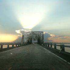
Sam Rayburn Reservoir is a large body of water in Deep East Texas, surrounded by two national forests and serving as a popular destination for water sports and fishing. The lake stretches across wide forested hills with many coves and arms winding between pine and hardwood trees.

Work on the dam began in the mid-1950s and continued for nearly a decade, with the project part of a broader plan for water supply and flood control. After completion, the structure created one of the largest human-made bodies of water in the state.

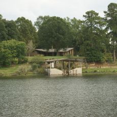
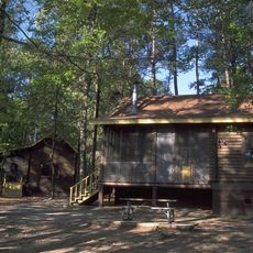
The reservoir carries the name of a politician who championed natural resource protection, renamed from an earlier designation after a local settlement. Anglers and outdoor enthusiasts use the water today as a recreation area, where dense forests reach the shoreline.

Several public access points around the shoreline offer boat ramps and docks, with some areas better suited for motorboats and others more appropriate for paddlecraft. Those exploring the water will find trails and fishing spots along different sections of the shore with varying conditions.

Certain shoreline zones harbor rare carnivorous plants and wild orchids that thrive in the swampy areas between water and forest. These botanical features surprise many visitors who know the water only for fishing or boating.

The community of curious travelers

AroundUs brings together thousands of curated places, local tips, and hidden gems, enriched daily by 60,000 contributors worldwide.

Start exploring
Location
GPS coordinates
31.06111,-94.10611
Latest update
December 20, 2025 02:09
Around this place
Toledo Bend Reservoir
United States of America

Toledo Bend Reservoir

53.1 km
Hodges Gardens State Park
United States of America

Hodges Gardens State Park

73.4 km
South Toledo Bend State Park
United States of America

South Toledo Bend State Park

53.6 km
Ellen Trout Zoo
United States of America

Ellen Trout Zoo

68.5 km
North Toledo Bend State Park
United States of America

North Toledo Bend State Park

64.8 km
Mission Dolores State Historic Site
United States of America

Mission Dolores State Historic Site

51.5 km
Pines Theater
United States of America

Pines Theater

66.8 km
Burr's Ferry Bridge
United States of America

Burr's Ferry Bridge

55.6 km
Lake Amanda
United States of America

Lake Amanda

34.1 km
Sterne-Hoya House Museum and Library
United States of America

Sterne-Hoya House Museum and Library

79.3 km
William Garrett Plantation
United States of America

William Garrett Plantation

52.9 km
Woodmen of the World Building
United States of America

Woodmen of the World Building

79.6 km
Kirby-Hill House
United States of America

Kirby-Hill House

79.5 km
US 190 Bridge at the Neches River
United States of America

US 190 Bridge at the Neches River

24.8 km
Gaines–Oliphint House
United States of America

Gaines–Oliphint House

56.2 km
Burks House
United States of America

Burks House

63.9 km
Jasper County Courthouse
United States of America

Jasper County Courthouse

18.6 km
Hardin County Courthouse
United States of America

Hardin County Courthouse

79.7 km
Newton County Courthouse
United States of America

Newton County Courthouse

40.6 km
San Augustine County Courthouse and Jail
United States of America

San Augustine County Courthouse and Jail

52.2 km
Ezekiel W. Cullen House
United States of America

Ezekiel W. Cullen House

52 km
Tyler County Courthouse
United States of America

Tyler County Courthouse

43.4 km
Bowers-Felts House
United States of America

Bowers-Felts House

68.3 km
Everitt-Cox House
United States of America

Everitt-Cox House

67.2 km
Brookshire, Houston-Yeates House
United States of America

Brookshire, Houston-Yeates House

66.7 km
Texas Forestry Museum
United States of America

Texas Forestry Museum

65.4 km
Heritage Village Museum
United States of America

Heritage Village Museum

45.5 km
Main Theater
United States of America

Main Theater

79.5 km
Show the full map
« Sam Rayburn Reservoir - Water reservoir in Deep East Texas, United States » is provided by Around Us (aroundus.com). Images and texts are derived from Wikimedia project under a Creative Commons license. You are allowed to copy, distribute, and modify copies of this page, under the conditions set by the license, as long as this note is clearly visible.

Discover hidden gems everywhere you go!

From secret cafés to breathtaking viewpoints, skip the crowded tourist spots and find places that match your style. Our app makes it easy with voice search, smart filtering, route optimization, and insider tips from travelers worldwide. Download now for the complete mobile experience.

Around Us App Screenshot

A unique approach to discovering new places

Le Figaro

All the places worth exploring

France Info

A tailor-made excursion in just a few clicks

20 Minutes

Around Us
Travel Guide & Maps
Download

Send to your phone

QR Code
1

Open the camera app on your mobile.

2

Point at the QR code with your camera. A notification will appear.

3

Tap the notification to open the link.