Enable Location

We need your location to show you interesting places around you

Discover nearby places

Find interesting locations and hidden gems around you

Precise directions

Get accurate directions and distances to places

Your location is never shared with other users. It's only used when you tap the location button.

Seven Mile Bridge

Log in to your account

Start exploring — it's free

Trusted by 61,674 travelers worldwide

Continue with Google
Continue with Apple
or

We will send you a code to connect

By continuing, you accept our Terms and Conditions and our Privacy Policy

Check your inbox

We've sent a pincode in your inbox. Please enter the code below.

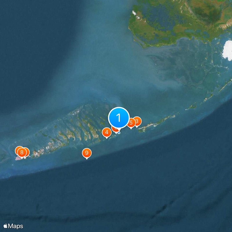
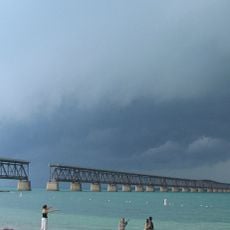
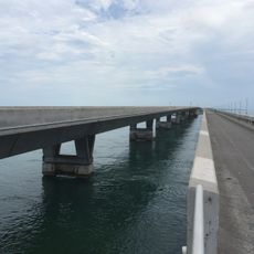
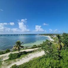
Seven Mile Bridge, Road bridge between Marathon and Little Duck Key, Florida Keys, US

Description

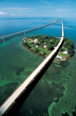
Seven Mile Bridge is a road viaduct linking Marathon to Little Duck Key in the Florida Keys. The structure rises about 65 feet above sea level and rests on hundreds of concrete piers stretching nearly 11 kilometers through shallow bays and sandy channels.

History

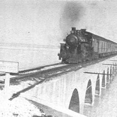
The first crossing was built between 1909 and 1912 as a railway line connecting Key West to the mainland. After severe hurricanes in the 1930s damaged the original route, it was converted for automobiles until the current concrete bridge was completed in 1982.

Culture

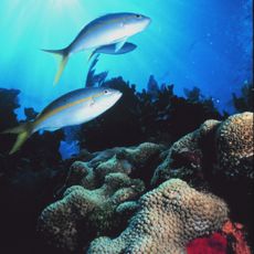
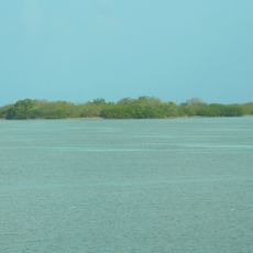
The name refers to the length of the crossing over open water, which drivers follow from the middle part of the island chain to the next inhabited island. Anglers and cyclists use sections of the old viaduct alongside as a public path with views of the shallow bays and reefs around.

Practical

The route runs in a straight line from one island to the next and can be challenging during strong winds or rain because there are no protective windbreaks. Sun protection and plenty of drinking water are advisable, as the roadway sits fully exposed above open water.

Did you know?

Pipes beneath the roadway carry freshwater to the southern islands because they lack their own groundwater supply. Crossing the span means also traveling above one of the longest freshwater pipelines in the entire Florida Keys.

Location
Official opening
May 24, 1982
Length
10,887.5 m
GPS coordinates
24.68194,-81.22389
Latest update
December 12, 2025 20:59

AroundUs brings together thousands of curated places, local tips, and hidden gems, enriched daily by 60,000 contributors worldwide. Discover all places nearby (Florida).

Around this place
Conch Republic
United States of America

Conch Republic

58.3 km
Overseas Railroad
United States of America

Overseas Railroad

10.7 km
Bahia Honda Rail Bridge
United States of America

Bahia Honda Rail Bridge

7.6 km
Pigeon Key
United States of America

Pigeon Key

7.4 km
Florida Keys National Marine Sanctuary
United States of America

Florida Keys National Marine Sanctuary

1.6 km
Martello Gallery-Key West Art and Historical Museum
United States of America

Martello Gallery-Key West Art and Historical Museum

55.7 km
Smathers Beach
United States of America

Smathers Beach

57.3 km
Looe Key
United States of America

Looe Key

23.7 km
Sugarloaf Key Bat Tower
United States of America

Sugarloaf Key Bat Tower

35.1 km
Sombrero Key Light
United States of America

Sombrero Key Light

12.9 km
Dolphin Research Center
United States of America

Dolphin Research Center

29.7 km
National Key Deer Refuge
United States of America

National Key Deer Refuge

18.7 km
Indian Key State Historic Site
United States of America

Indian Key State Historic Site

58.2 km
Long Key Bridge
United States of America

Long Key Bridge

38.2 km
Higgs Beach
United States of America

Higgs Beach

58.8 km
American Shoal Light
United States of America

American Shoal Light

34.6 km
West Martello Tower
United States of America

West Martello Tower

58.9 km
Key West Tropical Forest & Botanical Garden
United States of America

Key West Tropical Forest & Botanical Garden

54.5 km
Pigeon Key Historic District
United States of America

Pigeon Key Historic District

7.4 km
Pigeon Key
United States of America

Pigeon Key

7.4 km
George Adderley House
United States of America

George Adderley House

15.6 km
Bahia Honda State Park
United States of America

Bahia Honda State Park

4.5 km
Loggerhead Beach
United States of America

Loggerhead Beach

6.3 km
African Cemetery at Higgs Beach
United States of America

African Cemetery at Higgs Beach

58.8 km
USS R-12
United States of America

USS R-12

52.1 km
Oceans Edge Resort & Marina Key West
United States of America

Oceans Edge Resort & Marina Key West

52.9 km
Sugarloaf Beach
United States of America

Sugarloaf Beach

34.5 km
Flamingo Campground Amphitheater
United States of America

Flamingo Campground Amphitheater

58.6 km
Show the full map
« Seven Mile Bridge - Road bridge between Marathon and Little Duck Key, Florida Keys, US » is provided by Around Us (aroundus.com). Images and texts are derived from Wikimedia project under a Creative Commons license. You are allowed to copy, distribute, and modify copies of this page, under the conditions set by the license, as long as this note is clearly visible.

Discover hidden gems everywhere you go!

From secret cafés to breathtaking viewpoints, skip the crowded tourist spots and find places that match your style. Our app makes it easy with voice search, smart filtering, route optimization, and insider tips from travelers worldwide. Download now for the complete mobile experience.

Around Us App Screenshot

A unique approach to discovering new places

Le Figaro

All the places worth exploring

France Info

A tailor-made excursion in just a few clicks

20 Minutes

Around Us
Travel Guide & Maps
Download

Send to your phone

QR Code
1

Open the camera app on your mobile.

2

Point at the QR code with your camera. A notification will appear.

3

Tap the notification to open the link.