Government Cut, Shipping channel in Miami, United States
Government Cut is a manmade shipping channel between Miami Beach and Fisher Island, opened in 1905 after Congress authorized it in 1902. Dredging began in 1903 and the fill was used to enlarge Fisher Island. The channel gives the Port of Miami a direct route to the Atlantic, and its entrance is the reference point for Miami's ocean tides.
Congress approved the project in 1902, and dredging work to create this direct route to the harbor was completed in 1905. The channel permanently altered the area's geography, as excavated materials and construction efforts helped develop surrounding islands.
The cut's name comes from the U.S. government, which authorized it; Congress approved the project in 1902 after the House Committee on Rivers and Harbors acted on June 13. Local tides for Miami are reported at the cut's entrance, with Jupiter Inlet the next-closest mainland point for tide information. Three agencies share the waterway: the Port of Miami handles navigation, the U.S. Coast Guard safety and security, and the U.S. Army Corps of Engineers the channel and dredging.
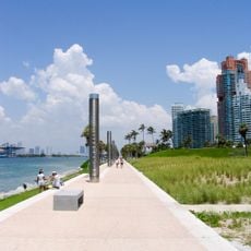
The best views of the ships are from the shores or waterfront promenades that offer clear sightlines to the channel. Early morning and late afternoon are ideal times to watch vessel traffic and activity.
The dredged fill was not dumped at sea: it was used to enlarge the privately owned Fisher Island. Later widening and deepening of the cut added land to the Port of Miami and created the foundation for the MacArthur Causeway east of Interstate 395.
The community of curious travelers
AroundUs brings together thousands of curated places, local tips, and hidden gems, enriched daily by 93,773 contributors worldwide.