Chest opened
+${chestReward.xp} XP
Explorer
NOUVEAU ×${chestReward.collectible.quantity}
tapez pour fermer
Chest locked

Open chests in the app

Around Us is built for your phone — chests unlock when you walk, explore and capture nearby places.

Enable Location

We need your location to show you interesting places around you

Discover nearby places

Find interesting locations and hidden gems around you

Precise directions

Get accurate directions and distances to places

Your location is never shared with other users. It's only used when you tap the location button.

Ochlockonee River

Log in to your account

Start exploring — it's free

Trusted by 72,890 travelers worldwide

Continue with Google
Continue with Apple
or

We will send you a code to connect

By continuing, you accept our Terms and Conditions and our Privacy Policy

Check your inbox

We've sent a pincode in your inbox. Please enter the code below.

Ochlockonee River
Discussion Reviews 1 Photos
9.3k Popularity

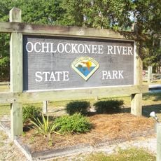
Ochlockonee River, River system in Florida Panhandle, United States

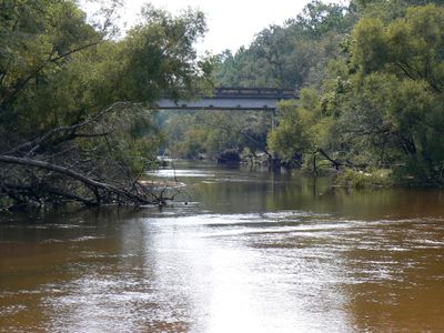
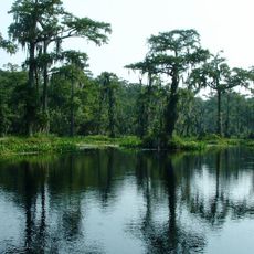
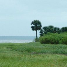
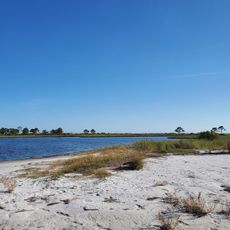
The Ochlockonee River is a river system in the Florida Panhandle that flows roughly 206 miles from Georgia through Florida. It empties into Ochlockonee Bay and Apalachee Bay, passing through varied landscapes and creating boundary lines between counties along the way.

Spanish explorers established this river as the western boundary of their Apalachee Province, marking it on maps as Claraquachine or Yellow River. This designation became important for controlling territory during the colonial period in the Southeast.

The river's name comes from the Hitchiti language, meaning yellow river, reflecting historical connections to Native American communities. This naming remains visible in how locals speak about the waterway and connects modern visits to the region's earlier inhabitants.

The river has multiple access points where visitors can fish for largemouth bass, black crappie, striped bass, and channel catfish. The warmer months offer the best conditions for fishing when water levels are more stable.

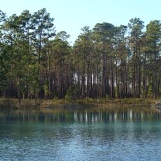
A large dam was built in 1927 that created Lake Talquin, transforming a stretch of fast-moving water into a calm reservoir. This lake offers a completely different experience from the natural flowing sections above and below it.

The community of curious travelers

AroundUs brings together thousands of curated places, local tips, and hidden gems, enriched daily by 60,000 contributors worldwide.

Start exploring
Location
GPS coordinates
29.97667,-84.43750
Latest update
December 10, 2025 15:58
Around this place
Wakulla Springs
United States of America

Wakulla Springs

31.6 km
Apalachicola National Forest
United States of America

Apalachicola National Forest

41.7 km
St. Marks National Wildlife Refuge
United States of America

St. Marks National Wildlife Refuge

34 km
St. Marks Light
United States of America

St. Marks Light

27.1 km
Edward Ball Wakulla Springs State Park
United States of America

Edward Ball Wakulla Springs State Park

31.9 km
Bragg Memorial Stadium
United States of America

Bragg Memorial Stadium

52 km
San Marcos de Apalache Historic State Park
United States of America

San Marcos de Apalache Historic State Park

29.3 km
Ochlockonee River State Park
United States of America

Ochlockonee River State Park

5.2 km
Tallahassee Museum
United States of America

Tallahassee Museum

49 km
Natural Bridge Battlefield Historic State Park
United States of America

Natural Bridge Battlefield Historic State Park

43.9 km
Tallahassee-St. Marks Historic Railroad Trail State Park
United States of America

Tallahassee-St. Marks Historic Railroad Trail State Park

49.5 km
Carnegie Library at FAMU
United States of America

Carnegie Library at FAMU

52.2 km
Tallahassee Museum Visitor Center
United States of America

Tallahassee Museum Visitor Center

49.1 km
Bellevue Plantation
United States of America

Bellevue Plantation

49.3 km
Crooked River Light
United States of America

Crooked River Light

30.4 km
United States of America

Wakulla State Forest

33.3 km
Camp Gordon Johnston Museum
United States of America

Camp Gordon Johnston Museum

29.6 km
Old Sopchoppy High School Gymnasium
United States of America

Old Sopchoppy High School Gymnasium

10.5 km
Shell Point Beach
United States of America

Shell Point Beach

16.6 km
Old Wakulla County Courthouse
United States of America

Old Wakulla County Courthouse

22.9 km
Sopchoppy School
United States of America

Sopchoppy School

10.6 km
Mount Beasor Primitive Baptist Church
United States of America

Mount Beasor Primitive Baptist Church

14.9 km
Winterle House
United States of America

Winterle House

50.4 km
San Marcos de Apalache Historic State Park
United States of America

San Marcos de Apalache Historic State Park

29.3 km
Carrabelle History Museum
United States of America

Carrabelle History Museum

26 km
Dog Island Light
United States of America

Dog Island Light

30.9 km
Sand Beach
United States of America

Sand Beach

48.8 km
Wilson Beach
United States of America

Wilson Beach

5.2 km
Show the full map
Reviews
Share your experience

No review yet

Discussions
Start a discussion...

No discussion yet

« Ochlockonee River - River system in Florida Panhandle, United States » is provided by Around Us (aroundus.com). Images and texts are derived from Wikimedia project under a Creative Commons license. You are allowed to copy, distribute, and modify copies of this page, under the conditions set by the license, as long as this note is clearly visible.

Discover hidden gems everywhere you go!

From secret cafés to breathtaking viewpoints, skip the crowded tourist spots and find places that match your style. Our app makes it easy with voice search, smart filtering, route optimization, and insider tips from travelers worldwide. Download now for the complete mobile experience.

Around Us App Screenshot

A unique approach to discovering new places

Le Figaro

All the places worth exploring

France Info

A tailor-made excursion in just a few clicks

20 Minutes

Around Us
Travel Guide & Maps
Download

Send to your phone

QR Code
1

Open the camera app on your mobile.

2

Point at the QR code with your camera. A notification will appear.

3

Tap the notification to open the link.