Enable Location

We need your location to show you interesting places around you

Discover nearby places

Find interesting locations and hidden gems around you

Precise directions

Get accurate directions and distances to places

Your location is never shared with other users. It's only used when you tap the location button.

Log in to your account

Start exploring — it's free

Trusted by 62,521 travelers worldwide

Continue with Google
Continue with Apple
or

We will send you a code to connect

By continuing, you accept our Terms and Conditions and our Privacy Policy

Check your inbox

We've sent a pincode in your inbox. Please enter the code below.

Rodman Reservoir

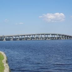
Rodman Reservoir, body of water

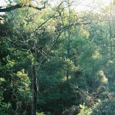
Rodman Reservoir is a large body of water in northern Florida near Palatka, stretching approximately 15 miles and surrounded by flooded woods and trees. The water contains aquatic plants like water hyacinths and eelgrass that create habitats for various fish species and shape the overall environment.

The reservoir was created in 1968 when a dam called Kirkpatrick Dam was built across the Ocklawaha River to control water levels. This dam transformed a flowing river into a large water body and was designed to support fish populations and manage water resources for the region.

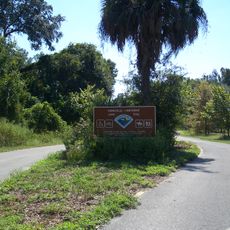
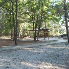
The reservoir is easiest to visit during regular periods when water levels are relatively stable, though levels are lowered every few years for environmental management. Visitors should watch for floating logs and stumps in the water, especially during low-water periods, and bring a valid fishing license and appropriate safety gear.

The reservoir is known for its exceptionally large bass, with several specimens documented weighing over 17 pounds, coming close to Florida's record. This unusual size results from the special ecosystem and careful water-level management that gives fish optimal conditions for growth.

The community of curious travelers

AroundUs brings together thousands of curated places, local tips, and hidden gems, enriched daily by 60,000 contributors worldwide.

Start exploring
Location
GPS coordinates
29.50722,-81.91639
Latest update
February 7, 2026 11:01
Around this place
Ravine Gardens State Park
United States of America

Ravine Gardens State Park

29.8 km
Marjorie Kinnan Rawlings Historic State Park
United States of America

Marjorie Kinnan Rawlings Historic State Park

23.8 km
Gainesville-Hawthorne Trail State Park
United States of America

Gainesville-Hawthorne Trail State Park

28 km
Memorial Bridge
United States of America

Memorial Bridge

32.3 km
Dunns Creek
United States of America

Dunns Creek

31.8 km
Etoniah Creek State Forest
United States of America

Etoniah Creek State Forest

27.8 km
Welaka State Forest
United States of America

Welaka State Forest

25.7 km
Mount Royal
United States of America

Mount Royal

26 km
Bronson-Mulholland House
United States of America

Bronson-Mulholland House

32.1 km
Central Academy
United States of America

Central Academy

31.4 km
St. Mark's Episcopal Church
United States of America

St. Mark's Episcopal Church

31.9 km
Putnam County Courthouse
United States of America

Putnam County Courthouse

31.5 km
Fort Shannon
United States of America

Fort Shannon

30.1 km
Larimer Memorial Library
United States of America

Larimer Memorial Library

31.8 km
James W. Townsend House
United States of America

James W. Townsend House

2.7 km
Trinity Episcopal Church
United States of America

Trinity Episcopal Church

25.6 km
Melrose Historic District
United States of America

Melrose Historic District

26.3 km
Rochelle School
United States of America

Rochelle School

31.2 km
T. W. Randall House
United States of America

T. W. Randall House

30.9 km
Neilson House
United States of America

Neilson House

30.4 km
Orange Springs Methodist Episcopal Church and Cemetery
United States of America

Orange Springs Methodist Episcopal Church and Cemetery

2.9 km
Armstrong House
United States of America

Armstrong House

21.6 km
Hawthorne Historical Museum and Cultural Center
United States of America

Hawthorne Historical Museum and Cultural Center

18.8 km
Kerr City Historic District
United States of America

Kerr City Historic District

20 km
Morgan-Townsend House
United States of America

Morgan-Townsend House

24.9 km
McIntosh Historic District
United States of America

McIntosh Historic District

30.1 km
Island Grove Masonic Lodge No. 125
United States of America

Island Grove Masonic Lodge No. 125

19.4 km
Melrose Woman's Club
United States of America

Melrose Woman's Club

26 km
Show the full map
« Rodman Reservoir - body of water » is provided by Around Us (aroundus.com). Images and texts are derived from Wikimedia project under a Creative Commons license. You are allowed to copy, distribute, and modify copies of this page, under the conditions set by the license, as long as this note is clearly visible.

Discover hidden gems everywhere you go!

From secret cafés to breathtaking viewpoints, skip the crowded tourist spots and find places that match your style. Our app makes it easy with voice search, smart filtering, route optimization, and insider tips from travelers worldwide. Download now for the complete mobile experience.

Around Us App Screenshot

A unique approach to discovering new places

Le Figaro

All the places worth exploring

France Info

A tailor-made excursion in just a few clicks

20 Minutes

Around Us
Travel Guide & Maps
Download

Send to your phone

QR Code
1

Open the camera app on your mobile.

2

Point at the QR code with your camera. A notification will appear.

3

Tap the notification to open the link.