Enable Location

We need your location to show you interesting places around you

Discover nearby places

Find interesting locations and hidden gems around you

Precise directions

Get accurate directions and distances to places

Your location is never shared with other users. It's only used when you tap the location button.

Jennings State Forest

Log in to your account

Start exploring — it's free

Trusted by 62,565 travelers worldwide

Continue with Google
Continue with Apple
or

We will send you a code to connect

By continuing, you accept our Terms and Conditions and our Privacy Policy

Check your inbox

We've sent a pincode in your inbox. Please enter the code below.

Jennings State Forest

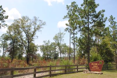
Jennings State Forest, State forest in Clay County, Florida, United States

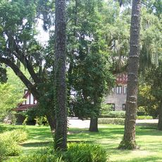
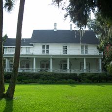
Jennings State Forest is a large protected woodland in Clay County, Florida, with diverse habitats including sandhills, seepage slopes, and the headwaters of Black Creek. The land offers visitors multiple ecosystems and water features to explore throughout their visit.

The forest was established to implement sustainable forestry practices and preserve ecological areas for the long term. It was created in response to the need to protect Florida's woodlands and maintain their natural systems.

The forest serves as an educational center where visitors learn about forest management, conservation methods, and the importance of protecting natural habitats.

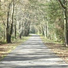
Visitors will find multiple hiking trails, four canoe launch points, and primitive camping areas for activities like hiking, horseback riding, and fishing. Accessibility varies with seasons and weather conditions, so it is wise to check current conditions before your visit.

The property hosts a large ecosystem restoration project that protects threatened species like the gopher tortoise and northern bobwhite. This work is visible to visitors and shows how conservation efforts operate in practice.

The community of curious travelers

AroundUs brings together thousands of curated places, local tips, and hidden gems, enriched daily by 60,000 contributors worldwide.

Start exploring
Location
GPS coordinates
30.15663,-81.86927
Latest update
December 11, 2025 18:09
Around this place
Buckman Bridge
United States of America

Buckman Bridge

19.9 km
Jacksonville-Baldwin Rail Trail
United States of America

Jacksonville-Baldwin Rail Trail

22.9 km
Memorial Park
United States of America

Memorial Park

25.1 km
United States of America

Cecil Commerce Center

6.9 km
Maple Leaf
United States of America

Maple Leaf

17.6 km
Red Bank Plantation
United States of America

Red Bank Plantation

25.2 km
St. Margaret's Episcopal Church and Cemetery
United States of America

St. Margaret's Episcopal Church and Cemetery

19.4 km
Murray Hill Theatre
United States of America

Murray Hill Theatre

22.6 km
Middleburg United Methodist Church
United States of America

Middleburg United Methodist Church

9.9 km
Our Lady of the Angels Catholic Church
United States of America

Our Lady of the Angels Catholic Church

24.8 km
Museum of Southern History
United States of America

Museum of Southern History

20.5 km
Middleburg Historic District
United States of America

Middleburg Historic District

9.8 km
Village Store
United States of America

Village Store

20.4 km
River Road Historic District
United States of America

River Road Historic District

16.6 km
Memorial Home Community Historic District
United States of America

Memorial Home Community Historic District

20.3 km
Holly Cottage
United States of America

Holly Cottage

19.5 km
Lane-Towers House
United States of America

Lane-Towers House

21.8 km
Winterbourne
United States of America

Winterbourne

16.7 km
Joseph Green House
United States of America

Joseph Green House

15.7 km
Clark-Chalker House
United States of America

Clark-Chalker House

9.8 km
George A. Chalker House
United States of America

George A. Chalker House

10 km
William Helffrich House
United States of America

William Helffrich House

15.9 km
Orange Park, Florida MPS
United States of America

Orange Park, Florida MPS

15.5 km
William Clarke Estate
United States of America

William Clarke Estate

14.7 km
Haskell-Long House
United States of America

Haskell-Long House

9.6 km
Frosard W. Budington House
United States of America

Frosard W. Budington House

9.8 km
William Westcott House
United States of America

William Westcott House

14.7 km
George Randolph Frisbee, Jr. House
United States of America

George Randolph Frisbee, Jr. House

9.7 km
Show the full map
« Jennings State Forest - State forest in Clay County, Florida, United States » is provided by Around Us (aroundus.com). Images and texts are derived from Wikimedia project under a Creative Commons license. You are allowed to copy, distribute, and modify copies of this page, under the conditions set by the license, as long as this note is clearly visible.

Discover hidden gems everywhere you go!

From secret cafés to breathtaking viewpoints, skip the crowded tourist spots and find places that match your style. Our app makes it easy with voice search, smart filtering, route optimization, and insider tips from travelers worldwide. Download now for the complete mobile experience.

Around Us App Screenshot

A unique approach to discovering new places

Le Figaro

All the places worth exploring

France Info

A tailor-made excursion in just a few clicks

20 Minutes

Around Us
Travel Guide & Maps
Download

Send to your phone

QR Code
1

Open the camera app on your mobile.

2

Point at the QR code with your camera. A notification will appear.

3

Tap the notification to open the link.