Chest opened
+${chestReward.xp} XP
Explorer
NOUVEAU ×${chestReward.collectible.quantity}
tapez pour fermer
Chest locked

Open chests in the app

Around Us is built for your phone — chests unlock when you walk, explore and capture nearby places.

Enable Location

We need your location to show you interesting places around you

Discover nearby places

Find interesting locations and hidden gems around you

Precise directions

Get accurate directions and distances to places

Your location is never shared with other users. It's only used when you tap the location button.

Log in to your account

Start exploring — it's free

Trusted by 73,028 travelers worldwide

Continue with Google
Continue with Apple
or

We will send you a code to connect

By continuing, you accept our Terms and Conditions and our Privacy Policy

Check your inbox

We've sent a pincode in your inbox. Please enter the code below.

Jacksonville Air Route Traffic Control Center
Discussion Reviews Photo
3k Popularity

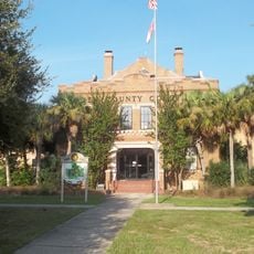
Jacksonville Air Route Traffic Control Center, Air traffic control center in Hilliard, Florida, US

Jacksonville Air Route Traffic Control Center is an air traffic facility in Hilliard, Florida that monitors flights across several southeastern states and ocean areas. The facility manages thousands of daily flight movements using radar and communication systems to ensure safety and efficiency in air traffic.

The facility originated as part of the Federal Aviation Administration's effort to modernize air traffic control systems during commercial aviation growth. It was developed to safely handle the increasing number of flight movements over southeastern airspace.

Air traffic controllers at Jacksonville Center maintain constant communication with pilots and neighboring facilities while coordinating thousands of daily flight movements.

Visitors can view the facility from outside, but public access to the control room is not available. It is helpful to check beforehand whether photography is permitted or if there are public information resources on-site.

The facility monitors not only commercial aircraft but also military planes over vast areas of the Atlantic Ocean and Gulf of Mexico. This makes it an important hub for international aviation operations in this region.

The community of curious travelers

AroundUs brings together thousands of curated places, local tips, and hidden gems, enriched daily by 60,000 contributors worldwide.

Start exploring
GPS coordinates
30.69900,-81.90820
Latest update
December 12, 2025 12:02
Around this place
Dungeness
United States of America

Dungeness

42.2 km
Jacksonville-Baldwin Rail Trail
United States of America

Jacksonville-Baldwin Rail Trail

41.4 km
Crooked River State Park
United States of America

Crooked River State Park

37.6 km
Okefenokee Wilderness
United States of America

Okefenokee Wilderness

42.5 km
St. Marys Historic District
United States of America

St. Marys Historic District

37.2 km
McIntosh Sugarworks
United States of America

McIntosh Sugarworks

33.2 km
Fairbanks House
United States of America

Fairbanks House

42.8 km
Folkston Railfan Platform
United States of America

Folkston Railfan Platform

17.4 km
Orange Hall
United States of America

Orange Hall

34.6 km
Trout River Bridge
United States of America

Trout River Bridge

40.6 km
Amelia Island Museum of History
United States of America

Amelia Island Museum of History

42.7 km
Woodbine Historic District
United States of America

Woodbine Historic District

34.7 km
Old Camden County Courthouse
United States of America

Old Camden County Courthouse

34.9 km
Charlton County Courthouse
United States of America

Charlton County Courthouse

17.4 km
Lewis Mausoleum
United States of America

Lewis Mausoleum

40.8 km
Kingsland Commercial Historic District
United States of America

Kingsland Commercial Historic District

23.6 km
Machaba Balu Preserve
United States of America

Machaba Balu Preserve

30.6 km
John M. Hopkins Cabin
United States of America

John M. Hopkins Cabin

21.5 km
Mount Olive Missionary Baptist Church
United States of America

Mount Olive Missionary Baptist Church

39.6 km
William Mizell, Sr., House
United States of America

William Mizell, Sr., House

17.8 km
Florida–Georgia border
United States of America

Florida–Georgia border

24.8 km
The Selfie Showroom
United States of America

The Selfie Showroom

38.3 km
Cumberland Island National Seashore Museum
United States of America

Cumberland Island National Seashore Museum

34.5 km
Ice House Museum
United States of America

Ice House Museum

42.1 km
David Levy Yulee Sculpture
United States of America

David Levy Yulee Sculpture

42.6 km
AMC Yulee 10
United States of America

AMC Yulee 10

35.8 km
St. Marys Submarine Museum
United States of America

St. Marys Submarine Museum

34.4 km
St. Marys River Bridge
United States of America

St. Marys River Bridge

21.6 km
Show the full map
Reviews
Share your experience

No review yet

Discussions
Start a discussion...

No discussion yet

« Jacksonville Air Route Traffic Control Center - Air traffic control center in Hilliard, Florida, US » is provided by Around Us (aroundus.com). Images and texts are derived from Wikimedia project under a Creative Commons license. You are allowed to copy, distribute, and modify copies of this page, under the conditions set by the license, as long as this note is clearly visible.

Discover hidden gems everywhere you go!

From secret cafés to breathtaking viewpoints, skip the crowded tourist spots and find places that match your style. Our app makes it easy with voice search, smart filtering, route optimization, and insider tips from travelers worldwide. Download now for the complete mobile experience.

Around Us App Screenshot

A unique approach to discovering new places

Le Figaro

All the places worth exploring

France Info

A tailor-made excursion in just a few clicks

20 Minutes

Around Us
Travel Guide & Maps
Download

Send to your phone

QR Code
1

Open the camera app on your mobile.

2

Point at the QR code with your camera. A notification will appear.

3

Tap the notification to open the link.