Enable Location

We need your location to show you interesting places around you

Discover nearby places

Find interesting locations and hidden gems around you

Precise directions

Get accurate directions and distances to places

Your location is never shared with other users. It's only used when you tap the location button.

St. Marys Historic District

Log in to your account

Start exploring — it's free

Trusted by 63,035 travelers worldwide

Continue with Google
Continue with Apple
or

We will send you a code to connect

By continuing, you accept our Terms and Conditions and our Privacy Policy

Check your inbox

We've sent a pincode in your inbox. Please enter the code below.

Discussion Reviews 1 Photos
2.5k Popularity

St. Marys Historic District, historic district in Georgia, United States

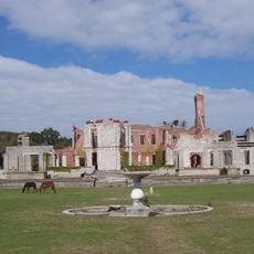
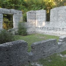
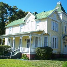
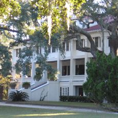
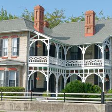
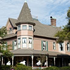
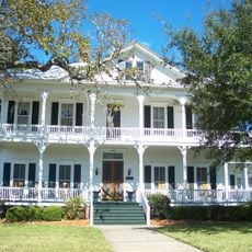
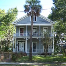
St. Marys Historic District is a neighborhood in inland Georgia spanning about 230 acres along Waterfront Road, where residential homes, business buildings, and churches from two centuries line the streets. The structures mostly date from the late 18th through early 20th centuries and display different building styles and purposes.

The district originated in the 16th century when Spanish settlers established their community in this location. In 1976 the area received official recognition through the National Register of Historic Places, confirming its value as a preserved piece of early American history.

The district displays a mix of wooden and stone buildings that reveal the different social groups who settled here over time. You can see how the architecture from private homes to religious buildings reflects the community's evolution across the centuries.

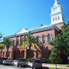
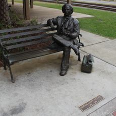
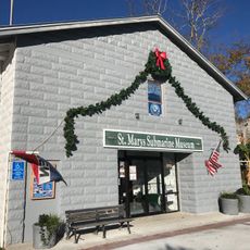
Visitors can explore the area on foot and view buildings like Orange Hall and the United Methodist Church, which houses a notable bell. It is wise to allow enough time to walk through and see the various homes and public structures at a relaxed pace.

The district contains a large oak tree planted on the day of George Washington's burial, marked as a memorial to this significant moment. The tree connects local history directly to an important event in the nation's past.

The community of curious travelers

AroundUs brings together thousands of curated places, local tips, and hidden gems, enriched daily by 60,000 contributors worldwide.

Start exploring
Location
Location
GPS coordinates
30.74333,-81.52333
Latest update
December 12, 2025 17:45
Around this place
Dungeness
United States of America

Dungeness

5 km
Fort Clinch
United States of America

Fort Clinch

7.9 km
Fort Clinch State Park
United States of America

Fort Clinch State Park

7.9 km
Plum Orchard
United States of America

Plum Orchard

13.7 km
Original Town of Fernandina Historic Site
United States of America

Original Town of Fernandina Historic Site

8.9 km
Amelia Island Light
United States of America

Amelia Island Light

11 km
Crooked River State Park
United States of America

Crooked River State Park

11.4 km
Fort San Carlos
United States of America

Fort San Carlos

8.8 km
McIntosh Sugarworks
United States of America

McIntosh Sugarworks

7.7 km
Fernandina Beach Historic District
United States of America

Fernandina Beach Historic District

10 km
Fairbanks House
United States of America

Fairbanks House

10.1 km
Greyfield
United States of America

Greyfield

6.6 km
Nassau County Courthouse
United States of America

Nassau County Courthouse

10 km
Orange Hall
United States of America

Orange Hall

3.2 km
Amelia Island Museum of History
United States of America

Amelia Island Museum of History

10.2 km
Tabby House
United States of America

Tabby House

10.3 km
Bailey House
United States of America

Bailey House

10.2 km
United States Post Office, Custom House, and Courthouse
United States of America

United States Post Office, Custom House, and Courthouse

9.9 km
John Denham Palmer House
United States of America

John Denham Palmer House

10.6 km
Merrick-Simmons House
United States of America

Merrick-Simmons House

10.4 km
Fort Clinch
United States of America

Fort Clinch

7.9 km
Florida–Georgia border
United States of America

Florida–Georgia border

12.5 km
Sea Camp Beach
United States of America

Sea Camp Beach

6.3 km
Cumberland Island National Seashore Museum
United States of America

Cumberland Island National Seashore Museum

3.4 km
Ice House Museum
United States of America

Ice House Museum

4.9 km
David Levy Yulee Sculpture
United States of America

David Levy Yulee Sculpture

9.8 km
AMC Yulee 10
United States of America

AMC Yulee 10

13.5 km
St. Marys Submarine Museum
United States of America

St. Marys Submarine Museum

3.5 km
Show the full map
Reviews
Share your experience

No review yet

Discussions
Start a discussion...

No discussion yet

« St. Marys Historic District - historic district in Georgia, United States » is provided by Around Us (aroundus.com). Images and texts are derived from Wikimedia project under a Creative Commons license. You are allowed to copy, distribute, and modify copies of this page, under the conditions set by the license, as long as this note is clearly visible.

Discover hidden gems everywhere you go!

From secret cafés to breathtaking viewpoints, skip the crowded tourist spots and find places that match your style. Our app makes it easy with voice search, smart filtering, route optimization, and insider tips from travelers worldwide. Download now for the complete mobile experience.

Around Us App Screenshot

A unique approach to discovering new places

Le Figaro

All the places worth exploring

France Info

A tailor-made excursion in just a few clicks

20 Minutes

Around Us
Travel Guide & Maps
Download

Send to your phone

QR Code
1

Open the camera app on your mobile.

2

Point at the QR code with your camera. A notification will appear.

3

Tap the notification to open the link.