Enable Location

We need your location to show you interesting places around you

Discover nearby places

Find interesting locations and hidden gems around you

Precise directions

Get accurate directions and distances to places

Your location is never shared with other users. It's only used when you tap the location button.

Berrien County

Log in to your account

Save your favorite places
Create custom travel routes
Rate and review places
Access the full interactive map
Continue with Google
Continue with Apple
Continue with email
By continuing, you accept our Terms and Conditions and our Privacy Policy
Create an account
Add to collection
Map
Suggest a change
Share

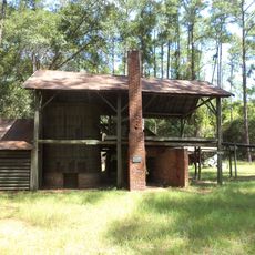
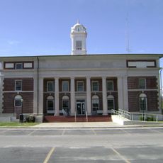
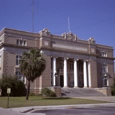
Berrien County, Administrative county in southern Georgia, United States.

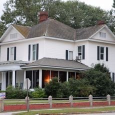
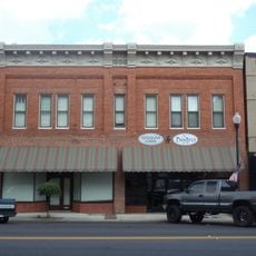
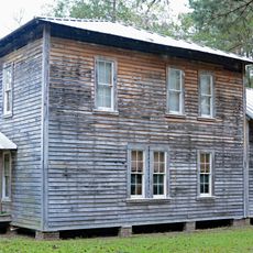
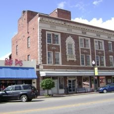
Berrien County is an administrative division in southern Georgia that covers 458 square miles and consists primarily of agricultural land and smaller communities. Four municipalities—Nashville, Alapaha, Enigma, and Ray City—form the populated centers within its boundaries.

This county was created in 1856 when the Georgia General Assembly carved it from portions of Coffee, Irwin, and Lowndes counties. The name honors Senator John M. Berrien, a prominent political figure of that period.

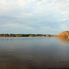
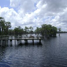
Sports and outdoor recreation shape how people in this county spend their free time and gather as communities. Local programs and natural spaces like the river draw residents together throughout the year.

Visitors can enjoy fishing along the Alapaha River and explore designated hunting areas throughout the county. Several public tennis courts and sports facilities are available across the different communities.

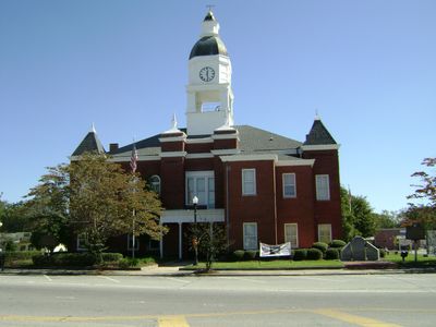
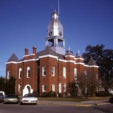
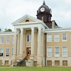
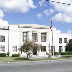
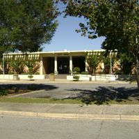
A memorial at the Nashville courthouse honors 25 county soldiers who died at sea off Scotland during World War I. Their names are engraved in stone, preserving a piece of local history that many travelers overlook.

Location: Georgia

Inception: 1856

Capital city: Nashville

Shares border with: Irwin County, Lowndes County, Coffee County, Atkinson County, Lanier County, Cook County, Tift County

Website: http://berriencountygeorgia.com

GPS coordinates: 31.27000,-83.23000

Latest update: December 7, 2025 20:42

Photos
Around this place
Reed Bingham State Park
United States of America

Reed Bingham State Park

31.8 km
Banks Lake National Wildlife Refuge
United States of America

Banks Lake National Wildlife Refuge

29.5 km
Georgia Museum of Agriculture & Historic Village
United States of America

Georgia Museum of Agriculture & Historic Village

36.1 km
McCranie's Turpentine Still
United States of America

McCranie's Turpentine Still

19 km
The Crescent
United States of America

The Crescent

48.2 km
William G. Harrison House
United States of America

William G. Harrison House

7.6 km
The Complex
United States of America

The Complex

47.6 km
Tifton Residential Historic District
United States of America

Tifton Residential Historic District

33.7 km
West Hall
United States of America

West Hall

47.2 km
Student Union (Valdosta State University)
United States of America

Student Union (Valdosta State University)

47.4 km
Tifton Commercial Historic District
United States of America

Tifton Commercial Historic District

33.5 km
Atkinson County Courthouse
United States of America

Atkinson County Courthouse

36 km
Tift County Courthouse
United States of America

Tift County Courthouse

33.5 km
Berrien County Courthouse
United States of America

Berrien County Courthouse

7.3 km
Crestwood
United States of America

Crestwood

45.1 km
Ocilla Public School
United States of America

Ocilla Public School

36.2 km
Alapaha Colored School
United States of America

Alapaha Colored School

12 km
Irwin County Courthouse
United States of America

Irwin County Courthouse

35.9 km
SOWEGA Building
United States of America

SOWEGA Building

23.7 km
Lowndes County Civic Center
United States of America

Lowndes County Civic Center

47.6 km
Cook County Courthouse
United States of America

Cook County Courthouse

23.6 km
Brookwood North Historic District
United States of America

Brookwood North Historic District

46.9 km
North Patterson Street Historic District
United States of America

North Patterson Street Historic District

48 km
Eleventh District A & M School-South Georgia College Historic District
United States of America

Eleventh District A & M School-South Georgia College Historic District

43.6 km
Valdosta Garden Center
United States of America

Valdosta Garden Center

48.2 km
Tift Theatre for the Performing Arts
United States of America

Tift Theatre for the Performing Arts

33.4 km
AMC Classic Tifton 6
United States of America

AMC Classic Tifton 6

35.3 km
Ashley Cinemas
United States of America

Ashley Cinemas

44.9 km
Show the full map
Reviews

Visited this place? Tap the stars to rate it and share your experience / photos with the community! Try now! You can cancel it anytime.

Administrative divisions
« Berrien County - Administrative county in southern Georgia, United States » is provided by Around Us (aroundus.com). Images and texts are derived from Wikimedia project under a Creative Commons license. You are allowed to copy, distribute, and modify copies of this page, under the conditions set by the license, as long as this note is clearly visible.

Discover hidden gems everywhere you go!

From secret cafés to breathtaking viewpoints, skip the crowded tourist spots and find places that match your style. Our app makes it easy with voice search, smart filtering, route optimization, and insider tips from travelers worldwide. Download now for the complete mobile experience.

Around Us App Screenshot

A unique approach to discovering new places

Le Figaro

All the places worth exploring

France Info

A tailor-made excursion in just a few clicks

20 Minutes