Chest opened
+${chestReward.xp} XP
Explorer
NOUVEAU ×${chestReward.collectible.quantity}
tapez pour fermer
Chest locked

Open chests in the app

Around Us is built for your phone — chests unlock when you walk, explore and capture nearby places.

Enable Location

We need your location to show you interesting places around you

Discover nearby places

Find interesting locations and hidden gems around you

Precise directions

Get accurate directions and distances to places

Your location is never shared with other users. It's only used when you tap the location button.

Ashland

Log in to your account

Start exploring — it's free

Trusted by 72,886 travelers worldwide

Continue with Google
Continue with Apple
or

We will send you a code to connect

By continuing, you accept our Terms and Conditions and our Privacy Policy

Check your inbox

We've sent a pincode in your inbox. Please enter the code below.

Discussion Reviews 1 Photos
12k Popularity

Ashland, Administrative center in Clay County, Alabama.

Ashland is the county seat of Clay County in Alabama, serving as the administrative center for the region. The downtown area houses government offices and facilities that manage services for the surrounding county.

The town was founded in 1867 through a land donation by Hollingsworth Watts and named after Henry Clay's Kentucky property. Its incorporation in 1871 established it as the formal administrative center for the region.

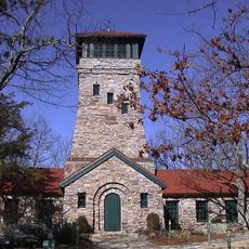
The Clay County Courthouse with its Classical Revival architecture stands as the heart of the community, where locals gather for government business and everyday interactions. The building's presence shapes how residents experience downtown life.

The courthouse and most government offices are located in downtown and easy to access on foot. It's best to visit during regular business hours when all services are available.

The town sits at an elevation of about 1,130 feet (340 meters) above sea level, making it one of the highest-positioned county seats in the state. This elevated location shapes the landscape and approaches to town.

The community of curious travelers

AroundUs brings together thousands of curated places, local tips, and hidden gems, enriched daily by 60,000 contributors worldwide.

Start exploring
GPS coordinates
33.27373,-85.83607
Latest update
December 7, 2025 20:47
Around this place
Talladega Superspeedway
United States of America

Talladega Superspeedway

39 km
Cheaha Mountain
United States of America

Cheaha Mountain

23.7 km
International Motorsports Hall of Fame
United States of America

International Motorsports Hall of Fame

40.3 km
Cheaha State Park
United States of America

Cheaha State Park

22.8 km
Coldwater Covered Bridge
United States of America

Coldwater Covered Bridge

37.2 km
Bunker Tower
United States of America

Bunker Tower

23.7 km
J. L. M. Curry House
United States of America

J. L. M. Curry House

28 km
Swayne Hall
United States of America

Swayne Hall

31.4 km
Waldo Covered Bridge
United States of America

Waldo Covered Bridge

21.4 km
Orange Vale
United States of America

Orange Vale

32 km
Russell Family Historic District
United States of America

Russell Family Historic District

38.6 km
Miss Willie's House
United States of America

Miss Willie's House

30.1 km
Davis C. Cooper House
United States of America

Davis C. Cooper House

38.2 km
Clay County Courthouse
United States of America

Clay County Courthouse

59 m
First Presbyterian Church
United States of America

First Presbyterian Church

30.5 km
Dudley Snow House
United States of America

Dudley Snow House

34.6 km
A.J. and Emma E. Thomas Coley House
United States of America

A.J. and Emma E. Thomas Coley House

37.8 km
B. B. Comer Memorial Library
United States of America

B. B. Comer Memorial Library

40.1 km
Reuben Herzfeld House
United States of America

Reuben Herzfeld House

37.8 km
Avondale Historic District
United States of America

Avondale Historic District

38.4 km
Idlewild
United States of America

Idlewild

32.8 km
Walt Farr Native American Relic Museum
United States of America

Walt Farr Native American Relic Museum

22.8 km
North Central Historic District
United States of America

North Central Historic District

36.9 km
South Central Historic District
United States of America

South Central Historic District

39.2 km
Talladega College Entrance Gate
United States of America

Talladega College Entrance Gate

31.3 km
Ritz Theatre
United States of America

Ritz Theatre

30.7 km
Miller Covered Bridge
United States of America

Miller Covered Bridge

34.2 km
Horseshoe Bend National Military Park Visitor Center
United States of America

Horseshoe Bend National Military Park Visitor Center

33.8 km
Show the full map
Reviews
Share your experience

No review yet

Discussions
Start a discussion...

No discussion yet

« Ashland - Administrative center in Clay County, Alabama » is provided by Around Us (aroundus.com). Images and texts are derived from Wikimedia project under a Creative Commons license. You are allowed to copy, distribute, and modify copies of this page, under the conditions set by the license, as long as this note is clearly visible.

Discover hidden gems everywhere you go!

From secret cafés to breathtaking viewpoints, skip the crowded tourist spots and find places that match your style. Our app makes it easy with voice search, smart filtering, route optimization, and insider tips from travelers worldwide. Download now for the complete mobile experience.

Around Us App Screenshot

A unique approach to discovering new places

Le Figaro

All the places worth exploring

France Info

A tailor-made excursion in just a few clicks

20 Minutes

Around Us
Travel Guide & Maps
Download

Send to your phone

QR Code
1

Open the camera app on your mobile.

2

Point at the QR code with your camera. A notification will appear.

3

Tap the notification to open the link.