Enable Location

We need your location to show you interesting places around you

Discover nearby places

Find interesting locations and hidden gems around you

Precise directions

Get accurate directions and distances to places

Your location is never shared with other users. It's only used when you tap the location button.

Log in to your account

Start exploring — it's free

Trusted by 63,687 travelers worldwide

Continue with Google
Continue with Apple
or

We will send you a code to connect

By continuing, you accept our Terms and Conditions and our Privacy Policy

Check your inbox

We've sent a pincode in your inbox. Please enter the code below.

Punk Rock Shelter
Discussion Reviews Photo
2.1k Popularity

Punk Rock Shelter, Archaeological site in Putnam County, Georgia, US

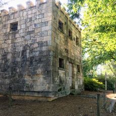
Punk Rock Shelter is an archaeological site in Putnam County, Georgia, formed by natural granite boulder formations that provided refuge and protection. The location sits within southeastern woodland terrain with proximity to water sources that sustained early inhabitants.

The site was discovered in 1974 during the Wallace Reservoir Archaeological Survey with artifacts spanning 1250 to 1650. Flooding of Lake Oconee in 1979 submerged the location permanently underwater.

The shelter served communities of Hitchiti descent who practiced rituals reflecting their spiritual beliefs and daily life patterns. Locations like this held meaning beyond mere survival, functioning as spaces for communal and ceremonial gatherings.

The site now rests approximately 65 feet (20 meters) below Lake Oconee's surface and remains accessible only to specialized underwater archaeology teams. Regular visitors cannot access the location directly.

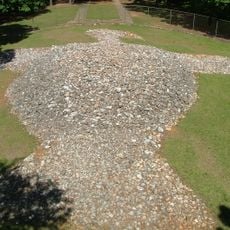
Red quartz pebbles recovered from the site point to ceremonial practices and possibly traditional sweat rituals conducted by inhabitants. Such colored stones were often incorporated into spiritual practices that researchers continue to study.

The community of curious travelers

AroundUs brings together thousands of curated places, local tips, and hidden gems, enriched daily by 60,000 contributors worldwide.

Start exploring
Location
GPS coordinates
33.39150,-83.18930
Latest update
December 14, 2025 09:47
Around this place
Rock Eagle Effigy Mound
United States of America

Rock Eagle Effigy Mound

18.7 km
Andalusia
United States of America

Andalusia

30.5 km
Liberty Hall
United States of America

Liberty Hall

32.9 km
Old Governor's Mansion
United States of America

Old Governor's Mansion

34.9 km
Old State Capitol
United States of America

Old State Capitol

35.1 km
A. H. Stephens State Park
United States of America

A. H. Stephens State Park

33.2 km
Hamburg State Park
United States of America

Hamburg State Park

43.6 km
Madison Historic District
United States of America

Madison Historic District

34.5 km
Samuel Rockwell House
United States of America

Samuel Rockwell House

38.3 km
Carter-Newton House
United States of America

Carter-Newton House

34.6 km
Atkinson Hall, Georgia College
United States of America

Atkinson Hall, Georgia College

34.7 km
Milledgeville Historic District
United States of America

Milledgeville Historic District

35.1 km
Morgan County Courthouse
United States of America

Morgan County Courthouse

34.3 km
Springfield Baptist Church (Greensboro, Georgia)
United States of America

Springfield Baptist Church (Greensboro, Georgia)

20.7 km
Jefferson Hall
United States of America

Jefferson Hall

27.3 km
Jewell Historic District
United States of America

Jewell Historic District

39.3 km
Terrell-Sadler House
United States of America

Terrell-Sadler House

17.4 km
Siloam Historic District
United States of America

Siloam Historic District

18.8 km
Devereux-Coleman House
United States of America

Devereux-Coleman House

28.6 km
Bethesda Baptist Church and Cemetery
United States of America

Bethesda Baptist Church and Cemetery

33.4 km
A. H. Stephens State Park
United States of America

A. H. Stephens State Park

33.2 km
Dr. Calvin M. Baber House
United States of America

Dr. Calvin M. Baber House

21.5 km
John O'Flaherty House
United States of America

John O'Flaherty House

25.3 km
Eatonton Historic District
United States of America

Eatonton Historic District

20 km
Greene County Courthouse
United States of America

Greene County Courthouse

20.6 km
Zachry-Kingston House
United States of America

Zachry-Kingston House

18.7 km
Greensboro Commercial Historic District
United States of America

Greensboro Commercial Historic District

20.5 km
Maxwell Student Union
United States of America

Maxwell Student Union

34.8 km
Show the full map
Reviews
Share your experience

No review yet

Discussions
Start a discussion...

No discussion yet

« Punk Rock Shelter - Archaeological site in Putnam County, Georgia, US » is provided by Around Us (aroundus.com). Images and texts are derived from Wikimedia project under a Creative Commons license. You are allowed to copy, distribute, and modify copies of this page, under the conditions set by the license, as long as this note is clearly visible.

Discover hidden gems everywhere you go!

From secret cafés to breathtaking viewpoints, skip the crowded tourist spots and find places that match your style. Our app makes it easy with voice search, smart filtering, route optimization, and insider tips from travelers worldwide. Download now for the complete mobile experience.

Around Us App Screenshot

A unique approach to discovering new places

Le Figaro

All the places worth exploring

France Info

A tailor-made excursion in just a few clicks

20 Minutes

Around Us
Travel Guide & Maps
Download

Send to your phone

QR Code
1

Open the camera app on your mobile.

2

Point at the QR code with your camera. A notification will appear.

3

Tap the notification to open the link.