Chest opened
+${chestReward.xp} XP
Explorer
NOUVEAU ×${chestReward.collectible.quantity}
tapez pour fermer
Chest locked

Open chests in the app

Around Us is built for your phone — chests unlock when you walk, explore and capture nearby places.

Enable Location

We need your location to show you interesting places around you

Discover nearby places

Find interesting locations and hidden gems around you

Precise directions

Get accurate directions and distances to places

Your location is never shared with other users. It's only used when you tap the location button.

Cape Fear River

Log in to your account

Start exploring — it's free

Trusted by 72,881 travelers worldwide

Continue with Google
Continue with Apple
or

We will send you a code to connect

By continuing, you accept our Terms and Conditions and our Privacy Policy

Check your inbox

We've sent a pincode in your inbox. Please enter the code below.

Cape Fear River
Discussion Reviews 3 Photos
62.8k Popularity

Cape Fear River, Blackwater river in southeastern North Carolina, US.

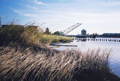
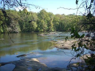
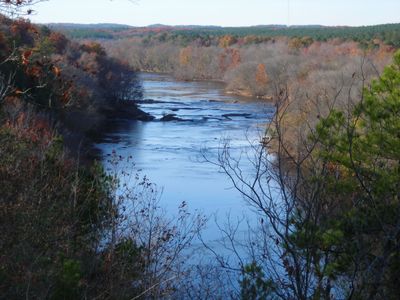
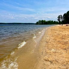
Cape Fear River is a blackwater waterway in southeastern North Carolina that flows 202 miles (325 kilometers) from the Piedmont region to the Atlantic Ocean. The current runs through wooded banks and wetlands before opening into a wide estuary near Wilmington.

European settlers used the waterway as a main transport route inland starting in the early 18th century. The channel enabled lumber mills to develop and export timber and naval stores through the port at Wilmington.

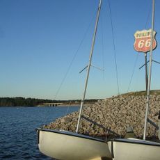
The name comes from the dangerous shoals and sandbars near the mouth that sailors feared for centuries. Today anglers and boaters use the waterway regularly, with many families returning to the same fishing spots across generations.

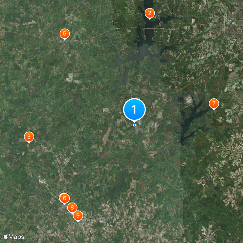
Several ramps along the waterway provide access for canoes and small boats, especially around Fayetteville and downstream. During warm weather the current is usually calm, but after heavy rain the water can move faster and become muddier.

The dark color of the water comes from tannins released by decaying leaves and plant material in the swamps upstream. This natural tint gives the waterway its characteristic look and sets it apart from clearer streams nearby.

The community of curious travelers

AroundUs brings together thousands of curated places, local tips, and hidden gems, enriched daily by 60,000 contributors worldwide.

Start exploring
Location
GPS coordinates
35.59583,-79.05278
Latest update
December 13, 2025 18:51
Around this place
Jordan Lake
United States of America

Jordan Lake

17.3 km
Deep River Camelback Truss Bridge
United States of America

Deep River Camelback Truss Bridge

17.3 km
Temple Theater
United States of America

Temple Theater

17.1 km
Chatham County Courthouse
United States of America

Chatham County Courthouse

17.8 km
Railroad House
United States of America

Railroad House

17.1 km
Samuel Bartley Holleman House
United States of America

Samuel Bartley Holleman House

13.2 km
Lee County Courthouse
United States of America

Lee County Courthouse

17.5 km
Lee Avenue Historic District
United States of America

Lee Avenue Historic District

18.1 km
Pittsboro Historic District
United States of America

Pittsboro Historic District

18 km
Pittsboro Masonic Lodge
United States of America

Pittsboro Masonic Lodge

17.8 km
Lee County Training School
United States of America

Lee County Training School

18 km
Lewis Freeman House
United States of America

Lewis Freeman House

18.1 km
Seaforth Beach
United States of America

Seaforth Beach

14.6 km
Hawkins Avenue Historic District
United States of America

Hawkins Avenue Historic District

16.8 km
A. P. Terry House
United States of America

A. P. Terry House

18.3 km
Hall-London House
United States of America

Hall-London House

18 km
Sheriff Stephen Wiley Brewer Farmstead
United States of America

Sheriff Stephen Wiley Brewer Farmstead

17.8 km
Sanford High School, Former
United States of America

Sanford High School, Former

17.1 km
Patrick St. Lawrence House
United States of America

Patrick St. Lawrence House

17.6 km
Ebenezer Methodist Church
United States of America

Ebenezer Methodist Church

15.2 km
Reid House
United States of America

Reid House

18.1 km
Luther Clegg House
United States of America

Luther Clegg House

15.2 km
East Sanford Historic District
United States of America

East Sanford Historic District

16.6 km
Henry Adolphus London House
United States of America

Henry Adolphus London House

18.5 km
McClenahan House
United States of America

McClenahan House

17.6 km
Rosemount-McIver Park Historic District
United States of America

Rosemount-McIver Park Historic District

17.6 km
New Hope Valley Railway
United States of America

New Hope Valley Railway

10 km
Vista Point Beach
United States of America

Vista Point Beach

11.9 km
Show the full map
Reviews
Share your experience

No review yet

Discussions
Start a discussion...

No discussion yet

« Cape Fear River - Blackwater river in southeastern North Carolina, US » is provided by Around Us (aroundus.com). Images and texts are derived from Wikimedia project under a Creative Commons license. You are allowed to copy, distribute, and modify copies of this page, under the conditions set by the license, as long as this note is clearly visible.

Discover hidden gems everywhere you go!

From secret cafés to breathtaking viewpoints, skip the crowded tourist spots and find places that match your style. Our app makes it easy with voice search, smart filtering, route optimization, and insider tips from travelers worldwide. Download now for the complete mobile experience.

Around Us App Screenshot

A unique approach to discovering new places

Le Figaro

All the places worth exploring

France Info

A tailor-made excursion in just a few clicks

20 Minutes

Around Us
Travel Guide & Maps
Download

Send to your phone

QR Code
1

Open the camera app on your mobile.

2

Point at the QR code with your camera. A notification will appear.

3

Tap the notification to open the link.