Enable Location

We need your location to show you interesting places around you

Discover nearby places

Find interesting locations and hidden gems around you

Precise directions

Get accurate directions and distances to places

Your location is never shared with other users. It's only used when you tap the location button.

Austin Creek State Recreation Area

Log in to your account

Start exploring — it's free

Trusted by 62,844 travelers worldwide

Continue with Google
Continue with Apple
or

We will send you a code to connect

By continuing, you accept our Terms and Conditions and our Privacy Policy

Check your inbox

We've sent a pincode in your inbox. Please enter the code below.

Austin Creek State Recreation Area

Austin Creek State Recreation Area, State recreation area in Sonoma County, California.

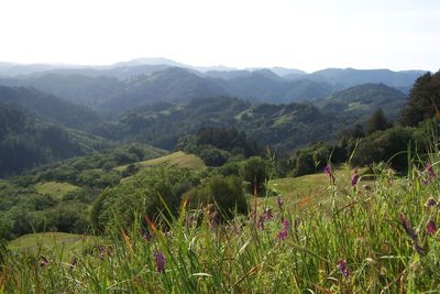
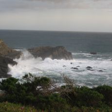
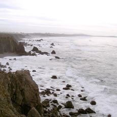
Austin Creek State Recreation Area is a 5,927-acre park in Sonoma County with rolling hills, open woodlands, and meadows. The landscape spans elevations from about 150 to 1,500 feet and is laced with streams and riparian corridors.

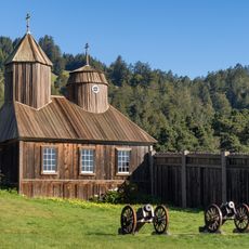
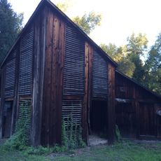
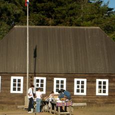
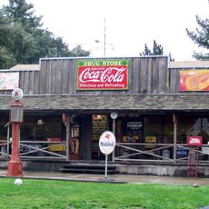
Pond Farm, an artists' colony established in the 1940s, left behind ruins that visitors can still see today. The settlement reflects how creative people were drawn to this region during that era.

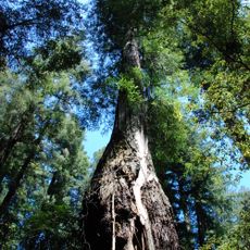
The Pomo people lived here for centuries, and their presence shaped how the landscape looks and feels today. Walking through the park, you sense this long connection between people and the land.

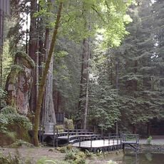
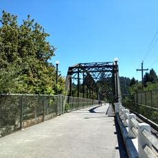
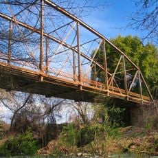
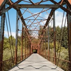
The park offers around 20 miles of trails, back-country camping areas, and standard campgrounds to suit different needs. Arrive early and wear proper footwear, as trails vary in difficulty and terrain.

The park shelters rare plants like Douglas iris and California poppies that thrive at different elevations throughout the area. This botanical variety emerges from the mix of oak woodlands and riparian zones.

The community of curious travelers

AroundUs brings together thousands of curated places, local tips, and hidden gems, enriched daily by 60,000 contributors worldwide.

Start exploring
Location
GPS coordinates
38.56690,-123.05300
Latest update
December 10, 2025 20:03
Around this place
Bohemian Grove
United States of America

Bohemian Grove

11.8 km
Fort Ross
United States of America

Fort Ross

17.6 km
Armstrong Redwoods State Natural Reserve
United States of America

Armstrong Redwoods State Natural Reserve

4.9 km
Goat Rock Beach
United States of America

Goat Rock Beach

14.8 km
Salt Point State Park
United States of America

Salt Point State Park

23.8 km
Sonoma Coast State Park
United States of America

Sonoma Coast State Park

22.1 km
Pacific Coast Air Museum
United States of America

Pacific Coast Air Museum

22.9 km
Pond Farm
United States of America

Pond Farm

4.9 km
Stillwater Cove
United States of America

Stillwater Cove

21.5 km
Madrona Manor
United States of America

Madrona Manor

15.2 km
Sonoma Coast State Marine Conservation Area
United States of America

Sonoma Coast State Marine Conservation Area

24.3 km
Healdsburg Memorial Bridge
United States of America

Healdsburg Memorial Bridge

17.3 km
Hand Fan Museum
United States of America

Hand Fan Museum

16.6 km
Stillwater Cove Regional Park
United States of America

Stillwater Cove Regional Park

21.2 km
Rotchev House
United States of America

Rotchev House

17.6 km
Ragle Ranch Regional Park
United States of America

Ragle Ranch Regional Park

25.2 km
Hinds Hotel
United States of America

Hinds Hotel

21.8 km
James H. and Frances E. Laughlin House
United States of America

James H. and Frances E. Laughlin House

24.2 km
Healdsburg Carnegie Library
United States of America

Healdsburg Carnegie Library

16.9 km
Ferrari-Carano vineyards and winery
United States of America

Ferrari-Carano vineyards and winery

17.2 km
Cunningham-Hembree Estate
United States of America

Cunningham-Hembree Estate

21.1 km
Raven Arts Theater
United States of America

Raven Arts Theater

16.7 km
Arched Rock Beach
United States of America

Arched Rock Beach

22.2 km
Guerneville Bridge
United States of America

Guerneville Bridge

8.9 km
Stoke Ranch
United States of America

Stoke Ranch

25 km
Lambert Bridge
United States of America

Lambert Bridge

14.6 km
Wohler Bridge
United States of America

Wohler Bridge

16.1 km
Warm Springs Creek Bridge
United States of America

Warm Springs Creek Bridge

16.8 km
Show the full map
« Austin Creek State Recreation Area - State recreation area in Sonoma County, California » is provided by Around Us (aroundus.com). Images and texts are derived from Wikimedia project under a Creative Commons license. You are allowed to copy, distribute, and modify copies of this page, under the conditions set by the license, as long as this note is clearly visible.

Discover hidden gems everywhere you go!

From secret cafés to breathtaking viewpoints, skip the crowded tourist spots and find places that match your style. Our app makes it easy with voice search, smart filtering, route optimization, and insider tips from travelers worldwide. Download now for the complete mobile experience.

Around Us App Screenshot

A unique approach to discovering new places

Le Figaro

All the places worth exploring

France Info

A tailor-made excursion in just a few clicks

20 Minutes

Around Us
Travel Guide & Maps
Download

Send to your phone

QR Code
1

Open the camera app on your mobile.

2

Point at the QR code with your camera. A notification will appear.

3

Tap the notification to open the link.