Chest opened
+${chestReward.xp} XP
Explorer
NOUVEAU ×${chestReward.collectible.quantity}
tapez pour fermer
Chest locked

Open chests in the app

Around Us is built for your phone — chests unlock when you walk, explore and capture nearby places.

Enable Location

We need your location to show you interesting places around you

Discover nearby places

Find interesting locations and hidden gems around you

Precise directions

Get accurate directions and distances to places

Your location is never shared with other users. It's only used when you tap the location button.

Hollister

Log in to your account

Start exploring — it's free

Trusted by 72,882 travelers worldwide

Continue with Google
Continue with Apple
or

We will send you a code to connect

By continuing, you accept our Terms and Conditions and our Privacy Policy

Check your inbox

We've sent a pincode in your inbox. Please enter the code below.

Discussion Reviews 6 Photos
96.5k Popularity

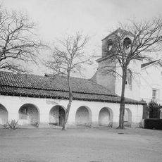
Hollister, Agricultural center in San Benito County, California, United States.

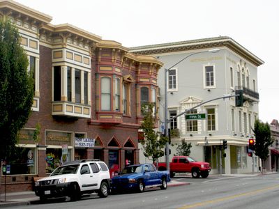
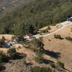
Hollister is a city in San Benito County on the Central Coast of California, surrounded by farmland and rolling hills. Streets in the center run somewhat offset from each other because the Calaveras Fault passes directly through town, slowly shifting the ground beneath.

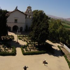
The town began in 1868 on the former Mexican land grant Rancho San Justo, when William Welles Hollister established a new settlement here. It was first part of Monterey County until San Benito County was created as a separate entity in 1874.

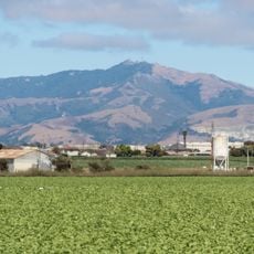
The town takes its name from rancher William Welles Hollister, who managed large grazing lands here in the mid-19th century. Local gatherings and celebrations reflect the agricultural character that still shapes how residents live and work in the area today.

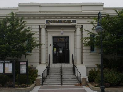
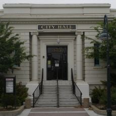
The town has a Mediterranean climate with warm, dry summers and mild winters, with summer temperatures often around 80°F (27°C). The old Carnegie Library building from 1906 on Fifth Street at number 375 now serves as City Hall and is the main point for administrative matters.

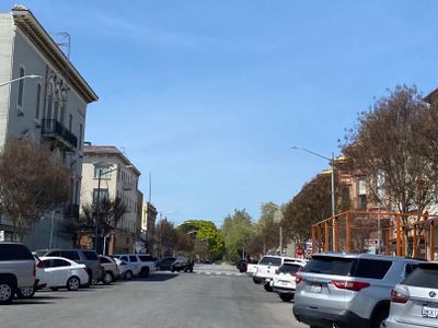
The Calaveras Fault moves here continuously and slowly without triggering large earthquakes, a process scientists call aseismic creep. Curbs and pavement show clearly visible offsets that you can notice when walking through the center of town.

The community of curious travelers

AroundUs brings together thousands of curated places, local tips, and hidden gems, enriched daily by 60,000 contributors worldwide.

Start exploring
Inception
1868
Elevation above the sea
88 m
GPS coordinates
36.84694,-121.39806
Latest update
December 16, 2025 10:21
Around this place
Mission San Juan Bautista
United States of America

Mission San Juan Bautista

12.3 km
Fremont Peak
United States of America

Fremont Peak

13.8 km
Fremont Peak State Park
United States of America

Fremont Peak State Park

13.4 km
San Juan Bautista State Historic Park
United States of America

San Juan Bautista State Historic Park

12.2 km
Fremont Peak Observatory
United States of America

Fremont Peak Observatory

13.2 km
Jose Castro House
United States of America

Jose Castro House

12.2 km
Juan de Anza House
United States of America

Juan de Anza House

12.3 km
Hollister Carnegie Library
United States of America

Hollister Carnegie Library

594 m
Rozas House
United States of America

Rozas House

12.5 km
Benjamin Wilcox House
United States of America

Benjamin Wilcox House

12.1 km
United States of America

San Juan Bautista Historic District

12.3 km
Marentis House
United States of America

Marentis House

12.8 km
United States of America

Immaculate Conception Catholic Church

9.9 km
United States of America

Hollister Hills State Vehicular Recreation Area

7.2 km
United States of America

San Justo Reservoir

5 km
United States of America

Hollister Family Fun Park

7.4 km
United States of America

Pinnacle Hills Golf Club

11.1 km
United States of America

Ridgemark Golf & Country Club

5.3 km
United States of America

Hollister Hills SVRA Upper Ranch

8.8 km
United States of America

Upper Ranch Entrance

9.9 km
United States of America

San Juan Oaks Golf Club

6.6 km
United States of America

St. Francis Retreat

9.7 km
United States of America

Swank Farms

5.3 km
United States of America

Granada Theater

680 m
United States of America

Casa de Carousel

15.8 km
United States of America

Overlook

8.1 km
United States of America

Scenic viewpoint

9 km
United States of America

Hector Heights Overlook

11.6 km
Show the full map
Reviews
Share your experience

No review yet

Discussions
Start a discussion...

No discussion yet

« Hollister - Agricultural center in San Benito County, California, United States » is provided by Around Us (aroundus.com). Images and texts are derived from Wikimedia project under a Creative Commons license. You are allowed to copy, distribute, and modify copies of this page, under the conditions set by the license, as long as this note is clearly visible.

Discover hidden gems everywhere you go!

From secret cafés to breathtaking viewpoints, skip the crowded tourist spots and find places that match your style. Our app makes it easy with voice search, smart filtering, route optimization, and insider tips from travelers worldwide. Download now for the complete mobile experience.

Around Us App Screenshot

A unique approach to discovering new places

Le Figaro

All the places worth exploring

France Info

A tailor-made excursion in just a few clicks

20 Minutes

Around Us
Travel Guide & Maps
Download

Send to your phone

QR Code
1

Open the camera app on your mobile.

2

Point at the QR code with your camera. A notification will appear.

3

Tap the notification to open the link.