Enable Location

We need your location to show you interesting places around you

Discover nearby places

Find interesting locations and hidden gems around you

Precise directions

Get accurate directions and distances to places

Your location is never shared with other users. It's only used when you tap the location button.

Fremont Peak

Log in to your account

Start exploring — it's free

Trusted by 64,631 travelers worldwide

Continue with Google
Continue with Apple
or

We will send you a code to connect

By continuing, you accept our Terms and Conditions and our Privacy Policy

Check your inbox

We've sent a pincode in your inbox. Please enter the code below.

Discussion Reviews 1 Photos
9.7k Popularity

Fremont Peak, Mountain summit in San Benito County, California.

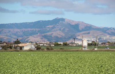
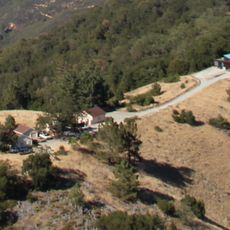
Fremont Peak is a granite summit in San Benito County, California, with views over Monterey Bay, Santa Clara Valley, and San Benito Valley on clear days. The peak sits within a state park that has hiking trails, picnic areas, and campsites.

In 1846, American officer John C. Frémont set up a military position on this summit and raised the American flag in defiance of Mexican authorities. This act, which happened just before the Mexican-American War began, led to the site being named a California Historical Landmark.

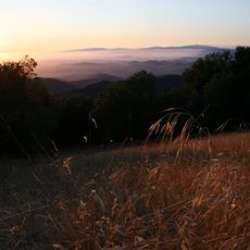
The Fremont Peak Observatory Association runs a public observatory near the summit, where visitors can attend night sky viewing sessions. On clear evenings, the darkness of the surrounding hills makes the sky above the peak especially good for stargazing.

The summit is reached by a short trail that most visitors can handle without difficulty. Weather at this elevation can shift quickly, so bring a layer even on warm days.

The peak was named after John C. Frémont long after his brief stay there, not by the man himself. A small monument near the top marks the spot where he reportedly planted the flag in 1846.

The community of curious travelers

AroundUs brings together thousands of curated places, local tips, and hidden gems, enriched daily by 60,000 contributors worldwide.

Start exploring
Location
GPS coordinates
36.75721,-121.50411
Latest update
March 3, 2026 10:12
Around this place
National Steinbeck Center
United States of America

National Steinbeck Center

16.2 km
Fremont Peak State Park
United States of America

Fremont Peak State Park

363 m
San Juan Bautista State Historic Park
United States of America

San Juan Bautista State Historic Park

10.2 km
Moss Landing State Beach
United States of America

Moss Landing State Beach

26.3 km
Salinas River State Beach
United States of America

Salinas River State Beach

26.2 km
Salinas River National Wildlife Refuge
United States of America

Salinas River National Wildlife Refuge

26.8 km
Monterey County Jail
United States of America

Monterey County Jail

16.7 km
Fremont Peak Observatory
United States of America

Fremont Peak Observatory

564 m
Jose Castro House
United States of America

Jose Castro House

10.1 km
Rancho Las Palmas
United States of America

Rancho Las Palmas

21.2 km
Juan de Anza House
United States of America

Juan de Anza House

10 km
Jose Eusebio Boronda Adobe
United States of America

Jose Eusebio Boronda Adobe

16.7 km
Monterey County Court House
United States of America

Monterey County Court House

16.7 km
Krough House
United States of America

Krough House

16.6 km
Hollister Carnegie Library
United States of America

Hollister Carnegie Library

13.8 km
Godfrey M. Bockius House
United States of America

Godfrey M. Bockius House

28 km
Sheriff William Joseph Nesbitt House
United States of America

Sheriff William Joseph Nesbitt House

16.6 km
Rozas House
United States of America

Rozas House

10.2 km
Castroville Japanese Language School
United States of America

Castroville Japanese Language School

21.9 km
Giant artichoke
United States of America

Giant artichoke

22.2 km
Samuel M. Black House
United States of America

Samuel M. Black House

16.2 km
Monterey Zoo
United States of America

Monterey Zoo

21.1 km
Peter J. Bontadelli House
United States of America

Peter J. Bontadelli House

25.4 km
Porter-Vallejo Mansion
United States of America

Porter-Vallejo Mansion

27.1 km
B. V. Sargent House
United States of America

B. V. Sargent House

16.5 km
Benjamin Wilcox House
United States of America

Benjamin Wilcox House

9.6 km
Judge Lee House
United States of America

Judge Lee House

28.1 km
Marentis House
United States of America

Marentis House

10.5 km
Show the full map
Reviews
Share your experience

No review yet

Discussions
Start a discussion...

No discussion yet

« Fremont Peak - Mountain summit in San Benito County, California » is provided by Around Us (aroundus.com). Images and texts are derived from Wikimedia project under a Creative Commons license. You are allowed to copy, distribute, and modify copies of this page, under the conditions set by the license, as long as this note is clearly visible.

Discover hidden gems everywhere you go!

From secret cafés to breathtaking viewpoints, skip the crowded tourist spots and find places that match your style. Our app makes it easy with voice search, smart filtering, route optimization, and insider tips from travelers worldwide. Download now for the complete mobile experience.

Around Us App Screenshot

A unique approach to discovering new places

Le Figaro

All the places worth exploring

France Info

A tailor-made excursion in just a few clicks

20 Minutes

Around Us
Travel Guide & Maps
Download

Send to your phone

QR Code
1

Open the camera app on your mobile.

2

Point at the QR code with your camera. A notification will appear.

3

Tap the notification to open the link.