Enable Location

We need your location to show you interesting places around you

Discover nearby places

Find interesting locations and hidden gems around you

Precise directions

Get accurate directions and distances to places

Your location is never shared with other users. It's only used when you tap the location button.

Butano State Park

Log in to your account

Start exploring — it's free

Trusted by 62,925 travelers worldwide

Continue with Google
Continue with Apple
or

We will send you a code to connect

By continuing, you accept our Terms and Conditions and our Privacy Policy

Check your inbox

We've sent a pincode in your inbox. Please enter the code below.

Discussion Reviews 1 Photos
9.3k Popularity

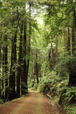
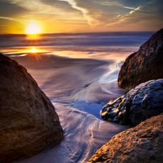
Butano State Park, State park with redwood forests in San Mateo County, United States.

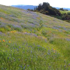
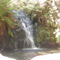
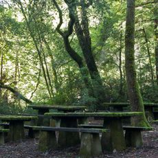
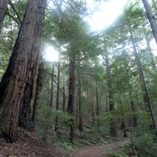
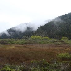
Butano State Park covers roughly 4,700 acres with dense redwood forests, coastal scrub plants, and a creek canyon running through the center. Trails wind through the property and connect different forest sections, allowing visitors to move between shaded groves and more open areas.

The state established this protected area in 1956 to safeguard the forest from ongoing logging operations that had damaged much of the region. This action marked a turning point when California began preserving its remaining old-growth redwood forests.

Early inhabitants of the region relied on the forest and creek for sustenance and materials. The towering redwoods remain a reminder of how communities once lived closely with these natural resources.

The park offers drive-in sites near the entrance and walk-in options that require a short hike, plus a remote backpacking area for those who want deeper forest solitude. Most overnight facilities are located close to parking and facilities, though reaching the farthest camping option involves a longer trail.

The name comes from an old word for drinking vessels carved from animal horns, documented by a Spanish priest in 1816. This linguistic connection reveals how early European arrivals named places based on objects they encountered from local use.

The community of curious travelers

AroundUs brings together thousands of curated places, local tips, and hidden gems, enriched daily by 60,000 contributors worldwide.

Start exploring
Location
Inception
1956
GPS coordinates
37.21330,-122.31000
Latest update
December 8, 2025 19:55
Around this place
Big Basin Redwoods State Park
United States of America

Big Basin Redwoods State Park

9 km
Pigeon Point Lighthouse
United States of America

Pigeon Point Lighthouse

8.2 km
Año Nuevo State Park
United States of America

Año Nuevo State Park

9.2 km
Skyline-to-the-Sea Trail
United States of America

Skyline-to-the-Sea Trail

7.7 km
Año Nuevo Island
United States of America

Año Nuevo Island

11.9 km
San Gregorio State Beach
United States of America

San Gregorio State Beach

14.7 km
Portola Redwoods State Park
United States of America

Portola Redwoods State Park

11 km
Bean Hollow State Beach
United States of America

Bean Hollow State Beach

8.9 km
Pescadero State Beach
United States of America

Pescadero State Beach

10.6 km
Pomponio State Beach
United States of America

Pomponio State Beach

12.3 km
Russian Ridge Open Space Preserve
United States of America

Russian Ridge Open Space Preserve

14.4 km
Tip Toe Falls
United States of America

Tip Toe Falls

8.9 km
Memorial Park
United States of America

Memorial Park

7.3 km
Sam McDonald County Park
United States of America

Sam McDonald County Park

10.1 km
Theodore J. Hoover Natural Preserve
United States of America

Theodore J. Hoover Natural Preserve

13.3 km
Methodist Episcopal Church of Pescadero
United States of America

Methodist Episcopal Church of Pescadero

7.6 km
San Gregorio House
United States of America

San Gregorio House

14.4 km
Rancho Del Oso Nature and History Center
United States of America

Rancho Del Oso Nature and History Center

13.3 km
Headquarters Administration Building
United States of America

Headquarters Administration Building

9.1 km
Greyhound Rock Beach
United States of America

Greyhound Rock Beach

15.3 km
Waddell Beach (State Parks)
United States of America

Waddell Beach (State Parks)

13.3 km
Ano Nuevo light station
United States of America

Ano Nuevo light station

11.9 km
Pebble Beach
United States of America

Pebble Beach

9.8 km
Gazos Creek State Beach
United States of America

Gazos Creek State Beach

7.3 km
Waddell Creek Beach
United States of America

Waddell Creek Beach

13.4 km
Arroyo De Los Frijoles Beach
United States of America

Arroyo De Los Frijoles Beach

8.9 km
Cove Beach
United States of America

Cove Beach

10.7 km
Pescadero Beach
United States of America

Pescadero Beach

10.7 km
Show the full map
Reviews
Share your experience

No review yet

Discussions
Start a discussion...

No discussion yet

« Butano State Park - State park with redwood forests in San Mateo County, United States » is provided by Around Us (aroundus.com). Images and texts are derived from Wikimedia project under a Creative Commons license. You are allowed to copy, distribute, and modify copies of this page, under the conditions set by the license, as long as this note is clearly visible.

Discover hidden gems everywhere you go!

From secret cafés to breathtaking viewpoints, skip the crowded tourist spots and find places that match your style. Our app makes it easy with voice search, smart filtering, route optimization, and insider tips from travelers worldwide. Download now for the complete mobile experience.

Around Us App Screenshot

A unique approach to discovering new places

Le Figaro

All the places worth exploring

France Info

A tailor-made excursion in just a few clicks

20 Minutes

Around Us
Travel Guide & Maps
Download

Send to your phone

QR Code
1

Open the camera app on your mobile.

2

Point at the QR code with your camera. A notification will appear.

3

Tap the notification to open the link.