Enable Location

We need your location to show you interesting places around you

Discover nearby places

Find interesting locations and hidden gems around you

Precise directions

Get accurate directions and distances to places

Your location is never shared with other users. It's only used when you tap the location button.

Russian Ridge Open Space Preserve

Log in to your account

Start exploring — it's free

Trusted by 62,916 travelers worldwide

Continue with Google
Continue with Apple
or

We will send you a code to connect

By continuing, you accept our Terms and Conditions and our Privacy Policy

Check your inbox

We've sent a pincode in your inbox. Please enter the code below.

Russian Ridge Open Space Preserve
Discussion Reviews 1 Photos
2.7k Popularity

Russian Ridge Open Space Preserve, Regional park in San Mateo County, California.

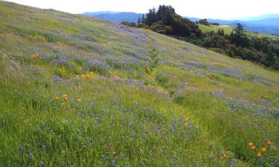
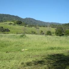
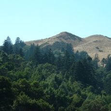
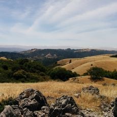
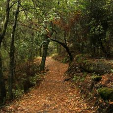
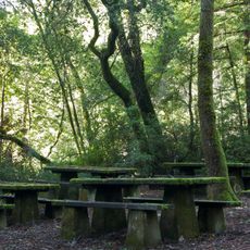
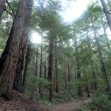
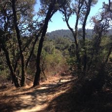
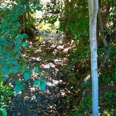
Russian Ridge Open Space Preserve is a 3,137-acre protected area in the Santa Cruz Mountains featuring dense forests interspersed with open meadows. Over 10 miles of trails wind through the terrain, connecting different elevation zones and terrain types across the landscape.

A Russian immigrant named Paskey operated a dairy farm here from 1920 to 1950, establishing the foundation for the preserve's current name. During the 1970s, the Midpeninsula Regional Open Space District acquired the land to protect it from residential development.

The name reflects the Russian heritage tied to early agricultural settlers who shaped this landscape. Visitors walking the trails encounter a place whose identity remains connected to those who farmed here long ago.

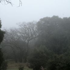
The preserve is accessible through two main entry points: roadside parking along Skyline Boulevard and a dedicated lot at the Audrey C. Rust Commemorative Site. Visitors should be prepared for variable weather conditions and changing trail conditions due to elevation changes across the landscape.

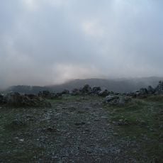
From Borel Hill, the highest point in the area at about 2,572 feet (784 m), visitors can see both San Francisco Bay to the east and the Pacific Ocean to the west on clear days. This rare vantage point bridges two distinct coastal regions from a single location.

The community of curious travelers

AroundUs brings together thousands of curated places, local tips, and hidden gems, enriched daily by 60,000 contributors worldwide.

Start exploring
Location
GPS coordinates
37.31940,-122.21700
Latest update
December 12, 2025 14:22
Around this place
Jackling House
United States of America

Jackling House

11.4 km
Ridge Vineyards
United States of America

Ridge Vineyards

7.9 km
Permanente Quarry

Permanente Quarry

9.4 km
Rancho San Antonio County Park
United States of America

Rancho San Antonio County Park

11.1 km
Black Mountain
United States of America

Black Mountain

6.1 km
Portola Redwoods State Park
United States of America

Portola Redwoods State Park

6.8 km
Arastradero Preserve
United States of America

Arastradero Preserve

8.4 km
Searsville Dam
United States of America

Searsville Dam

9.9 km
Frenchman's Tower
United States of America

Frenchman's Tower

9.8 km
Windy Hill Open Space Preserve
United States of America

Windy Hill Open Space Preserve

4.9 km
Folger Estate Stable Historic District
United States of America

Folger Estate Stable Historic District

10.5 km
Our Lady of the Wayside Church
United States of America

Our Lady of the Wayside Church

7.3 km
Monte Bello Open Space Preserve
United States of America

Monte Bello Open Space Preserve

6 km
Los Trancos Open Space Preserve
United States of America

Los Trancos Open Space Preserve

3.5 km
Tip Toe Falls
United States of America

Tip Toe Falls

7.8 km
Los Altos History Museum
United States of America

Los Altos History Museum

11.5 km
Memorial Park
United States of America

Memorial Park

8.2 km
Saratoga Gap Open Space Preserve
United States of America

Saratoga Gap Open Space Preserve

11 km
Foothill Observatory
United States of America

Foothill Observatory

9 km
Sam McDonald County Park
United States of America

Sam McDonald County Park

5 km
Paul Shoup House
United States of America

Paul Shoup House

10.6 km
Thornewood Open Space Preserve
United States of America

Thornewood Open Space Preserve

8.8 km
Purisima Creek
United States of America

Purisima Creek

10.3 km
Stanford Dish
United States of America

Stanford Dish

10.5 km
MacFarland House
United States of America

MacFarland House

11.7 km
Portola Valley School
United States of America

Portola Valley School

7.1 km
Wilcox Solar Observatory
United States of America

Wilcox Solar Observatory

10.9 km
Portola Valley Library
United States of America

Portola Valley Library

7.1 km
Show the full map
Reviews
Share your experience

No review yet

Discussions
Start a discussion...

No discussion yet

« Russian Ridge Open Space Preserve - Regional park in San Mateo County, California » is provided by Around Us (aroundus.com). Images and texts are derived from Wikimedia project under a Creative Commons license. You are allowed to copy, distribute, and modify copies of this page, under the conditions set by the license, as long as this note is clearly visible.

Discover hidden gems everywhere you go!

From secret cafés to breathtaking viewpoints, skip the crowded tourist spots and find places that match your style. Our app makes it easy with voice search, smart filtering, route optimization, and insider tips from travelers worldwide. Download now for the complete mobile experience.

Around Us App Screenshot

A unique approach to discovering new places

Le Figaro

All the places worth exploring

France Info

A tailor-made excursion in just a few clicks

20 Minutes

Around Us
Travel Guide & Maps
Download

Send to your phone

QR Code
1

Open the camera app on your mobile.

2

Point at the QR code with your camera. A notification will appear.

3

Tap the notification to open the link.