Enable Location

We need your location to show you interesting places around you

Discover nearby places

Find interesting locations and hidden gems around you

Precise directions

Get accurate directions and distances to places

Your location is never shared with other users. It's only used when you tap the location button.

Rancho San Antonio County Park

Log in to your account

Start exploring — it's free

Trusted by 61,880 travelers worldwide

Continue with Google
Continue with Apple
or

We will send you a code to connect

By continuing, you accept our Terms and Conditions and our Privacy Policy

Check your inbox

We've sent a pincode in your inbox. Please enter the code below.

Rancho San Antonio County Park, County park in Santa Clara County, US

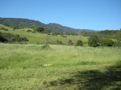
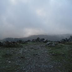
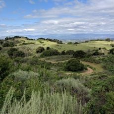
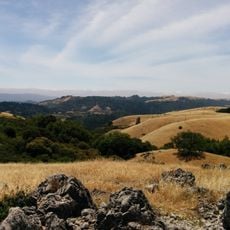
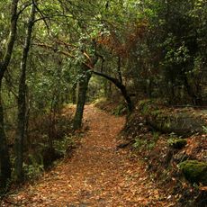
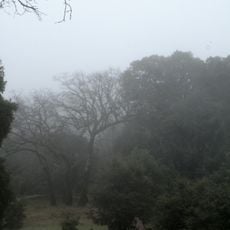
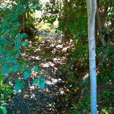
Rancho San Antonio is a county park with approximately 3,988 acres (1,615 hectares) of land in Santa Clara County. The landscape features grasslands, chaparral, and oak woodlands connected by an extensive trail network.

The land was originally a Mexican land grant in the 1800s. It became a protected nature area when Santa Clara County established the park in 1977.

The land was home to the Ohlone people for over 3,000 years, who called this place Partacsi. This deep indigenous heritage remains part of the area's identity today.

The park has parking lots, restrooms, drinking fountains, and picnic areas near the main entrance. The trail system is well-marked, allowing visitors to choose different difficulty levels.

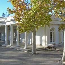
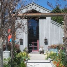
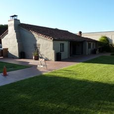
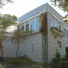
Deer Hollow Farm within the park is a working farm with organic gardens and farm animals that shows visitors traditional farming methods. This hands-on place helps both children and adults understand where food comes from and how it is grown.

The community of curious travelers

AroundUs brings together thousands of curated places, local tips, and hidden gems, enriched daily by 60,000 contributors worldwide.

Start exploring
Inception
1977
Operator
Santa Clara County Parks and Recreation Department
Shares border with
Rancho San Antonio Open Space Preserve
Address
Cristo Rey Drive
GPS coordinates
37.33110,-122.09300
Latest update
December 8, 2025 19:54
Around this place
Apple Park
United States of America

Apple Park

7.4 km
Computer History Museum
United States of America

Computer History Museum

9.4 km
Steve Jobs Theatre
United States of America

Steve Jobs Theatre

7.6 km
Permanente Quarry

Permanente Quarry

2.1 km
Black Mountain
United States of America

Black Mountain

5.1 km
Steve Jobs Garage
United States of America

Steve Jobs Garage

2.5 km
Mountain View Center for the Performing Arts
United States of America

Mountain View Center for the Performing Arts

6.6 km
NASA Ames Exploration Center
United States of America

NASA Ames Exploration Center

9 km
Le Petit Trianon
United States of America

Le Petit Trianon

4.2 km
Saint Joseph Parish
United States of America

Saint Joseph Parish

6.4 km
Fremont Older Open Space Preserve
United States of America

Fremont Older Open Space Preserve

5.3 km
Monte Bello Open Space Preserve
United States of America

Monte Bello Open Space Preserve

5.6 km
Los Trancos Open Space Preserve
United States of America

Los Trancos Open Space Preserve

7.6 km
Vasona Reservoir
United States of America

Vasona Reservoir

4.3 km
Don Burnett Bicycle-Pedestrian Bridge
United States of America

Don Burnett Bicycle-Pedestrian Bridge

3.7 km
United States of America

Shiv Durga Temple of Bay Area

9.2 km
Sunnyvale Heritage Park Museum
United States of America

Sunnyvale Heritage Park Museum

6.6 km
Los Altos History Museum
United States of America

Los Altos History Museum

5.8 km
Saratoga Gap Open Space Preserve
United States of America

Saratoga Gap Open Space Preserve

8.4 km
Foothill Observatory
United States of America

Foothill Observatory

5 km
Paul Shoup House
United States of America

Paul Shoup House

5.3 km
Purisima Creek
United States of America

Purisima Creek

4.6 km
Historic Adobe Building
United States of America

Historic Adobe Building

7.3 km
Церковь Святого Николая
United States of America

Церковь Святого Николая

9.2 km
Deep Cliff Golf Course
United States of America

Deep Cliff Golf Course

3.6 km
Woodhills
United States of America

Woodhills

5.8 km
Mountain View Public Library
United States of America

Mountain View Public Library

6.6 km
McKelvey Park
United States of America

McKelvey Park

6.2 km
Show the full map
« Rancho San Antonio County Park - County park in Santa Clara County, US » is provided by Around Us (aroundus.com). Images and texts are derived from Wikimedia project under a Creative Commons license. You are allowed to copy, distribute, and modify copies of this page, under the conditions set by the license, as long as this note is clearly visible.

Discover hidden gems everywhere you go!

From secret cafés to breathtaking viewpoints, skip the crowded tourist spots and find places that match your style. Our app makes it easy with voice search, smart filtering, route optimization, and insider tips from travelers worldwide. Download now for the complete mobile experience.

Around Us App Screenshot

A unique approach to discovering new places

Le Figaro

All the places worth exploring

France Info

A tailor-made excursion in just a few clicks

20 Minutes

Around Us
Travel Guide & Maps
Download

Send to your phone

QR Code
1

Open the camera app on your mobile.

2

Point at the QR code with your camera. A notification will appear.

3

Tap the notification to open the link.