Enable Location

We need your location to show you interesting places around you

Discover nearby places

Find interesting locations and hidden gems around you

Precise directions

Get accurate directions and distances to places

Your location is never shared with other users. It's only used when you tap the location button.

The Forest of Nisene Marks State Park

Log in to your account

Start exploring — it's free

Trusted by 62,057 travelers worldwide

Continue with Google
Continue with Apple
or

We will send you a code to connect

By continuing, you accept our Terms and Conditions and our Privacy Policy

Check your inbox

We've sent a pincode in your inbox. Please enter the code below.

The Forest of Nisene Marks State Park, State park in Santa Cruz, United States.

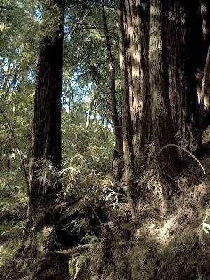
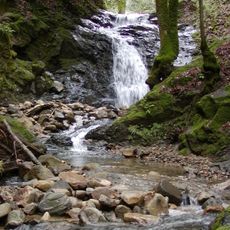
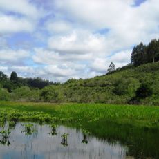
The Forest of Nisene Marks State Park is a protected landscape covering about 10,000 acres of redwood forest and second-growth woodland. A network of trails winds through the land, connecting different sections of the forest.

The land was clear-cut by the Loma Prieta Lumber Company between 1883 and 1923 before the Marks family purchased it. They later donated the land to establish and preserve it as a public forest park.

The park preserves California's logging heritage through visible remnants of sawmills, railroad tracks, and trestle sites scattered throughout the forest. Visitors encounter these industrial traces while hiking and gain insight into how the land was once used.

The park offers more than 30 miles of trails for hiking, mountain biking, and horseback riding, with designated areas for dogs near the entrance. Trail conditions vary with the season and weather, so visitors should check before planning their visit.

The epicenter of the 1989 Loma Prieta earthquake was located within the park boundaries. This geological event made the forest a site of scientific interest for researchers and visiting students.

The community of curious travelers

AroundUs brings together thousands of curated places, local tips, and hidden gems, enriched daily by 60,000 contributors worldwide.

Start exploring
Inception
1963
Operator
California Department of Parks and Recreation
GPS coordinates
37.04460,-121.88500
Latest update
December 7, 2025 19:27
Around this place
Show the full map
« The Forest of Nisene Marks State Park - State park in Santa Cruz, United States » is provided by Around Us (aroundus.com). Images and texts are derived from Wikimedia project under a Creative Commons license. You are allowed to copy, distribute, and modify copies of this page, under the conditions set by the license, as long as this note is clearly visible.

Discover hidden gems everywhere you go!

From secret cafés to breathtaking viewpoints, skip the crowded tourist spots and find places that match your style. Our app makes it easy with voice search, smart filtering, route optimization, and insider tips from travelers worldwide. Download now for the complete mobile experience.

Around Us App Screenshot

A unique approach to discovering new places

Le Figaro

All the places worth exploring

France Info

A tailor-made excursion in just a few clicks

20 Minutes

Around Us
Travel Guide & Maps
Download

Send to your phone

QR Code
1

Open the camera app on your mobile.

2

Point at the QR code with your camera. A notification will appear.

3

Tap the notification to open the link.