Enable Location

We need your location to show you interesting places around you

Discover nearby places

Find interesting locations and hidden gems around you

Precise directions

Get accurate directions and distances to places

Your location is never shared with other users. It's only used when you tap the location button.

Seacliff State Beach

Log in to your account

Start exploring — it's free

Trusted by 62,992 travelers worldwide

Continue with Google
Continue with Apple
or

We will send you a code to connect

By continuing, you accept our Terms and Conditions and our Privacy Policy

Check your inbox

We've sent a pincode in your inbox. Please enter the code below.

Seacliff State Beach
Discussion Reviews 1 Photos
12.9k Popularity

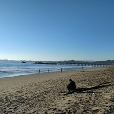
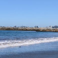
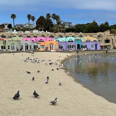
Seacliff State Beach, Coastal state beach in Monterey Bay, US

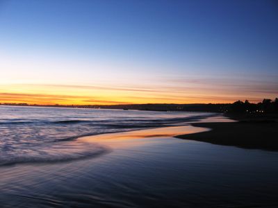
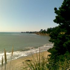
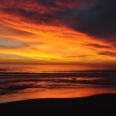
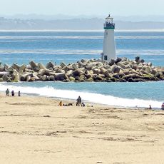
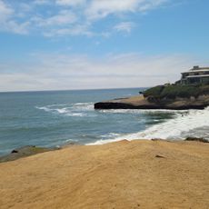
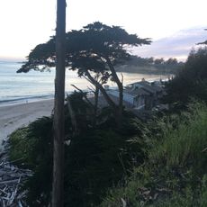
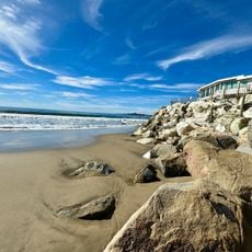
Seacliff State Beach is a coastal strip along the northern edge of Monterey Bay with sandy shores and steep cliffs that drop to the Pacific Ocean. The beach combines natural rock formations with man-made structures that add character to the landscape.

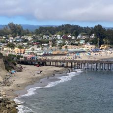
The beach gained notice during World War I when the concrete ship Palo Alto was built and positioned along the shore as an experimental structure. The vessel remained and gradually became embedded in the coastal setting over the passing years.

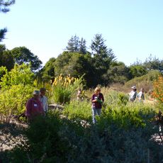
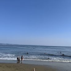
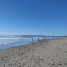
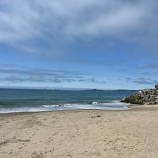
The beach draws locals and visitors who come to watch the ocean, walk along the water, and explore tide pools during low tide when sea creatures become visible.

The beach provides restrooms, picnic areas with grills, and marked parking spaces run by California State Parks. Planning a visit during low tide makes it possible to reach tide pools and see more of the rocky areas along the shore.

The submerged concrete ship Palo Alto now serves as an artificial reef drawing a variety of marine life to the site, making it an unexpected underwater habitat. Divers and snorkelers discover a functioning ecosystem built around this century-old structure.

The community of curious travelers

AroundUs brings together thousands of curated places, local tips, and hidden gems, enriched daily by 60,000 contributors worldwide.

Start exploring
Location
Operator
California Department of Parks and Recreation
GPS coordinates
36.97220,-121.91400
Latest update
December 7, 2025 20:42
Around this place
The Forest of Nisene Marks State Park
United States of America

The Forest of Nisene Marks State Park

8.5 km
New Brighton State Beach
United States of America

New Brighton State Beach

1.4 km
Manresa State Beach
United States of America

Manresa State Beach

6.5 km
Rispin Mansion
United States of America

Rispin Mansion

3.8 km
Twin Lakes State Beach
United States of America

Twin Lakes State Beach

8.2 km
Santa Cruz Breakwater Light
United States of America

Santa Cruz Breakwater Light

8 km
Ellicott Slough National Wildlife Refuge
United States of America

Ellicott Slough National Wildlife Refuge

8.3 km
Venetian Court
United States of America

Venetian Court

3.5 km
Santa Cruz Museum of Natural History
United States of America

Santa Cruz Museum of Natural History

8.6 km
Rio Del Mar Beach
United States of America

Rio Del Mar Beach

1.7 km
Pleasure Point roadhouse
United States of America

Pleasure Point roadhouse

4.9 km
Harbor Beach
United States of America

Harbor Beach

7.8 km
Twin Lakes Beach
United States of America

Twin Lakes Beach

8 km
Glen Canyon Covered Bridge
United States of America

Glen Canyon Covered Bridge

8.5 km
Hihn Building
United States of America

Hihn Building

3.2 km
Esplanade Park Beach
United States of America

Esplanade Park Beach

3.2 km
Capitola Beach
United States of America

Capitola Beach

3.4 km
Centro Hortícola y Jardín Botánico de Cabrillo College
United States of America

Centro Hortícola y Jardín Botánico de Cabrillo College

1.2 km
Santa Cruz Boardroom
United States of America

Santa Cruz Boardroom

4.6 km
Private's Beach
United States of America

Private's Beach

4.2 km
Seabright Beach
United States of America

Seabright Beach

8.4 km
Sunny Cove Beach
United States of America

Sunny Cove Beach

6.8 km
Beer Can Beach
United States of America

Beer Can Beach

3.3 km
Moran Lake Beach
United States of America

Moran Lake Beach

6 km
Hooper Beach
United States of America

Hooper Beach

3.7 km
Potbelly Beach
United States of America

Potbelly Beach

1.5 km
Lincoln Beach
United States of America

Lincoln Beach

7.3 km
Branciforte Branch Library
United States of America

Branciforte Branch Library

8.3 km
Show the full map
Reviews
Share your experience

No review yet

Discussions
Start a discussion...

No discussion yet

« Seacliff State Beach - Coastal state beach in Monterey Bay, US » is provided by Around Us (aroundus.com). Images and texts are derived from Wikimedia project under a Creative Commons license. You are allowed to copy, distribute, and modify copies of this page, under the conditions set by the license, as long as this note is clearly visible.

Discover hidden gems everywhere you go!

From secret cafés to breathtaking viewpoints, skip the crowded tourist spots and find places that match your style. Our app makes it easy with voice search, smart filtering, route optimization, and insider tips from travelers worldwide. Download now for the complete mobile experience.

Around Us App Screenshot

A unique approach to discovering new places

Le Figaro

All the places worth exploring

France Info

A tailor-made excursion in just a few clicks

20 Minutes

Around Us
Travel Guide & Maps
Download

Send to your phone

QR Code
1

Open the camera app on your mobile.

2

Point at the QR code with your camera. A notification will appear.

3

Tap the notification to open the link.